Showing posts with label lakes. Show all posts

Monday, June 29, 2015

Scientists have discovered how dramatic climate change in the Southern Sahara reduced the largest freshwater lake on Earth to the desert dunes we see today in just a few hundred years

Alpha Galileo via Royal Halloway, University of London: Researchers from Royal Holloway, Birkbeck and Kings College, University of London used satellite images to map abandoned shore lines around Palaeolake Mega-Chad, and analysed sediments to calculate the age of these shore lines, producing a lake level history spanning the last 15,000 years.

At its peak around 6,000 years ago, Palaeolake Mega-Chad was the largest freshwater lake on Earth, with an area of 360,000 km2. Now today’s Lake Chad is reduced to a fraction of that size, at only 355 km2. The drying of Lake Mega-Chad reveals a story of dramatic climate change in the southern Sahara, with a rapid change from a giant lake to desert dunes and dust, due to changes in rainfall from the West African Monsoon. The research, published this week in the journal Proceedings of the National Academy of Sciences of the United States of America confirms earlier suggestions that the climate change was abrupt, with the southern Sahara drying in just a few hundred years.

Part of the Palaeolake Mega-Chad basin that has dried completely is the Bodélé depression, which lies in remote northern Chad. The Bodélé depression is the World’s single greatest source of atmospheric dust, with dust being blown across the Atlantic to South America, where it is believed to be helping to maintain the fertility of tropical rainforests. However, the University of London team’s research shows that a small lake persisted in the Bodélé depression until about 1,000 years ago. This lake covered the parts of the Bodélé depression which currently produce most dust, limiting the dust potential until recent times.

“The Amazon tropical forest is like a giant hanging basket” explains Dr Simon Armitage from the Department of Geography at Royal Holloway. “In a hanging basket, daily watering quickly washes soluble nutrients out of the soil, and these need to be replaced using fertiliser if the plants are to survive. Similarly, heavy washout of soluble minerals from the Amazon basin means that an external source of nutrients must be maintaining soil fertility. As the World’s most vigorous dust source, the Bodélé depression has often been cited as a likely source of these nutrients, but our findings indicate that this can only be true for the last 1,000 years,” he added.

NASA image of a dust storm near what's left of Lake Chad

Monday, March 16, 2015

In Russia, a drying lake threatens an 'era of water wars'

Angelina Davydova in Reuters via the Thomson Reuters Foundation: In Russia's Siberian south, near the border of Mongolia, the world's largest freshwater lake is shrinking. The surrounding communities depend on Lake Baikal, which contains about one-fifth of the earth's unfrozen freshwater reserves, for their power, water and livelihoods.

But in the past four months the lake’s water level has dropped so low that experts are calling it a crisis – one they warn could lead to conflicts in Russia over water. The lake is now at its lowest level in over 30 years and experts predict it will keep dropping until melting mountain snow and spring rains begin to recharge the lake around late April or mid-May.

The problem, scientists and environmentalists say, is a combination of climate change and growing use of hydropower. During last year's unusually dry summer and autumn, the lake got only 67 percent of the freshwater inflow it normally receives; experts predict in the first quarter of 2015 that figure will fall to 50 percent.

...Lake Baikal's dramatic drying already is causing tensions between the two regions that rely on it. In the Buryat Republic, upstream of the lake, wells are running empty and the area's fishing industry is struggling with decreasing fish populations.

..."Welcome to the era of water wars in Russia," said Alexander Kolotov, Russian coordinator of the international ecological coalition Rivers Without Boundaries. "Water is becoming the country's most valuable resource."....

The village of Enkhaluk on the eastern shore of Lake Baikal, shot by Аркадий Зарубин, Wikimedia Commons, under the Creative Commons Attribution-Share Alike 3.0 Unported license

Friday, June 27, 2014

Deforestation starves fish

A press release from the University of Cambridge: Research shows forest debris that drains into lakes is an important contributor to freshwater food chains – bolstering fish diets to the extent that increased forest cover causes fish to get ‘fat’ and sparse forest leaves smaller, underfed fish. Debris from forests that washes into freshwater lakes supplements the diets of microscopic zooplankton and the fish that feed off them – creating larger and stronger fish, new research shows.

The researchers warn that, as forests are eroded through human activities such as logging, the impacts will be felt in aquatic as well as terrestrial food chains. In fact, the study was conducted at a Canadian lake chosen because it had suffered ecological disaster during the mid-20th century: acid rain as a result of the local nickel smelting industry.

Despite moves to reduce environmental impact, many areas of vegetation surrounding the lake are still in recovery. This enabled scientists to study Yellow Perch fish from different parts of a lake that has varying degrees of surrounding forest coverage.

Carbon from forest debris has a different elemental mass than carbon produced by algae in the aquatic food chain. By analysing the young Perch that had been born that year, scientists were able to determine that at least 34% of the fish biomass comes from vegetation, increasing to 66% in areas surrounded by rich forest. Essentially, the more forest around the edge of the lake, the fatter the fish in that part of the lake were.

Scientists say that the young fish in lake areas with scant forest cover were much smaller, and consequently much less likely to survive and breed. “We found fish that had almost 70% of their biomass made from carbon that came from trees and leaves instead of aquatic food chain sources,” said Dr Andrew Tanentzap from Cambridge’s Department of Plant Sciences, and lead author of the new study, published today in the journal Nature Communications....

US Fish and Wildlife image of yellow perch 

Wednesday, June 11, 2014

New England lakes recovering rapidly from acid rain

University of New Hampshire Media Relations: For more than 40 years, policy makers have been working to reduce acid rain, a serious environmental problem that can devastate lakes, streams, and forests and the plants and animals that live in these ecosystems. Now new research funded by the NH Agricultural Experiment Station (NHAES) at the University of New Hampshire College of Life Sciences and Agriculture indicates that lakes in New England and the Adirondack Mountains are recovering rapidly from the effects of acid rain.

Researchers found that sulfate concentration in rain and snow declined by more than 40 percent in the 2000s, and sulfate concentration in lakes declined at a greater rate from 2002 to 2010 than during the 1980s or 1990s. During the 2000s, nitrate concentration in rain and snow declined by more than 50 percent and nitrate concentration declined in lakes.

“This is really good news for New England. Lakes are accelerating in their recovery from the past effects of acid rain. Our data clearly demonstrate that cleaning up air pollution continues to have the desired effect of improving water quality for our region’s lakes,” said NHAES researcher William McDowell, professor of environmental science and director of the NH Water Resources Research Center.

In addition to McDowell, the research team included Kristin Strock, assistant professor at Dickinson College; Sarah Nelson, assistant research professor with the Senator George J. Mitchell Center and cooperating assistant research professor in Watershed Biogeochemistry in the UMaine School of Forest Resources; Jasmine Saros, associate director of the Climate Change Institute at UMaine and professor in UMaine’s School of Biology & Ecology; Jeffrey Kahl, then-director of environmental and energy strategies at James Sewall Company.

Researchers analyzed data collected since 1991 at 31 sites in Maine, New Hampshire, Vermont, Massachusetts, Rhode Island, and southern New York and 43 sites in the Adirondack Mountains of New York. The results are presented in “Decadal Trends Reveal Recent Acceleration in the Rate of Recovery from Acidification in the Northeastern U.S.” in the journal Environmental Science & Technology....

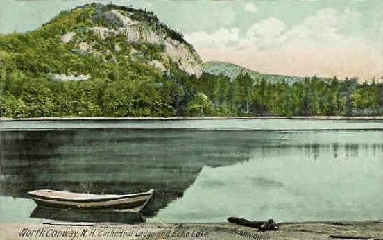
A 1914 postcard of Echo Lake in New Hampshire

Tuesday, March 25, 2014

Global warming may increase methane emissions from freshwater ecosystems

A press release from the University of Exeter: New research led by the University of Exeter suggests that rising global temperatures will increase the quantity of the key greenhouse gas methane emitted from freshwater ecosystems to the Earth’s atmosphere – which could in turn lead to further warming.
The collaborative study, led by Dr Gabriel Yvon-Durocher from the University of Exeter, collated data from hundreds of laboratory experiments and field surveys to demonstrate that the speed at which methane fluxes increase with temperature was the same whether single species populations of methanogens, microbial communities or whole ecosystems were analyzed.
Dr Yvon-Durocher said: “This is important because biological methane fluxes are a major component of global methane emissions, but there is uncertainty about their magnitude and the factors that regulate them. This hinders our ability to predict the response of this key component of the carbon cycle to global warming. Our research provides scientists with an important clue about the mechanisms that may control the response of methane emissions from ecosystems to global warming.”
Methane is an important greenhouse gas because it has 25 times the global warming effect of carbon dioxide. The production of methane in freshwater ecosystems is brought about by an ancient group of microorganisms called Archaea that exist in waterlogged sediments where there is no oxygen. They play an important role in the decomposition of biomass, but rather than producing carbon dioxide, they produce methane as a by-product of their metabolism.

The report, published today in the leading scientific journal Nature, also showed that the temperature response of methane production is much higher than respiration (production of carbon dioxide) or photosynthesis (consumption of carbon dioxide), indicating that global warming may increase the amount of methanerelative to carbon dioxide emitted globally from aquatic ecosystems, terrestrial wetlands and rice paddies...
Archaeobacteria in a hot springs in Yellowstone National Park, shot by Wing-Chi Poon, Wikimedia Commons, under the Creative Commons Attribution-Share Alike 2.5 Generic license

Saturday, January 25, 2014

Arctic inland waters emit large amounts of carbon

A press release from Umea University (Sweden): Geoscientist Erik Lundin shows in his thesis that streams and lakes of Northern Sweden are hotspots for emissions of carbon dioxide and methane into the atmosphere. Erik defends his findings at Umeå University on Friday 31 January.

"Especially small streams, which in this study accounted for only about four percent of the investigated water systems, turned out to be particularly important by releasing about ten times as much carbon as lakes," says Erik Lundin. "The reason for this is that streams generally have high concentrations of carbon dioxide, but also because they are turbulent which promotes exchange of gases with the atmosphere."

One of the greatest challenges of our time is to understand the effects of future climate change and its underlying causes. This requires more knowledge of the global carbon cycle, but also how it is affected by a changing climate.

Erik Lundin shows in his study that lakes release a large portion of their carbon dioxide and methane in connection with thaw. It is partly because organic materials that decompose in the lakes in the winter form dissolved carbon dioxide and methane which is then trapped under the ice. When the ice breaks up in the spring these dissolved gases are released, sometimes as quickly as within a few days.

The study also shows that two thirds of catchment carbon loss is through lakes and streams, either through emissions into the atmosphere, but also as dissolved organic and inorganic carbon, which are transported by rivers downstream.

...The results shows that Arctic lakes are more efficient carbon sequestrators than warmer boreal lakes. It indicates that with a warmer climate northern lakes will reduce their coal storage ability and we can expect larger emissions of carbon dioxide and methane from our northernmost lakes....

A lake in the Abisko region of Sweden, shot by Robin van Mourik, Wikimedia Commons via Flickr, under the Creative Commons Attribution-Share Alike 2.0 Generic license 

Friday, December 13, 2013

Report backlash may have contributed to Uttarakhand disaster

Sujit Chakraborty in Thomson Reuters Foundation: A report warned a decade ago about the threat posed by a glacial lake that in June burst its banks and contributed to flooding that killed thousands in the Indian state of Uttarakhand. But fears that the report – and reporting about it – were too sensational may have contributed to a lack of preparedness for the disaster a decade later, people living in the area say.

Environmental expert K.N. Vajpai, director of Climate Himalaya, a nongovernmental organisation said he fears that officials at the Wadia Institute of Himalayan Geology, which monitors Chaurabari Lake and produced the report, may have been hesitant to overstate the risk from a glacial lake outburst at the lake in the days before the disaster, given a government backlash against their report a decade earlier.

In 2004, a scientist at the Wadia Institute, a government glacial monitoring agency, warned that Chaurabari Lake posed an imminent risk to people living in the region. “Chaurabari Lake Will Explode Like a Bomb Anytime,” read a front-page headline about the report in the Indian newspaper Dainik Jagran in 2004. The story was based on a report prepared by D.P. Dobhal, the Wadia Institute’s head of glaciology, said Lakshmi Prasad Pant, who wrote the story for Dainik Jagran.

...The scientist “was severely reprimanded by the government for ‘leaking the report’ and ‘sensationalising the issue’ and the institute sent me a notice and published it in their records that my entry there was banned for life,” Pant said. Dobhal, in a telephone interview with Thomson Reuters Foundation, confirmed the report was withdrawn from circulation....

This lake near Uttarahkand is called Dodital, situated at a height of 3,024 metres (9,921 ft). Shot by Nikhilchandra81, Wikimedia Commons, under the Creative Commons Attribution-Share Alike 3.0 Unported license

Friday, November 29, 2013

China desert lake shrinks by one-third in 13 years

Space Daily via AFP: China's largest desert freshwater lake has shrunk by one-third in the last 13 years, state media said Thursday, as the country's breakneck modernisation continues to damage the environment.

Northern China's Hongjiannao Lake covers 32.16 square kilometres (12.86 sq miles), less than half its size in 1969 and two-thirds of its area in 2000, Xinhua news agency said.

"Experts said human activities including reservoir construction, mining and agricultural irrigation are the main causes for the sad phenomenon," Xinhua added.

The lake, in Shaanxi province on its border with Inner Mongolia, could vanish completely in a few decades, state media has previously claimed.

China's rapid industrialisation has caused massive environmental damage and is a major source of discontent...

Sunday, November 10, 2013

Sikkim government gives fresh lease of life to dying Himalayan springs, lakes

Truthdive via ANI: The Government of Sikkim has given a fresh lease of life to its dying mountain springs and lakes with an objective to ensure water security in the Himalayan region. About 65,000 rural households in Sikkim are hugely dependent on these springs for drinking water and irrigation needs throughout the year.

Funded under the MGNREGA national flagship programme, the state government launched the ” Dhara Vikas Scheme”, or “Spring Shed Development Scheme” in 2008 in active collaboration with WWF-India, People’s Science Institute, Dehradun, ACWADAM, Pune and others by using rainwater harvesting, geohydrology and GIS techniques.

Principles of geohydrology, watershed and GIS were integrated to conceptualize this new initiative which was launched through the Rural Management and Development Department to revive and restore 50 Himalayan water springs and four lakes mainly located in drought-prone areas.

Factors responsible for the drying up of these springs and lakes were climate changes, population increase, erratic rainfall and unrestricted developmental activity, all of which created a hydrological imbalance. An independent assessment by IISc, Bangalore observed that the Dhara Vikas Scheme has shown encouraging results and has led to a significant 15 per cent enhancement in the spring discharge...

Crow's Lake is one of hundreds in Northern Sikkim. Shot by Carsten.nebel, Wikimedia Commons, under the Creative Commons Attribution 3.0 Unported license

Monday, October 28, 2013

Swelling lakes in Hol Xil pose railway threat

Space Daily via Xinhua: Swelling lakes on the Qinghai-Tibet Plateau, a notable sign of global warming, are threatening the safety of the world's highest railway, according to climate and ecological experts. One flooded lake is now only 8 km away from a section of the Qinghai-Tibet Railway in the depopulated area of Hol Xil Nature Reserve, according to the latest satellite monitoring by the Qinghai Provincial Academy of Meteorological Sciences.

Liu Baokang, engineer with the academy's remote-sensing and ecological evaluation center, said several lakes in the nature reserve have been overflowing since 2011 after receiving an increasing volume of melted snow from glaciers on the plateau, known as the "roof of the world."

Liu said the center's research shows that the lakes have become a threat to the railway's roadbed and roads on the Qinghai-Tibet Highway as well as important oil pipelines, cables and power facilities that run through the region.

Sitting 4,600 meters above sea level, the 45,000 square km Hol Xil nature reserve is China's largest unpopulated area and is home to wild yaks and endangered Tibetan antelope. Major lakes in the reserve, namely Zhuonai Lake, Qusay Lake and a salt lake, are all holding water at historically high levels.

Following a dyke breach in 2011, water has flowed from Zhuonai Lake and fed into Qusay Lake. The latter's overflow has resulted in swelling of the salt lake downstream, which has more than tripled its 2011 size, endangering the rail line.

Wang Xinwen, a spokesman with the Qinghai-Tibet Railway Co., said the company has "prepared a comprehensive set of contingency plans to cope with an emergency." But he declined to give details of measures to be taken if the rail track were to become submerged in lake water....

A train on the Qinghai-Tibet Railway, shot by Henry Chen, Wikimedia Commons via Flickr, under the Creative Commons Attribution-Share Alike 2.0 Generic license

Saturday, October 26, 2013

Increasing toxicity of algal blooms tied to nutrient enrichment and climate change

Oregon State University News & Research Communications: Nutrient enrichment and climate change are posing yet another concern of growing importance – an apparent increase in the toxicity of some algal blooms in freshwater lakes and estuaries around the world, which threatens aquatic organisms, ecosystem health and human drinking water safety. As this nutrient enrichment, or “eutrophication” increases, so will the proportion of toxin-producing strains of cyanobacteria in harmful algal blooms, scientists said.

Researchers from Oregon State University and the University of North Carolina at Chapel Hill will outline recent findings in an analysis Friday in the journal Science. Cyanobacteria are some of the oldest microorganisms on Earth, dating back about 3.5 billion years to a time when the planet was void of oxygen and barren of most life. These bacteria are believed to have produced the oxygen that paved the way for terrestrial life to evolve. They are highly adaptive and persistent, researchers say, and today are once again adapting to new conditions in a way that threatens some of the life they originally made possible.

A particular concern is Microcystis sp., a near-ubiquitous cyanobacterium that thrives in warm, nutrient-rich and stagnant waters around the world. Like many cyanobacteria, it can regulate its position in the water column, and often forms green, paint-like scums near the surface.

In a high-light, oxidizing environment, microcystin-producing cyanobacteria have a survival advantage over other forms of cyanobacteria that are not toxic. Over time, they can displace the nontoxic strains, resulting in blooms that are increasingly toxic.

“Cyanobacteria are basically the cockroaches of the aquatic world,” said Timothy Otten, a postdoctoral scholar in the OSU College of Science and College of Agricultural Sciences, whose work has been supported by the National Science Foundation. “They're the uninvited guest that just won't leave.”...

A microcystis cousin of the cyanobacteria mentioned in this article, shot by T.Voekler, Wikimedia Commons, under the Creative Commons Attribution-Share Alike 3.0 Unported license

Wednesday, July 3, 2013

Cryosat measures largest-ever flood beneath Antarctica

European Space Agency: ESA’s CryoSat satellite has found a vast crater in Antarctica’s icy surface. Scientists believe the crater was left behind when a lake lying under about 3 km of ice suddenly drained. Far below the thick ice sheet that covers Antarctica, there are lakes of fresh water without a direct connection to the ocean. These lakes are of great interest to scientists who are trying to understand water transport and ice dynamics beneath the frozen Antarctic surface – but this information is not easy to obtain.

One method is to drill holes through kilometres of ice to the water – a difficult endeavour in the harsh conditions of the polar regions. But instead of looking down towards the ice, a team of European scientists is looking to the sky to improve our understanding of subglacial water and its transport.

By combining new measurements acquired by CryoSat with older data from NASA’s ICESat satellite, the team has mapped the large crater left behind by a lake, and even determined the scale of the flood that formed it.

From 2007 to 2008, six cubic kilometres of water – about the same amount that is stored in Scotland’s Loch Ness – drained from the lake, making it the largest event of its kind ever recorded. That amount of water equals a tenth of the melting that occurs beneath Antarctica each year. Since the end of 2008, the lake appears to be refilling but six times slower than it drained. It could take decades to reform.

The study, published recently in Geophysical Research Letters, highlights CryoSat’s unique capacity to map changes in Antarctica’s subglacial lakes in 3D, and sheds new light on events at the base of the ice sheet....

Location of the crater in Victoria Land, East Antarctica at about 73ºS and 156ºE. The color scale shows height derived from CryoSat data. The crater is located within the white box., image copyright ESA/M. McMillan

Saturday, June 8, 2013

Alpine lakes reflect climate change

Space Daily via SPX: Increases in temperature as a result of climate change are mirrored in lake waters where temperatures are also on the rise. A new study, by Dr. Martin Dokulil, retired researcher from the Institute for Limnology at the University of Innsbruck in Austria, forecasts surface water temperatures in large Austrian lakes for 2050 and discusses the impact on the lakes' structure, function and water quality. The research is published online in Springer's journal Hydrobiologia.

Austria has a multitude of lakes varying widely in type, size, flushing, altitude and geographic location. Most of these lakes are important ecosystems and are sensitive to environmental changes.

Surface water temperature is directly affected by climate change and is an essential aspect for recreation on the lakes by tourists, particularly during the summer season.

Dokulil analyzed long-term data records for air temperature and surface water temperatures dating back to the mid-1960s from the Austrian Hydrological Yearbooks. The nine large lakes studied, in or bordering Austria, were situated in different climatic zones. From these data, Dokulil was able to project temperature trends for the lakes' surface waters and predict temperatures for 2050....

The Gufelsee in the Austrian Alps, shot by Jensibua, Wikimedia Commons, under the Creative Commons CC0 1.0 Universal Public Domain Dedication

Monday, January 28, 2013

Pakistan, UN seek to cut risk of glacial lake floods

Rina Saeed Khan in AlertNet): Abdul Jabbar was in his house in the Bindu Gol valley of Pakistan’s northern Chitral district when a glacial lake burst through the ridge holding it back high above. .. The boulders and rocks deposited by the massive flood also blocked the Chitral River at the base of the valley for 12 hours. When the river finally broke through, it swept away bridges and damaged settlements downstream.

As temperatures in Pakistan’s mountain regions rise and glacial lake outbursts become more common, people in Chitral - where every valley has at least one glacier - are becoming more anxious. “We need to study this glacier,” said Jabbar. “We believe the melting ice underneath the glacier might burst through again.”

The U.N. Development Programme (UNDP) and Pakistan’s Ministry of Climate Change have chosen Bindu Gol valley as one of two sites for a new project to reduce the risks of glacial lake flooding in northern Pakistan. This $7.6 million project is one of the first initiatives to be funded by the U.N.-backed Adaptation Fund, which finances programmes that help developing countries adapt to the negative effects of climate change.

The other project site is the picturesque valley of Bagrote in the northern mountain region of Gilgit-Baltistan, which is home to half a dozen glaciers. In Bagrote, glaciers and humans exist in close proximity, but the warming climate is bringing more dangerous conditions for the valley’s inhabitants.

Glacial Lake Outburst Floods (GLOFs) are happening regularly, caused by glaciers melting in the summer months. Floods occur when the natural dams - formed of ice or glacial sediment - containing the lakes are breached. They can occur quite suddenly, carry a lot of debris and cause considerable damage.

“Glacial flood events are more frequent now in Bagrote, destroying houses, livestock, graveyards and orchards. The community’s expectations from this project are high,” explained Shahid Ali, the head of a community-based organisation in the valley....

Bagrote Valley, in Gilgit-Baltistan, Pakistan, shot by Zensky, public domain

Tuesday, November 6, 2012

Lake Aibi shrinks as desertification rises

Terra Daily via UPI: China faces a losing battle to restore Lake Aibi's ecosystem due to worsening desertification in the region of the salt lake, officials say. The large lake in northwestern China's Gobi region sits in an internally draining, salt-rich basin near the border of Xinjiang-Uighur province and Kazakhstan. It has been shrinking at more than 15 square miles a year because of encroaching desert.

Officials said about 580 square miles of the lake have dried up and its size has been reduced to less than 193 square miles, the Xinhua News Agency reported Saturday. Excessive land reclamation and flood irrigation are only adding to the problem. The dry earth left on the lake bed is frequently whipped up into sandstorms that plague China's northern regions every year, Xinhua reported.

The problem has not been solved despite efforts to restore the area's ecosystem in the past decade, said Gao Xiang, head of the Lake Aibi wetland reserve administration. The national wetland nature reserve covers an area of 1,030 square miles. Gao said the dried-up lake bed will become part of Mutetar Desert in four years without effective measures....

NASA image of Lake Aibi

Friday, October 5, 2012

Lakes react differently to warmer climate, study finds

PhysOrg: A future warmer climate will produce different effects in different lakes. Researchers from Lund University in Sweden have now been able to explain that the effects of climate change depend on what organisms are dominant in the lake. Algal blooms will increase, especially of toxic blue-green algae.

The study in question has been carried out by a group of researchers at the Department of Biology at Lund University. The research team is specifically focusing on predictions regarding how our water resources will be like in the future, in terms of drinking water, recreation, fishing and biodiversity. They have now published findings on the impact of a warmer climate on lakes in the journal Nature Climate Change.

"The most interesting and unexpected result from the study is that the reaction to climate change will vary between lakes; this has been observed previously but has puzzled researchers. We have shown that the variation is dependent on what organisms are dominant in the lake", says Lars-Anders Hansson, Professor of Aquatic Ecology at Lund University.

In lakes without fish, a warmer climate will lead to clear water without algal blooms. However, the results will be different in lakes containing fish. There, the warmer climate will benefit the fish, which will eat up large quantities of crustaceans (zooplankton). These crustaceans keep the algae in check. When the number of crustaceans falls, the algae will be free to multiply, and algal blooms will increase. "Since most lakes close to humans contain fish and are also already eutrophicated, we can expect to have to deal with algal blooms even more in the future", says Lars-Anders Hansson....

A lake in Sweden, shot by Freestyle nl, Wikimedia Commons, under the Creative Commons Attribution-Share Alike 3.0 Unported license

Tuesday, September 18, 2012

Shrinking lake threatens livelihoods in Malawi

IRIN: Mposa Village, in south-eastern Malawi’s Machinga District, used to sit on the shores of Lake Chilwa. Now its residents, who have long relied on the lake to earn a living, have to walk two hours to reach its edge.

Lake Chilwa, Malawi’s second largest lake, used to measure 60km by 40km, but it is shrinking after two years of below-average rainfall. Its shores have moved about 15km inward, and experts warn that if the coming rainy season does not bring adequate rainfall, the lake could dry up completely.

The falling water levels are already having a major economic impact on the 1.5 million people in three districts - Machinga, Zomba and Phalombe - who rely on the lake for fishing and farming. In a normal year, Lake Chilwa supplies up to 20,000 tons of fish, accounting for about 20 percent of all fish catches in Malawi. As parts of the lake have dried up, catches have fallen, although it is not yet clear by how much.

...Reduced sources of potable water, combined with poor sanitation in crowded areas that still have adequate water levels, likely contributed to a recent cholera outbreak.

...To sustain water levels, the lake needs 1,000mm of rain every year, but only received about 740mm during each of the last two rainy seasons, said Sosten Chiotha, a professor at the University of Malawi and an expert with the Lake Chilwa Basin Climate Change Adaptation Programme (LCBCCAP). Chiotha is also regional director of the Leadership for Environment and Development in Southern and Eastern Africa (LEAD), a global non-profit....

Lake Chilwa view from space

Tuesday, July 17, 2012

Global warming harms lakes

Terra Daily via SPX: Global warming also affects lakes. Based on the example of Lake Zurich, researchers from the University of Zurich demonstrate that there is insufficient water turnover in the lake during the winter and harmful Burgundy blood algae are increasingly thriving. The warmer temperatures are thus compromising the successful lake clean-ups of recent decades.

Many large lakes in Central Europe became heavily overfertilized in the twentieth century through sewage. As a result, algal blooms developed and cyanobacteria (photosynthetic bacteria) especially began to appear en masse. Some of these organisms form toxins that can compromise the use of the lake water. Dying algal blooms consume a lot of oxygen, thereby reducing the oxygen content in the lake with negative consequences for the fish stocks.

The problem with overfertilization was not merely the absolute amount of oxygen and phosphorus, the two most important nutrients for algae. Mankind has also changed the ratio between the two nutrients: The phosphorus load in lakes has been reduced vastly in recent decades, yet pollution with nitrogen compounds has not decreased on the same scale. The current ratio between the nutrients can thus trigger a mass appearance of certain cyanobacteria, even in lakes that have been deemed "restored".

"The problem today is that mankind is changing two sensitive lake properties at the same time, namely the nutrient ratios and, with global warming, water temperature," explains Thomas Posch, a limnologist from the University of Zurich. In collaboration with Zurich Water Supply, he analyzed 40 years' worth of data in a study that has just been published in Nature Climate Change....

Zürichsee, the village Au, Au peninsula and Zimmerberg region, as seen from Felsenegg, Thalwil and Horgen in the foreground, Wädenswil in the background. Shot by Roland zh, Wikimedia Commons, under the Creative Commons Attribution-Share Alike 3.0 Unported license

Friday, June 29, 2012

Urgent need for climate change adaptation in Australia's Lake Eyre region

Phys.org: The first stage of University of Adelaide research released today shows that South Australia's Arabunna country, which includes Lake Eyre in the far north, is likely to get both drier and hotter in decades to come.

"Temperatures could increase up to four degrees Celsius in Arabunna country in the next century, threatening the survival of many plants and animals," says the author of the report, Dr John Tibby from the University of Adelaide's Discipline of Geography, Environment and Population. "My report suggests that the climate may change in a series of 'jumps' rather than in a gradual manner, hence the need to make plans to adapt to this risk," Dr Tibby says.

"If the climate does change as predicted it will have major impacts on Arabunna country, its people and culture, meaning they will have to adapt to these changes," says Dr Melissa Nursey-Bray, lead researcher with the University of Adelaide's Arabunna Country Community-Based Adaptation to Climate Change project.

"To work out how to adapt, a collaboration between traditional owners and university researchers has been established to identify culturally appropriate adaptation options, allowing both Indigenous and Western expertise to help inform the plan."...

Lake Eyre South, shot by Matt Malone, Wikimedia Commons. The copyright holder of this file allows anyone to use it for any purpose, provided that the copyright holder is properly attributed. Redistribution, derivative work, commercial use, and all other use is permitted

Thursday, June 14, 2012

Rwanda flood disruptions

AllAfrica.com via the Rwanda Express (Kigali): Following floods in Gisaya swamp, Ngoma District Administration closed Gisaya road and stopped a boat that people had started using for transportation, expert say it is due to fluctuating climate.

Gisaya swamp that is located between Karembo and Rurenge sectors was flooded due to waters from Lake Mugesera that covered the road 2metres above the ground. However, nothing more than waiting for water to dry could be done. Although Karembo local leadership revealed that water is going down, people are not yet allowed to use that path.

Over flooding closed Gisaya swamp route leading to over 10 students and pupils to attend classes in schools of Karembo sector, waiting for water to go down and the road to become passable again. ...When asked on whether the disaster will be fought with community work, Mathias Ngenda revealed that it is a big problem because water comes from Lake Mugesera...