Friday, October 31, 2014

Californians will pay more for water, must still conserve

Reuters: Californians face higher water prices and permanent conservation measures amid drought, global warming and population growth in a state that has long struggled to satisfy urban and agricultural needs, the administration of Governor Jerry Brown said Thursday.

It will take up to $500 billion to improve the state's water infrastructure to improve supplies, reduce flood risk and shore up the fragile ecosystems that provide water for people, farms and wildlife, the state's top natural resources officials said in a long-awaited update to California's water plan.

"Water is going to cost more for Californians in the future," said Mark Cowin, director of the state department of water resources, in a conference call with reporters on Thursday. "That's a reality we're all going to have to get used to."

California is in its third year of a catastrophic drought that has dried up wells and forced farmers to leave fields fallow. But the state has long struggled to meet the water needs of thirsty cities and its mammoth agricultural sector, prompting a century of political fights between the wetter north and the drier south….

A shot of a parched California field from Marine One, White House photo

Thursday, October 30, 2014

Uzbekistan calls for help over disappearing Aral Sea

Terra Daily via AFP: Uzbekistan on Wednesday called for more international help over the shrinking of the Aral Sea, after recent images showed part of the lake had dried up completely. In an environmental catastrophe that haunts Central Asia, the Aral Sea on the border of Uzbekistan and Kazakhstan has been ravaged due to Soviet irrigation projects dating back to the 1960s.

Last month NASA said satellite imagery showed that the southern basin of the lake, once the world's fourth-largest inland body of water, had completely dried up "for the first time in modern history". Veteran Uzbek President Islam Karimov called on an international conference of experts and donors to come up with more aid to counter the devastation caused by the disappearance of the lake.

"The countries of the region do not have sufficient funds and logistical means to overcome the environmental, socio-economic and humanitarian consequences of the disaster," Karimov wrote in an appeal. "Today the Aral Sea is on the verge of extinction. This loss will affect the lives of millions of people in Uzbekistan and abroad," UN chief Ban Ki-moon said in a video address....

A stranded ship in the Aral Sea, shot by Staecker, public domain 

World losing 2,000 hectares of farm soil daily to salt-induced degradation

A press release from United Nations University: Salt-spoiled soils worldwide: 20% of all irrigated lands — an area equal to size of France; Extensive costs include $27 billion+ in lost crop value / year. UNU study identifies ways to reverse damage, says every hectare needed to feed world’s fast-growing population.

Every day for more than 20 years, an average of 2,000 hectares of irrigated land in arid and semi-ari
d areas across 75 countries have been degraded by salt, according to a new study — Economics of Salt-induced Land Degradation and Restoration — published today by the UNU Institute for Water, Environment and Health (UNU-INWEH).

Currently an area the size of France is affected — about 62 million hectares (20 percent) of the world’s irrigated lands, up from 45 million hectares in the early 1990s. Salt-induced land degradation occurs in arid and semi-arid regions where rainfall is too low to maintain regular percolation of rainwater through the soil and where irrigation is practiced without a natural or artificial drainage system.

Irrigation practices without drainage management trigger the accumulation of salts in the root zone, affecting several soil properties and reducing productivity. “To feed the world’s anticipated nine billion people by 2050, and with little new productive land available, it’s a case of all lands needed on deck,” says principal author Manzoor Qadir, Assistant Director of the Water and Human Development programme at UNU-INWEH. ”We can’t afford not to restore the productivity of salt-affected lands.”

Zafar Adeel, Director of UNU-INWEH, notes that the UN Food and Agriculture Organization projects a need to produce 70 percent more food by 2050, including a 50 percent rise in annual cereal production to about 3 billion tonnes....

Campbell's River in the Murray-Darling Basin, shot by Rangasyd, Wikimedia Commons, under the Creative Commons Attribution-Share Alike 3.0 Unported license 

India's Gujarat state braces for Cyclone Nilofar

BBC: Authorities in India have begun evacuating tens of thousands of people as a powerful cyclone heads for the western coast. Cyclone Nilofar, categorised as "severe" by weather forecasters, is expected to hit Gujarat state on Saturday morning.

India's Meteorological Department has predicted the storm will bring winds of up to 130km/h (80 mph). Rescue and relief teams have been deployed and the army is on stand-by.

A super-cyclone in 1999 killed more than 10,000 people in eastern Orissa state. Earlier this month, Cyclone Hudhud pounded India's eastern coast, killing more than 40 people, causing extensive damage and prompting the evacuation of some 350,000 people.

Cyclone Nilofar is also expected to pass around 250km (155 miles) from Karachi, Pakistan's biggest city, local weather officials said.

Pakistan's National Disaster Management Authority has told officials to prepare to evacuate villages along the coast and close beachside restaurants. Authorities in Gujarat's coastal Kutch district, where the cyclone is expected to make landfall, have begun evacuating more than 30,000 people from the area, senior local official MS Patel told the AFP news agency...

NASA image of Cyclone Nilofar in the Arabian Sea, October 29, 2014

Upgrading infrastructure could reduce future flood damage

A press release from the University of Colorado: The severe flooding that devastated a wide swath of Colorado last year might have been less destructive if the bridges, roads and other infrastructure had been upgraded or modernized, according to a new study from the University of Colorado Denver.

“People need to understand the importance and seriousness of infrastructure,” said Jimmy Kim, PhD, associate professor of structural engineering at the CU Denver College of Engineering and Applied Science and lead author the study. “There is an assumption that a bridge will stand forever and that’s simply not true.”

Kim along with co-authors Wesley Marshall, PhD, PE and Indrani Pal, PhD, both assistant professors of civil engineering at CU Denver, the leading public research college in Denver, examined the causes of the flooding and its impact on infrastructure.

...The rain began on Sept. 9, 2013 and didn’t stop until the 16th. In just days, places like Boulder County received three-quarters of its yearly precipitation. Bridges collapsed, roads failed and homes were swept away. According to the study, 120 bridges now need structural repair. Many were damaged by rushing water which washed out backfill soil and exposed bridge foundations.

Kim said new `scour control’ methods, aimed at reducing these washouts, should be developed to help bridges withstand future flooding. “You can do that by upgrading existing piers (columns) supporting the bridge or changing current design approaches” he said. “The Colorado Department of Transportation is currently working on improving scour design for bridge structures.”

...In Colorado, the report card says, 70 percent of major roads are poor or mediocre and 566 bridges are structurally deficient. “Reconstruction is very expensive and should be the last resort,” Kim said. “But we can repair or strengthen existing systems less expensively. We are looking at a growing national problem, one that will only get worse if we ignore it.”...

Colorado National Guard in the 2013 floods, US Department of Defense photo

Nearly 25 million food insecure in Sahel

IRIN: Food security and malnutrition rates across the Sahel are deteriorating, due in large part to ongoing conflict and instability in the Central African Republic (CAR), northern Mali, and northeast Nigeria, according to the UN Office for the Coordination of Humanitarian Affairs (OCHA).

Nearly five million more people have joined the ranks of the food insecure since the beginning of the year, bringing the estimated total to 24.7 million - more than double the number in 2013, says OCHA.  "The dramatic rise in insecurity across the region over the last year has generated a tremendous number of people that need to be fed and housed and given health care, because they've been ripped from their livelihoods, as well as their homes," said Robert Piper, the UN regional humanitarian coordinator for the Sahel. "It has also, of course, had an impact on the market and some food prices."

Some 6.5 million people have crossed the emergency threshold from being moderately food insecure to facing an acute food and livelihood crisis. This is four million more people in this category than in January.

"There's a big difference between Phase 2 [moderately food insecure], where you are food insecure but using coping mechanisms to deal with it, and Phase 3 [acute food and livelihood crisis], where you have started to use negative coping mechanisms that have potentially very long-term negative consequences," Piper said.

Negative coping mechanisms include taking out a loan that must be repaid from profits from the following year's harvest, eating seeds that should be saved for next year's planting season, and reducing the number of daily meals from three down to two, or even one....

The road to Timbuktu in Mali, shot by Annabel Symington, Wikimedia Commons via Flickr, under the Creative Commons 2.0 license 

Monday, October 27, 2014

No-till agriculture may not bring hoped-for boost in global crop yields

A press release from the University of California-Davis: No-till farming, a key conservation agriculture strategy that avoids conventional plowing and otherwise disturbing the soil, may not bring a hoped-for boost in crop yields in much of the world, according to an extensive new meta-analysis by an international team led by the University of California, Davis.

As the core principle of conservation agriculture, no-till has been promoted worldwide in an effort to sustainably meet global food demand. But after examining results from 610 peer-reviewed studies, the researchers found that no-till often leads to yield declines compared to conventional tillage systems. It still shows promise for yield gains in dryland areas, however.

...“The big challenge for agriculture is that we need to further increase yields but greatly reduce our environmental impacts,” said Cameron Pittelkow, who co-authored the study as a postdoctoral scholar at UC Davis and is now on the faculty of the University of Illinois.  “The common assumption that no-till is going to play a large role in the sustainable intensification of agriculture doesn’t necessarily hold true, according to our research findings.”

...The goals of conservation agriculture are to improve long-term productivity, profits and food security, particularly under the threat of climate change. Because conservation agriculture avoids tillage, it is less time-consuming and can be more cost-effective than conventional farming methods. In recent years, however, there has been some disagreement about the impact of no-till farming practices on yield.

...In regions with moist climates and sufficient precipitation, no-till farming actually resulted in yields that were on average 6 to 9 percent lower than with conventional tillage methods. “No one has ever stated that there would be a significant decline like this,” said Chris van Kessel, a professor of plant sciences at UC Davis and co-author of the study. “Our findings suggest that broad implementation of conservation agriculture may not be warranted in all areas, particularly where residue retention and crop rotation practices are hard to implement.” ...

No-till farming, such as used in this Illinois soybean field, shows promise in dry regions but causes lower yields in cold, moist areas like Northern Europe, a new study finds. (Paige Buck/USDA NRCS Illinois photo)

Friday, October 24, 2014

India’s largest dam given clearance but still faces flood of opposition

Janaki Lenin’s India Untamed via the Guardian (UK): Six years ago, former Indian prime minister Manmohan Singh laid the foundation stone for the 3,000MW Dibang multipurpose dam project. The dam, to be built across the Dibang river, in the north-eastern state of Arunachal Pradesh, will be the country’s largest. The state plans to build more than 160 dams in the coming years.

Dibang dam will not only generate power but supposedly control floods in the plains of neighbouring Assam state. The dam’s reservoir was estimated to submerge 5,000 hectares (12,000 acres) of dense forests along the Dibang river valley. The forest advisory committee (FAC), which examines the impact of infrastructure projects on wilderness areas, was appalled and rejected it.
For a project so large, the environmental impact assessment (EIA) failed to assess critical components of the project and was widely criticised for inadequately predicting the dam’s effects on the environment. Its evaluation of impacts on wildlife is a farce. The authors of the document list creatures not found in that area, such as Himalayan tahr, and concocted species not known to exist anywhere in the world, such as brown pied hornbill. Of the ones they could have got right, they mangled the names, referring to flycatchers as ‘flying catchers’ and fantail as ‘fanter’.

In his scathing critique, Anwaruddin Choudhury, an expert on the wildlife of north-east India, sarcastically concluded the EIA makes a case for the project to be shelved, as Dibang was the only place in the world “with these specialities!” Despite listing these amazing creatures, the EIA goes on to say “no major wildlife is observed”.

In a similar vein, the document claims only 301 people will be affected by the dam. Authorities must be puzzled that a project with so few affected people should be opposed by so many. Protests by local people began soon after the inaugural stone was laid in 2008. Since then large crowds have disrupted public hearings. On 5 October 2011, police fired on one such mass demonstration, injuring 10 people. Regional authorities branded anti-dam protestors as Maoist rebels, further angering them....

Tehri Dam in India, shot by Arvind Iyer, Wikimedia Commons via Flickr,  under the Creative Commons Attribution-Share Alike 2.0 Generic license

Ebola workers urge safety, solidarity

IRIN: Hanna Majanen summed it up best: "It is the things you do automatically that are difficult. People will touch their face, rub their eyes and bite their fingernails. These are the things you forget.”

As medical focal point for Médecins Sans Frontières (MSF) in Liberia, Majanen is well-versed in the rules and recommendations laid down by the organization for its frontline workers treating Ebola patients.

MSF, along with organizations like the World Health Organization (WHO) and the US Centers for Disease Control and Prevention (CDC), has urged health workers to get as close as they can to a "zero risk" working environment. That means not only following strict procedures on wearing personal protection equipment (PPE) and ensuring maximum standards of hygiene in every aspect of work, but ensuring psychological back-up for those treating Ebola patients, and limiting rotations.

The US-based NGO International Medical Corps (IMC), expanding its Ebola activities in Liberia, provides a five-day pre-deployment training programme for recruits with a strong focus on PPE, emphasizing that IMC prides itself on taking care of the "wellness, safety and security of all individuals".

 Health workers have always been among the fatalities in Ebola outbreaks, notably in Sudan and the then Zaire where the virus first came to light in 1976. But the West Africa epidemic highlighted their extreme vulnerability. According to WHO, in its Ebola Response Roadmap Situation Report for 8 October, some 401 health workers had contracted Ebola, with 232 confirmed or suspected deaths…

A new Ebola isolation war in Lagos, shot by Bryan Christensen, Wikimedia Commons via Flickr, under the Creative Commons Attribution 2.0 Generic license.

Newly discovered microbe Is key in climate change

Daniel Stolte at the University of Arizona News: Tiny soil microbes are among the world's biggest potential amplifiers of human-caused climate change, but whether microbial communities are mere slaves to their environment or influential actors in their own right is an open question. Now research by an international team of scientists from the U.S., Sweden and Australia, led by University of Arizona scientists, shows that a single species of microbe, discovered only recently, is an unexpected key player in climate change.

The findings, published in the journal Nature, should help scientists improve their simulations of future climate by replacing assumptions about the different greenhouse gases emitted from thawing permafrost with new understanding of how different communities of microbes control the release of these gases.

Earlier this year, the international team discovered that a single species of microbe, previously undescribed by science, was prominent in permafrost soils in northern Sweden that have begun to thaw under the effect of globally rising temperatures. Researchers suspected that it played a significant role in global warming by liberating vast amounts of carbon stored in permafrost soil close to the Arctic Circle in the form of methane, a powerful greenhouse gas trapping heat in the Earth's atmosphere. But the actual role of this microbe — assigned the preliminary name Methanoflorens stordalenmirensis, which roughly translates to "methane-bloomer from the Stordalen Mire" — was unknown.

The new research nails down the role of the new microbe, finding that the sheer abundance of Methanoflorens, as compared to other microbial species in thawing permafrost, should help to predict the collective impact on future climate change.
"If you think of the African savanna as an analogy, you could say that both lions and elephants produce carbon dioxide, but they eat different things," said senior author Scott Saleska, an associate professor in the UA’s Department of Ecology and Evolutionary Biology and director of the UA's new Ecosystem Genomics Institute. "In Methanoflorens, we discovered the microbial equivalent of an elephant, an organism that plays an enormously important role in what happens to the whole ecosystem."…

"Autumn landscape with fox," Bruno Liljefors - Bukowskis,public domain

Global consumption an increasingly significant driver of tropical deforestation

Karin Ljungklint at Chalmers University: International trade with agricultural and wood products is an increasingly important driver of tropical deforestation. More than a third of recent deforestation can be tied to production of beef, soy, palm oil and timber. “The trend is clear, the drivers of deforestation have been globalized and commercialized”, says assistant professor Martin Persson, Chalmers University of Technology.

In a report commissioned by US think-tank Center for Global Development (CGD) Mart
in Persson and colleagues in Linköping, Sweden, and Vienna, Austria, have investigated to which extent international trade in agricultural and silvicultural products drives deforestation in seven case countries: Argentina, Bolivia, Brazil, Paraguay, Indonesia, Malaysia and Papua New Guinea.

“From having been caused mainly by smallholders and production for local markets, an increasing share of deforestation today is driven by large-scale agricultural production for international markets. More than a third of global deforestation can be tied to rising production of beef, soy, palm oil and wood products,” says Martin Persson. “If we exclude Brazilian beef production, which is mainly destined for domestic markets, more than half of deforestation in our case countries is driven by international demand.”

The research group has also analyzed the magnitude of the associated carbon dioxide emissions embodied in these trade flows. In total 1.7 billion tons of carbon dioxide emissions can be linked to the production of the analyzed commodities, with one third being embodied in commodity exports. The biggest recipients of these embodied carbon emissions are China and the EU. By elucidating the links between consumption and environmental impacts, the aim is to identify more effective measures to address tropical forest loss by targeting key commodities and countries.

“Another key trend is that more and more corporations have pledged to rid their supply chains from deforestation. Pushed by environmental organizations and seeing the risks of being associated with environmental destruction, companies like Unilever and McDonalds are pressuring their suppliers to stop expanding production on forest land,” says Martin Persson.

It is no longer enough to just focus on the countries where deforestation happens and the potential policy measures available there, he adds….

Infographic from the Chalmers University website, via the Center for Global Development

Thursday, October 23, 2014

UN proposal of debt relief for climate adaptation divides aid experts

Karl Mathieson in Climate Change Hub at the Gurdian (UK): A UN proposal that would see small island states offered debt relief to pay for climate change contains a “fundamentally unjust” blind spot, according to development groups. But advocates see the idea as an innovative way to increase the money available for climate change adaptation in the most vulnerable states.

The UN Development Programme (UNDP) is working on an initiative that would see rich countries write off debt owed to them by Small Island Developing States (Sids) in exchange for the money being spent on climate change adaptation.

But development agencies are concerned the proposal conflates legitimate and illegitimate debt. Tim Gore, Oxfam’s global head of policy for food and climate change says: “They are two separate issues and just merging the two, you could argue, is one way to let developed countries off the hook.”

“It’s definitely an interesting proposal, but I think it’s fundamentally unjust,” says Alex Scrivener, a policy officer for the World Development Movement. “There’s a big difference between the climate debt accrued by rich countries as a result of their emitting CO2 over a long period of time and the often unjust debt which has been accrued by poorer countries,” he says.

Unjust debt, says Scrivener, is often “dictator debt” – money lent by rich countries to poor countries ruled by strongmen, who commonly used it to finance military ventures or vast follies. It is estimated at US$735bn and makes up almost one fifth of the total debt owed by the developing world. But the only Sids with dictator debt is Haiti, says Gail Hurley, a UNDP development finance specialist....

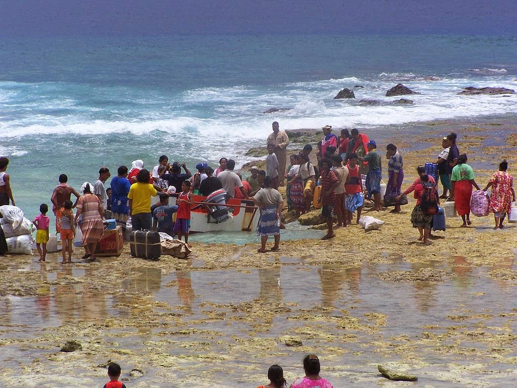
Cargo is offloaded from tenders that transfer passengers & cargo between the inter-island ferries and each of the outer islands of Tuvalu (here on the island of Niutao). A hazardous exercise, fraught with risk for passengers & the crew of the tenders. Shot by CESQLD, public domain

First-of-its-kind report ranks US insurance companies on climate change responses

A press release from Ceres: Amid growing evidence that climate change is having wide-ranging global impacts that will worsen in the years ahead, a new report from Ceres ranks the nation's 330 largest insurance companies on what they are saying and doing to respond to escalating climate risks. The report found strong leadership among fewer than a dozen companies but generally poor responses among the vast majority.

The report, Insurer Climate Risk Disclosure Survey Report & Scorecard: 2014 Findings & Recommendations, ranks property & casualty, health and life & annuity insurers that represent about 87 percent of the total US insurance market. The companies were ranked on a half-dozen climate related indicators, including governance, risk management, investment strategies, greenhouse gas management and public engagement (such as their climate policy positions.) The report is based on company disclosures last year in response to a climate risk survey developed by the National Association of Insurance Commissioners (NAIC).

“Despite being on the 'front line' of climate risks, most of the company responses show a profound lack of preparedness in addressing climate-related risks and opportunities,” said Mindy Lubber, president of Ceres, a nonprofit sustainability advocacy group. “A big positive in the report's findings is the strong leadership among a small number of property & casualty insurers – a trend that needs to become far more mainstream if the industry is to accelerate global responses to this colossal threat.”

The companies were ranked on a four-tier scoring system, based on a 100-point scale, that included "Leading," "Developing," "Beginning" and "Minimal" grades. Nine of the 330 companies – three percent overall – received the “Leading” rank, including ACE, Munich Re, Swiss Re, Allianz, Prudential, XL Group, The Hartford, Sompo Japan and Zurich. The Hartford and Prudential are the only U.S.-headquartered insurers among the nine firms.

The vast majority of the insurers – 276 of the 330 companies – earned “Beginning” or “Minimal” ratings. The heath and life & annuity insurers had especially weak responses, with 89 percent and 80 percent, respectively, receiving the lowest “Minimal” rating....

“As key regulators of this sector, we strongly encourage insurance industry leaders and investors who own these companies to take this challenge far more seriously,” said Washington Insurance Commissioner Mike Kreidler, who wrote the report foreword and chairs the NAIC’s Climate Change and Global Warming Working Group. “The insurance industry is uniquely positioned as the bearer of risk to make adjustments now to lessen dramatic impacts we know are coming. This is not a partisan issue, it’s a financial solvency issue and a consumer protection issue.”

The 2007 flooding of the Kishwaukee River in DeKalb, Illinois, shot by IvoShandor, Wikimedia Commons, under the Creative Commons 3.0 license

Wednesday, October 22, 2014

Brazil protects giant swathe of Amazon rainforest

Reuters: The Brazilian government said on Tuesday it has put an environmentally rich area of the Amazon rainforest under federal protection, creating a reserve larger than the U.S. state of Delaware.

The new reserve, called Alto Maues, has 6,680 square km (668,000 hectares or 1.65 million acres) of mostly untouched forests that are not known to have human presence, the Brazilian Environment Ministry said. Declaring a federal reserve means forest clearing and similar development are forbidden.

Putting large areas of mostly intact rainforest under federal protection is one of the tools the Brazilian government has to combat deforestation and reduce its greenhouse gas emissions. The creation of these reserves is part of the country's climate policy. Deforestation is the main cause of carbon emissions in Brazil, unlike most countries where the burning of fossil fuels leads emissions.

The decree creating the reserve was eagerly expected by environmental groups. "This is essential to protect unique Amazon species, such as
some types of primates," said Mauro Armelin, a conservationist working for the local office of the World Wildlife Fund (WWF)....

Amazon rainforest, shot by Neil Palmer (CIAT), Wikimedia Commons via Flickr, under the Creative Commons 2.0 license 

In disease outbreak management, flexibility can save lives and money

EurekAlert via Penn State: A new approach for responding to and managing disease outbreaks is being proposed by a team of epidemiologists led by two Penn State University researchers. The team's flexible approach could save many lives and millions of dollars.

The approach, called "adaptive management," allows decision-makers to use knowledge they gain during an outbreak to update ongoing interventions with the goal of containing outbreaks more quickly and efficiently. Current efforts to prevent or stem such outbreaks may fall short because of uncertainty and limited information about the real-time dynamics of the specific disease outbreak. The researchers have written a scientific paper on this adaptive management approach that will be published on 21 October in the open-access journal PLOS Biology.

"Responders often have incomplete information during a disease outbreak," said Katriona Shea, professor of biology at Penn State and a leader of the research team. "Everyone is trying to make rapid decisions, but we don't have reliable information to make the best decisions. Even if we have information about a previous outbreak, no two outbreaks are identical. Adaptive management involves planning to learn as you act for the most effective, efficient response."

...Organizations such as Doctors Without Borders work quickly to contain outbreaks as well as to prevent further spread. "Preparing, in advance, to include monitoring and evaluation with an eye toward changing management actions in light of changing conditions on the ground is the key to adaptive management. We've shown that a plan to manage adaptively can change the recommended actions on day one because, for example, you only need to manage for the worst-case scenario if it arises," Ferrari said.

...Historically, Ferrari said, "the argument has been for a very static policy because it's clear and easy to implement. We recognize that a more nuanced, context-specific approach could be better. We need to put the possibility of changing midstream into our toolbox, integrating scientific discovery with policymaking to improve intervention efforts."...

A new approach for responding to and managing disease outbreaks -- such as foot-and-mouth disease, measles, and viruses -- is being proposed by a team of epidemiologists led by two Penn State University researchers. Electron micrograph of foot and mouth disease virus by Shmuel Rozenblatt, Tel-Aviv University

Tuesday, October 21, 2014

Worst case scenarios of sea level rise, and why scientists and policymakers consider them

Robert McSweeney in the Carbon Brief: Sea levels could rise by a maximum of 190 centimetres by the end of the century, according to a new study, which examines a worst case scenario for sea level rise. In reality, the amount of sea level rise we get is likely to be less than that. But scientists and policymakers examine such 'worst case' scenarios to safeguard against climate risks.

With 10 per cent of the world's population living less than 10 metres above sea level, the threat of  coastal flooding is significant. The Intergovernmental Panel on Climate Change (IPCC) expects sea level rise to cause a ' significant increase' in sea levels extremes and the risk of coastal flooding.

The new study, published in  Environmental Research Letters, considers the assessment of 13 ice sheet experts. They conclude that the contribution from ice sheets is likely to be greater than projected by the IPCC. The paper suggests that sea levels could rise by as much as 190 cm this century.

Projections of sea level rise are typically constructed by working out the contribution to sea level rise from different  factors. The biggest contribution is from water expanding as it warms, followed by melting glaciers, then melting ice sheets on Greenland and Antarctica.

The crucial question for sea level rise this century is how much ice will be lost from the ice sheets, the authors argue. But it remains one of the largest uncertainties. In its Fifth Assessment Report (AR5), the IPCC  says there isn't sufficient evidence for them to give probabilities of large-scale losses of ice sheets.

The new study uses expert judgement to consider areas of ice sheet loss that are often not included in the sea level  models that the IPCC bases its assessment on. They then combine these judgements with the methods used in AR5 to produce their upper-limit figure of 190 cm....

A 2008 FEMA photo by Patsy Lynch of Hurricane Ike debris in Port Arthur, Texas

Monday, October 20, 2014

Improved electricity access has little impact on climate change

A press release from the International Institute for Applied Systems Analysis: Expanding access to household electricity services accounts for only a small portion of total emission growth, shows a new study from the International Institute for Applied Systems Analysis (IIASA), shedding light on an ongoing debate on potential conflicts between climate and development.

Improving household electricity access in India over the last 30 years contributed only marginally to the nation’s total carbon emissions growth during that time, according to a new study published in the journal Nature Climate Change.

“Energy access is fundamental to development: it brings improvements to all aspects of life, including education, communication, and health,” says IIASA researcher Shonali Pachauri, who conducted the study.

While increased energy access is widely agreed to be an important goal for development efforts, such as the UN Sustainable Energy for All Initiative, the climate impacts of increased access to electricity have been unclear. The new study is the first to examine the impact of electricity access on carbon dioxide emissions using two sources of retrospective data.

“This study shows that the climate impacts of expanding access are in fact very small,” says Pachauri. However, she adds, expanding low-carbon energy technologies in developing countries would bring many co-benefits beyond climate mitigation.

Pachauri used India as a case study because while the country still lacks electricity access for much of its population—around 400 million people—it has vastly increased access in the last 30 years. From 1981 to 2011, household electricity access in the country improved from around 25% to between 67-74% of the population, an increase of approximately 650 million people.  “India is at a similar stage to many other developing countries in terms of energy access” says Pachauri, “So we believe that these findings will be applicable on a broad scale to other developing countries.”...

Electricity meters in Kolkata, shot by Jorge Royan, Wikimedia Commons, under the Creative Commons 3.0 license

Brazil must target smallholders to curb rising deforestation

Anastasia Moloney in the Guardian (UK) via the Thomson Reuters Foundation: Farmers with smallholdings are not responsible for most of the destruction of Brazil’s Amazon rainforest, but their contribution to deforestation is rising and must be addressed if the country is to hold on to recent gains, according to an environmental research group.

Government efforts led to a 77% fall in deforestation in the Amazon between 2004 and 2011, but progress has slowed and deforestation is rising, the Stockholm Environment Institute (SEI) said in a report.

The report said that between 2004 and 2011, landowners with more than 500 hectares (1,235 acres) of property were responsible for about 48% of the deforestation. Areas owned by smallholders accounted for 12% of the forests destroyed during the same period.

However, since 2005, the contribution to annual deforestation by the largest landowners has fallen by 63%, while that of smallholders has increased by 69%, the report said. “Despite the gains made to stem deforestation from 2004 onwards … the outlook today is not all positive,” said Javier Godar, a research fellow at SEI and lead author of the study.

In 2013, deforestation increased by 28% compared with the previous year. Godar said part of the reason for the rise was that many conservation areas had been scaled down or had their protection status changed, and flagship public-private initiatives, such as a moratorium on trading soya beans from newly deforested areas in the Amazon, were about to end. A boom in infrastructure projects in the Amazon since 2009, including the building of new roads and dams, may also be contributing to Brazil’s rising deforestation rates, Godar said....

A logging truck in the Mato Grasso, shot by Herr Klugbeisser, Wikimedia Commons, under the Creative Commons 3.0 license 

Ebola hits West Africa food security

IRIN: West Africa's Ebola outbreak, which has been disrupting agricultural and market activities, threatens to erode food security and negatively affect the livelihoods of millions of already vulnerable people in Guinea, Liberia and Sierra Leone unless more is done to meet their immediate food and nutritional needs, say aid agencies.

They say they are still calculating the number of food insecure households, but alre
ady the results of initial rapid assessments are worrying.

The World Food Programme (WFP) found that more than 80 percent of people surveyed via mobile phone in the eastern part of Sierra Leone say they have been eating less expensive food since the outbreak began. Three-quarters of respondents have begun to reduce the number of daily meals and portion sizes.

...A rapid assessment survey last month in Sierra Leone by the Food and Agriculture Organization (FAO) found that 47 percent of farmers have had their work "considerably disrupted" by the Ebola outbreak.

"Here, we have the largest cocoa farms," said Sidikie Kabba, a farmer from eastern Sierra Leone. "Now it's quarantined because of Ebola, so people aren't travelling. Before, I was harvesting my produce - up to 50 bags - but now even 10 bags is difficult. So I'm losing money," he said...

A chart of Ebola deaths to October 1, created by Malanoqa, Wikimedia Commons, under the Creative Commons 4.0 International license

Lake Erie increasingly susceptible to large cyanobacteria blooms

A press release from the University of Michigan: Lake Erie has become increasingly susceptible to large blooms of toxin-producing cyanobacteria since 2002, potentially complicating efforts to rein in the problem in the wake of this year's Toledo drinking water crisis, according to a new study led by University of Michigan researchers.

Since the detection of the toxin microcystin left nearly half a million Ohio and Michigan residents without drinking water for several days in early August, discussions of ways to prevent a recurrence have largely focused on the need to reduce the amount of phosphorus fertilizer that washes off croplands and flows into western Lake Erie to trigger harmful cyanobacteria blooms.

In a study published online Oct. 8 in the journal Water Resources Research, scientists from U-M and the National Oceanic and Atmospheric Administration conclude that microcystin-producing cyanobacteria in Lake Erie are becoming more sensitive to phosphorus and that reductions may have to cut far deeper than recently proposed targets.

"Our results suggest that current phosphorus loading targets will be insufficient for reducing the intensity of cyanobacteria blooms to desired levels, so long as the lake remains in a heightened state of bloom susceptibility," said lead author Daniel Obenour, formerly of the U-M Water Center and now at North Carolina State University. Other authors are Don Scavia of U-M and Andrew Gronewold and Craig Stow of the National Oceanic and Atmospheric Administration.

...Though the total amount of phosphorus entering the lake seems to be the best predictor of bloom size, that variable alone doesn't fully explain the observed size increase during the study period examined by the team, 2002 to 2013....

NASA image of a toxic algae bloom in Lake Erie

Sophisticated sensor will give NOAA earlier warnings of severe storms

A press release from Lockheed Martin: A Lockheed Martin .. team delivered the first Geostationary Lightning Mapper (GLM) instrument that will provide earlier alerts of developing severe storms and contribute to more accurate tornado warnings. The sensor will fly on the National Oceanic and Atmospheric Administration’s (NOAA) next-generation Geostationary Operational Environmental Satellite (GOES) satellite missions, known as the GOES-R Series.

The team is preparing integration with the first GOES-R spacecraft at Lockheed Martin’s facility near Denver. The satellite is expected to launch in early 2016.

“GLM will have the potential to save lives by using lightning as a reliable indicator of severe weather, like tornados,” said Russell Katz, Lockheed Martin GLM deputy program manager. “A rapid increase of in-cloud lightning can precede severe weather on the ground. Changes in that type of lightning can also give us a better understanding of the updraft strength in thunderstorms.” The instrument also gives us a better understanding of the updraft strength of thunderstorms by capturing changes of the in-cloud lightning.”

GLM provides a new capability to track lightning flashes from geostationary orbit, with continuous coverage of the United States and most of the Western Hemisphere. The heart of the GLM instrument is a high-speed (500 frames per second), 1.8 megapixel focal plane, integrated with low-noise electronics and specialized optics to detect weak lightning signals, even against bright, sunlit cloud backgrounds.

...GOES satellites are a key element in NOAA’s National Weather Service operations, providing a continuous stream of environmental information (weather imagery and sounding data) used to support weather forecasting, severe-storm tracking and meteorological research....

The first Geostationary Lightning Mapper instrument, shown here in a file photo, will be launched aboard the National Oceanic and Atmospheric Administration’s next-generation weather satellite missions, GOES-R, starting in 2016. Photo from the Lockheed Martin website

Sunday, October 19, 2014

The link between environmental degradation and Ebola

Peter Stoett and Catherine Machalaba in the Toronto Star:  The Ebola epidemic besieging West Africa is perhaps the starkest warning yet that as we tear down forests, we open ourselves up to new strains of virulent disease. Among the key lessons from the current outbreak is that human-created pressures such as intensified food production, rapid trade and travel, and climate change, are putting future generations at risk of further Ebola-like catastrophes.

Through some mix of travel control, medical advances, and humanitarian assistance, we can hopefully stop the current outbreak’s carnage. But what can we do to prevent future outbreaks of so-called exotic diseases?

Delegates at the recent UN conference on biodiversity in South Korea expressed particular concern that the long-term alteration of habitats (by, for example, logging, farming, mining) and speeding climate change will increase the chances of the spread of exotic diseases. They compellingly made the case that Guinea, Liberia, and Sierra Leone are all known for their high deforestation rates; and each has been affected by periods of civil strife that exacerbated population displacement and relocation.

It would be premature to conclude that deforestation or other causes of ecosystem change were the factors behind this outbreak, but they remain part of the equation for Ebola, other emerging illnesses and even established diseases like malaria.

Unsustainable policies designed to increase agricultural output for export, illegal logging, the mercurial rise of the palm oil industry and the hunt for oil and gold within tropical and boreal forests — all of these place humans in greater contact with wild species, in some cases for the first time, enabling more efficient transmission of diseases both known and unknown.

Indeed, scientists started linking infectious diseases with environmental alteration decades ago. Today, climate change complicates the issue: most predictions (many of them already realized) suggest the changing climate will allow for the spread of invasive species, degrade ecosystems’ resiliency and ultimately broaden the reach of some diseases....

CDC Disease detective Kari Yacisin (left) conducts contact tracing for Ebola in West Africa with a local health official. CDC photo via Wikimedia Commons, under the Creative Commons 2.0 license

The 1934 drought was worst of the last millennium

A press release from the American Geophysical Union: The 1934 drought was by far the most intense and far-reaching drought of the last 1,000 years in North America, and was caused in part by an atmospheric phenomenon that may have also led to the current drought in California, according to a new study.

New research finds that the extent of the 1934 drought was approximately seven times larger than droughts of comparable intensity that struck North America between 1000 A.D. and 2005, and nearly 30 percent worse than the next most severe drought that struck the continent in 1580.

“We noticed that 1934 really stuck out as not only the worst drou
ght but far outside the normal range of what we see in the record,” said Benjamin Cook, an environmental scientist at NASA’s Goddard Institute for Space Studies in New York City and lead author of a new paper that has been accepted for publication in Geophysical Research Letters, a journal of the American Geophysical Union.

The new study also finds that the same atmospheric pattern of a high pressure ridge over the West Coast deflecting away storms laden with rain last winter was also present over the area during the winter of 1933-34.

This ridging pattern has preceded some of the worst West Coast droughts, including the 1976 California drought—the beginning of a two-year dry spell which is widely regarded as one of the most severe droughts in the state’s history. The three-year drought currently crippling California will cost the state $2.2 billion in 2014 alone, and will likely continue through 2015, according to a recent report from the University of California, Davis.

Yet the current drought is nothing, so far, compared to what occurred in 1934, the start of a decade-spanning drought that would come to be known as the Dust Bowl and was one of the worst environmental disasters in the history of the United States.

The drought, which afflicted nearly 72 percent of the western United States, was likely made even worse by atmospheric effects from human-created dust storms, according to the new research. The new study suggests that such interactions between the land and the atmosphere may have an important role to play in drought severity, said Cook, who holds a joint appointment at Columbia University’s Lamont-Doherty Earth Observatory....

Arthur Rothstein's 1936 of a dust storm in the Texas Panhandle

New forecasting method for predicting extreme floods in the Andes mountains

A press release from the Potsdam Institute for Climate Impact Research: Predicting floods following extreme rainfall in the central Andes is enabled by a new method. Climate change has made these events more frequent and more severe in recent decades. Now complex networks analysis of satellite weather data makes it possible to produce a robust warning system for the first time, a study to be published in the journal Nature Communications shows. This might allow for improved disaster preparedness. As the complex systems technique builds upon a mathematical comparison that can be utilised for any time series data, the approach could be applied to extreme events in all sorts of complex systems.

“Current weather forecast models cannot capture the intensity of the most extreme rainfall events, yet these events are of course the most dangerous, and can have severe impacts for the local population, for example major floods or even landslides,” says lead author Niklas Boers of the Potsdam Institute for Climate Impact Research (PIK). “Using complex networks analysis, we now found a way to predict such events in the South American Andes.”

When the monsoon hits South America from December to February, it brings moist warm air masses from the tropical Atlantic. Travelling westwards, these winds are blocked by the steep Andes mountains, several thousand metres high, and turn southwards. Under specific air pressure conditions, the warm air masses, loaded with moisture, meet cold and dry winds approaching from the south. This leads to abundant rainfa
ll at high elevations, resulting in floods in the densely populated foothills of the Bolivian and Argentinian Andes. “Surprisingly, and in contrast to widespread understanding so far, these events propagate against the southward wind direction,” says Boers.

The international team of scientists performed a ‘Big Data’ analysis of close to 50,000 high-resolution weather data time series dating from the 15 years since high quality satellite data became available, generated by NASA together with the Japan Aerospace Exploration Agency. “We found that these huge rainfall clusters start off in the area around Buenos Aires, but then wander northwestward towards the Andes, where after two days they cause extreme rainfall events”, says Boers. The new method makes it possible to correctly predict 90 percent of extreme rainfall events in the Central Andes occurring during conditions of the El Niño weather phenomenon when floods are generally more frequent, and 60 percent of those occurring under any other conditions....

The Andes between Chile and Argentina, shot by Jorge Morales Pideri, public domain

The 'threat multiplier’ of climate change

John D. Banusiewicz at Department of Defense News, Defense Media Activity: Defense Secretary Chuck Hagel [outlined] the effects of climate change on the world’s security environment and [unveiled] the Defense Department’s plan to meet that challenge in a speech this afternoon at the Conference of Defense Ministers of the Americas in Arequipa, Peru.

In a statement, Hagel noted that thinking ahead and planning for a wide range of contingencies is the Defense Department’s responsibili
ty in providing security for the nation, and that climate change is a trend that will affect national security.

“Rising global temperatures, changing precipitation patterns, climbing sea levels and more extreme weather events will intensify the challenges of global instability, hunger, poverty, and conflict,” he said. “They will likely lead to food and water shortages, pandemic disease, disputes over refugees and resources, and destruction by natural disasters in regions across the globe.”

The U.S. defense strategy refers to climate change as a “threat multiplier,” the secretary said, because it has the potential to exacerbate many challenges, including infectious disease and terrorism. “We are already beginning to see some of these impacts,” he added.

A changing climate will have real impacts on the military and the way it executes its missions, Hagel said, noting that the military could be called upon more often to support civil authorities and to provide humanitarian assistance and disaster relief in the face of more frequent and more intense natural disasters.

“Our coastal installations are vulnerable to rising sea levels and increased flooding, while droughts, wildfires and more extreme temperatures could threaten many of our training activities,” he said. “Our supply chains could be impacted, and we will need to ensure our critical equipment works under more extreme weather conditions.”

Weather always has affected military operations, and as the climate changes, the way the military executes operations may be altered or constrained, the secretary said. Uncertainty is no excuse for delaying action

David Gleason shot this picture of the Pentagon in 2008, Wikimedia Commons via Flickr, under the Creative Commons 2.0 license

Monday, October 13, 2014

Cyclone wreaks havoc on east India coast, kills at least eight

Reuters via the Thomson Reuters Foundation: Cyclone Hudhud powered its way inland over eastern India on Monday, leaving a swathe of destruction but the loss of life appeared limited after tens of thousands of people sought safety in storm shelters, aid workers and officials said.

Packing wind speeds of up to 195 kph (over 120 mph), Hudhud hammered the coasts of Andhra Pradesh and Odisha states on Sunday, killing at least eight people and causing widespread devastation.

In the port city of Visakhapatnam, which is home to two million people, wreckage was strewn everywhere. The storm uprooted trees, tore sign boards off buildings, snapped telecom and power lines and ripped roofs and walls from scores of homes.

"I saw the wind blow huge sign boards and water tanks and make them swirl and fly through the air before they came crashing down," said Narayana, cleaning up debris in front of his house, the roof and front wall of which had been torn off. "It is the first time I have seen such a horrific situation in Visakhapatnam."...

The effect of Cyclone Hudhud at RK Beach road, Visakhapatnam, shot by dityamadhav83, Wikimedia Commons, under the Creative Commons Attribution-Share International 4.0 license

Eastern China set for record-hot summers

Yahoo via AFP: By 2024, more than half of summers in eastern China will be as hot as in 2013, when the region was hit by a record-busting heatwave and devastating drought, a study said Sunday. Based on current global warming trends, the big heat will happen even if rising greenhouse gas emissions are braked over the next decade, it said.

The summer of 2013 was the hottest on record in eastern China -- a massive 1.1 degrees Celsius (two degrees Fahrenheit) above the long-term average. On 31 days, the temperature reached or exceeded the heatwave benchmark of 35 degrees Celsius -- more than double the usual June-August tally.

Nine provinces, with half a billion inhabitants, were affected. Direct economic losses, in China's most populated and economically developed region, have been put at 59 billion renminbi ($9.6 billion).

Reporting in the journal Nature Climate Change, scientists in Beijing, Canada and the United States said the probability of a 2013-like summer in eastern China had increased by a factor of 60 since the early 1950s....

Sunday, October 12, 2014

Rivers recover natural conditions quickly following dam removal

Oregon State University News and Research Communications: A study of the removal of two dams in Oregon suggests that rivers can return surprisingly fast to a condition close to their natural state, both physically and biologically, and that the biological recovery might outpace the physical recovery.

The analysis, published by researchers from Oregon State University in the journal PLOS One, examined portions of two rivers – the Calapooia River and Rogue River. It illustrated how rapidly rivers can recover, both from the long-term impact of the dam and from the short-term impact of releasing stored sediment when the dam is removed.

Most dams have decades of accumulated sediment behind them, and a primary concern has been whether the sudden release of all that sediment could cause significant damage to river ecology or infrastructure. However, this study concluded that the continued presence of a dam on the river constituted more of a sustained and significant alteration of riv
er status than did the sediment pulse caused by dam removal.

“The processes of ecological and physical recovery of river systems following dam removal are important, because thousands of dams are being removed all over the world,” said Desirée Tullos, an associate professor in the OSU Department of Biological and Ecological Engineering.

“Dams are a significant element in our nation’s aging infrastructure,” she said. “In many cases, the dams haven’t been adequately maintained and they are literally falling apart. Depending on the benefits provided by the dam, it’s often cheaper to remove them than to repair them.”...

The remains of the Savage Rapids Dam on the Rogue River in Oregon, shot by Finetooth, Wikimedia Commons, under the Creative Commons Attribution-Share Alike 3.0 Unported license

Saturday, October 11, 2014

Powerful typhoon churns toward Okinawa with strong winds

Reuters: A large powerful typhoon moved slowly towards Japan's Okinawa island chain on Saturday, packing heavy winds that disrupted flights and knocked out power.

Typhoon Vongfong, Japan's strongest storm this year, at 0500 GMT Saturday was about 150 km (94 miles) southeast of Naha City, the biggest city in Okinawa, and moving north at 15 kph (9 mph), Japan Meteorological Agency (JMA) said.

Its winds gusted up to 234 kph (146 mph). Fourteen people in Okinawa and Kagoshima prefecture in Kyushu were injured due to strong winds, the Mainichi newspaper reported.

It was likely to be closest to Okinawa - 1,600 km (1,000 miles) southwest of Tokyo, and the home of the largest contingent of U.S. troops in Japan - on Sunday morning Japan time, local media reports said.

The typhoon was expected to weaken as it moved north, however, and likely to hit land on Monday morning on the westernmost main island of Kyushu, before moving northeast towards Japan's main island of Honshu on Tuesday....

Typhoon Vongfong shot by NASA, October 10, 2014

Cyclones and climate change: The $9.7 trillion problem

Brian Kahn at the Weather Channel via Climate Central: You can do a lot with $9.7 trillion: buy all the real estate in Manhattan 12 times over, purchase 22 carbon copies of Apple, or an absurd quantity of apples. It’s also the amount of money that tropical cyclones could cost the global economy over the next century, especially if climate projections of fewer but more intense cyclones are accurate. In comparison to those losses, the cost of action to reduce emissions and beef up coastal preparedness is relatively cheap say researchers.

Humanity and cyclones are no strangers to each other. Roughly 35 percent of the world’s 7 billion people are in the path of cyclones and coastal populations are expected to swell in the coming century. To understand the future damage that cyclones could inflict on ever-growing coastal cities, two researchers looked at 60 years of cyclone and economic data in a recent National Bureau of Economic Research study.

They found that cyclones — known as hurricanes or typhoons depending on the ocean basin in which they form — left lasting impacts on the economies of the countries they hit. In the case of major events, such as 1-in-100 year storm like Hurricane Ivan in 2004, the impacts were worse and longer-lasting than a full-blown financial crisis. If that sounds shocking to you, you’re not the only one who felt that way. “We didn’t believe what we saw at first,” said Amir Jina, a postdoctoral researcher at the University of Chicago and one of the study’s authors.

Part of the surprise for Jina was the robustness of the results and how they fly in the face of one commonly held thought in economics that disasters can actually give a boost to a country’s economy in the long run.

The losses are essentially hidden in plain sight, spread over long periods of time rather than one big hit. Countries hit by cyclones continue to grow. But the study showed that they are knocked onto a different, slightly lower growth track, like a car switching from a highway’s fast lane to the slow (or at least slightly less fast) lane....

A beach house in Breezy Point, Queens, New York, wrecked by Hurricane Sandy, shot by Jim.henderson, Wikimedia Commons, under the Creative Commons CC0 1.0 Universal Public Domain Dedication

Satellite data shows surprising methane hotspot in US southwest

The Guardian (UK) via AP: A surprising hotspot of the potent global warming gas methane hovers over part of the southwestern US, according to satellite data and is likely to be leakage from pumping methane out of coal mines. The result hints that the US Environmental Protection Agency (EPA) and other agencies considerably underestimate leaks of methane, which is also called natural gas.

The higher level of methane is not a local safety or a health issue for residents, but is a factor in overall global warming. While methane isn’t the most plentiful heat-trapping gas, scientists worry about its increasing amounts and have had difficulties tracking emissions.

A satellite image shows the hotspot of atmospheric methane concentrations as a bright red blip over the Four Corners area of New Mexico, Colorado, Arizona and Utah in continental US. The image used data from 2003 to 2009.

Within that hotspot, a European satellite found atmospheric methane concentrations equivalent to emissions of about £1.3m a year. That’s about 80% more than the EPA figured. Other ground-based studies have calculated that EPA estimates were off by 50%. The methane concentration in the hotspot was more than triple the amount previously estimated by European scientists.

The amount of methane in the Four Corners, an area covering about 2,500 square miles would trap more heat in the atmosphere than all the carbon dioxide produced yearly in Sweden. That’s because methane is 86 times more potent for trapping heat in the sh
ort-term than carbon dioxide.

...“It’s the largest signal we can see from the satellite,” said study lead author Eric Kort, a University of Michigan atmospheric scientist. “It’s hard to hide from space.” There could be some areas elsewhere in the country where more methane is emitted if it is dispersed by wind, Kort said. Kort said the methane likely comes from leaks as workers extract natural gas from coal beds, and not from hydraulic fracturing, called fracking, because the data were collected before fracking really caught on....

Image of hotspot from NASA