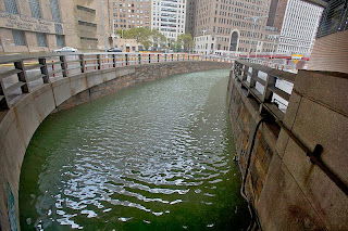
Thursday, October 31, 2013

Marking one year since Hurricane Sandy, UN officials urge focus on Caribbean

UN News Centre: On the anniversary of Hurricane Sandy making landfall in the United States, United Nations officials are reminding the public not to forget the storm’s less documented Caribbean victims. Commemoration ceremonies will take place around the northeast United States today, particularly in New York, where the devastating storm caused over $18 billion worth of damage to the city.

In an editorial published yesterday, in Aljazeera, Heraldo Muñoz, Director of UN Development Program (UNDP) Bureau for Latin America and the Caribbean, called on New Yorkers not to forget that the US was but the last stop on Sandy’s tour of destruction.

“Sandy, one of the largest Atlantic hurricanes on record, rumbled across the Bahamas, Cuba, the Dominican Republic, Jamaica and other countries before finally reaching the eastern seaboard of the US,” Mr. Muñoz wrote in the online editorial.

One year on, UNDP says that recovery efforts from the storm are underway, but some of the agency’s officials say that the suffering of those in developing Caribbean nations may have been underplayed. “Because of socio-economic vulnerabilities, people in developing countries are often less prepared for a large event and unfortunately are not as quick to bounce back or recover,” said Jo Scheuer, UNDP Coordinator of Disaster Risk Reduction and Recovery.

“While the mainland US suffered greater losses in terms of total fatalities and the extent of damage, for the Caribbean nations, Cuba and Haiti in particular, the storm was comparatively more expensive – having a much more profound impact on local livelihoods and the GDP,” Mr. Scheuer said, adding that in Haiti, the storm intensified the humanitarian crisis caused by the 2010 earthquake...

Hurricane Sandy damage at Guantanamo in Cuba. Shot by DVIDSHUB, Wikimedia Commons via Flickr, under the Creative Commons Attribution 2.0 Generic license

Is global heating hiding out in the oceans?

A press release from the Earth Institute at Columbia University: A recent slowdown in global warming has led some skeptics to renew their claims that industrial carbon emissions are not causing a century-long rise in Earth’s surface temperatures. But rather than letting humans off the hook, a new study in the leading journal Science adds support to the idea that the oceans are taking up some of the excess heat, at least for the moment. In a reconstruction of Pacific Ocean temperatures in the last 10,000 years, researchers have found that its middle depths have warmed 15 times faster in the last 60 years than they did during apparent natural warming cycles in the previous 10,000.

“We’re experimenting by putting all this heat in the ocean without quite knowing how it’s going to come back out and affect climate,” said study coauthor Braddock Linsley, a climate scientist at Columbia University’s Lamont-Doherty Earth Observatory. “It’s not so much the magnitude of the change, but the rate of change.”

...The IPCC scientists agree that much of the heat that humans have put into the atmosphere since the 1970s through greenhouse gas emissions probably has been absorbed by the ocean. However, the findings in Science put this idea into a long-term context, and suggest that the oceans may be storing even more of the effects of human emissions than scientists have so far realized.  “We may have underestimated the efficiency of the oceans as a storehouse for heat and energy,” said study lead author, Yair Rosenthal, a climate scientist at Rutgers University. “It may buy us some time – how much time, I don’t really know.  But it’s not going to stop climate change.”

...One explanation for the recent slowdown in global warming is that a prolonged La Niña-like cooling of eastern Pacific surface waters has helped to offset the global rise in temperatures from greenhouse gases.  In a study in the journal Nature in August, climate modelers at the Scripps Institution of Oceanography showed that La Niña cooling in the Pacific seemed to suppress global average temperatures during northern hemisphere winters but allowed temperatures to rise during northern hemisphere summers, explaining last year’s record U.S. heat wave and the ongoing loss of Arctic sea ice.

...The study’s long-term perspective suggests that the recent pause in global warming may just reflect random variations in heat going between atmosphere and ocean, with little long-term importance, says Drew Shindell, a climate scientist with joint appointments at Columbia’s Earth Institute and the NASA Goddard Institute for Space Studies, and a lead author on the latest IPCC report.  “Surface temperature is only one indicator of climate change,” he said. “Looking at the total energy stored by the climate system or multiple indicators--glacier melting, water vapor in the atmosphere, snow cover, and so on—may be more useful than looking at surface temperature alone.”...

CIA map of the Pacific Ocean, "by" Lasunncty, Wikimedia Commons, under the Creative Commons Attribution-Share Alike 3.0 Unported license

Climate change to disrupt soil nutrients in drylands

Jan Piotrowski in SciDev.net: The increased aridity expected this century as a result of climate change may disrupt the balance of key soil nutrients with a knock-on effect on soil fertility threatening livelihoods of more than two billion people, a study finds.

The drop in nitrogen and carbon concentrations that occurs as soils become dryer could have serious effects on ecosystem services such as food production, carbon storage and biodiversity, according to the Nature paper published today.

Loss of nitrogen and carbon, which are the basic building blocks of living organisms, drastically affects land’s productivity, says Fernando T. Maestre, a biologist and geologist from King Juan Carlos University, Spain, and a co-author of the report. “If plant productivity is reduced, the capability of the land to support livestock and crops will be affected and this will have a big impact on people who depend on them,” he tells SciDev.Net.

Drylands make up more than 40 per cent of the world's land area, and host a similar proportion of the world’s population. Many are expected to get drier because of climate change.

The study measured the nitrogen, carbon and phosphorus content of soil at 224 sites across all continents except Antarctica, which together represent a wide range of soil and vegetation types, climates and species diversity. As ecosystems became more arid, it found, both nitrogen and carbon concentrations decreased, which may significantly impair plant and microbial activity, with knock-on effects on organic decomposition and plant growth....

The Spider Rock Overlook at Canyon de Chelly in Arizona, National Park Service

Study of Brazilian Amazon shows 50,000 km of road was built in just three years

Terra Daily via SPX: Although road-building is a major contributor to deforestation and habitat loss, the way in which road networks develop is still poorly understood. A new study is among the first to measure the number of roads built in a rainforest ecosystem over an extended period of time.

It was published this month in the journal Regional Environmental Change by researchers including two Life Scientists from Imperial College London. They say studies like this will help combat future deforestation by allowing for more accurate predictions of where it might occur.

Even though roads often occupy less than 2 per cent of a country's land surface, they may have an ecological impact on an area up to ten times as large. These indirect effects can include changes in air and soil temperature and moisture, as well as restrictions on the movement of animals.

Research co-author Dr Rob Ewers, of Imperial's Department of Life Sciences, said: "Knowing where the roads are and the speed at which they are built is key to predicting deforestation. A number of models currently exist which rely on this knowledge, but there are no good studies of how quickly roads get built and where they go when they are built. An understanding of road networks is the big missing gap in our ability to predict the future of this region."...

The BR-174 in Roirama, Brazil, shot by Agencia CNT de Noticias, Wikimedia Commons via Flickr, under the Creative Commons Attribution 2.0 Generic license 

Africa urged to pursue homegrown climate change solutions

Thomson Reuters Foundation: African nations are entitled to a fair share of financial and other assistance from the developed world to help them cope with climate change, but they should also take the initiative to green their own economies and use land more sustainably and productively, experts told a conference on climate change and development in Ethiopia this month.

The Kenya-based Pan-African Climate Justice Alliance (PACJA), a coalition of non-governmental organisations, urged rich nations to commit at upcoming U.N. climate talks in Warsaw to provide climate aid equivalent to at least 1.5 percent of their gross domestic product (GDP). The group also called for the establishment of an international mechanism to protect the most vulnerable countries from losses and damage resulting from climate change.

At the Addis Ababa conference, which was attended by more than 700 delegates from 54 African countries, Carlos Lopes, U.N. under secretary general and executive secretary of the U.N. Economic Commission for Africa (ECA), said “principles of corrective and distributive justice should apply” at November’s U.N. climate negotiations in Warsaw.

Lopes noted that per capita carbon dioxide emissions in Africa are less than 1 tonne each year. Yet while Africa accounts for just 2.4 percent of global emissions, the negative impacts of climate change estimated as a percentage of GDP are higher in Africa than in wealthier parts of the world, he added.

As a result the continent is a massive ecological creditor, Lopes said, even though countries responsible for 80 percent of global emissions do not accept this concept. The aid Africa has received for adapting to climate change so far is less than 2 percent of the total it needs, he added...

A fruit stand in Swaziland, shot by Sara Atkins, Wikimedia Commons via Flickr, under the Creative Commons Attribution 2.0 Generic license

Wednesday, October 30, 2013

Thawing permafrost: The speed of coastal erosion in Eastern Siberia has nearly doubled

Alfred Wegener Institute: The high cliffs of Eastern Siberia – which mainly consist of permafrost – continue to erode at an ever quickening pace. This is the conclusion which scientists of the Alfred Wegener Institute, Helmholtz Centre for Polar and Marine Research have reached after their evaluation of data and aerial photographs of the coastal regions for the last 40 years. According to the researchers, the reasons for this increasing erosion are rising summer temperatures in the Russian permafrost regions as well the retreat of the Arctic sea ice. This coastal protection recedes more and more on an annual basis. As a result, waves undermine the shores. At the same time, the land surface begins to sink. The small island of Muostakh east of the Lena Delta is especially affected by these changes. Experts fear that it might even disappear altogether should the loss of land continue.

The interconnectedness is clear and unambiguous: The warmer the east Siberian permafrost regions become, the quicker the coast erodes. “If the average temperature rises by 1 degree Celsius in the summer, erosion accelerates by 1.2 metres annually,“ says AWI geographer Frank Günther, who investigates the causes of the coastal breakdown in Eastern Siberia together with German and Russian colleagues, and who has published his findings in two scientific articles.

...This increase in temperature is not without consequences. Whereas a thick layer of sea ice used to protect the frozen soil almost all year round, it now recedes in this part of the Arctic for increasing periods of time during the summer months. The number of summer days on which the sea ice in the southern Laptew Sea vanishes completely grows steadily. “During the past two decades, there were, on average, fewer than 80 ice-free days in this region per year. During the past three years, however, we counted 96 ice-free days on average. Thus, the waves can nibble at the permafrost coasts for approximately two more weeks each year,“ explains AWI permafrost researcher Paul Overduin.

The waves dig deep recesses into the base of the high coasts. The result: The undermined slopes break off bit by bit. During the past 40 years, the coastal areas surveyed retreated on average 2.2 meters per year. “During the past four years, this value has increased at least 1.6 times, in certain instances up to 2.4 times to reach 5.3 meters per year,“ says Paul Overduin.

For the little island of Muostakh east of the harbour town of Tiksi, this may well mean extinction. “In fewer than one hundred years, the island will break up into several sections, and then it will disappear quickly,“ predicts Frank Günther....

Waiting for supplies in Eastern Siberia, shot by NASA ICE, Wikimedia Commons via Flickr, under the Creative Commons Attribution 2.0 Generic license

UK Storm: Power cut continues at 15,000 homes in East

BBC: About 15,000 properties in the east of England are still without electricity after storms earlier this week. Winds of up to 80mph (129kmh) on Monday brought down trees and power lines, causing what UK Power Networks said was "extensive" damage.

At the height of the storm, 300,000 households in the region had no power. UK Power Networks said up to 8,000 properties were without power in Suffolk, 6,800 in Essex and 200 in Hertfordshire, as of 07:00 GMT.

It said Bedfordshire, Buckinghamshire, Norfolk and Cambridgeshire were "back to normal" on Tuesday. Most rail services resumed on Wednesday after two days of delays and cancellations.

Greater Anglia said it worked with Network Rail and had to deal with 230 fallen trees and several overhead wire problems....

Stormy weather in the UK from 2008, shot by Mat Fascione, Wikimedia Commons via Geograph UK, under the Creative Commons Attribution-Share Alike 2.0 Generic license

Hunger looms over Malawi

Thomson Reuters Foundation via Plan UK: Nearly 1.5 million villagers are short of food in rural Malawi after severe weather disrupted harvests, reports Plan International. Late and erratic rains, droughts and floods have all contributed, with the north of the East African country worst affected.

Many families are now down to one or two basic meals a day, instead of three, in a bid to ration what they have. “Most households have given up breakfast as one way of saving the little food they have stocked,” says Plan’s country director in Malawi, Lilly Omondi.

“As such, their dietary intake has decreased below normal and this may result in increased cases of malnutrition in children under the age of five.” Families could be short of food for up to five months while in one of the worst hit areas, villagers walked 12 miles to get food aid.

The government will provide 25,000 tonnes of maize for distribution after 30,000 tonnes of grain rotted in reserves earlier this year. Aid workers for Plan have begun distributing maize, pulses and corn-soya blend to families in Mzimba and Kasungu.

High maize prices and families’ lack of assets after repeated shortages are worsening the situation....

A UN food program feeding children in Malawi, shot by khym54, Wikimedia Commons via Flickr, under the Creative Commons Attribution 2.0 Generic license

China and Brazil launch a satellite for disaster reduction

Terra Daily via Xinhua: Another China-Brazil satellite will be launched from China at the end of this year to collect data for disaster prevention and environmental protection. The satellite, the third to be launched under the China-Brazil Earth Resources Satellite Program (CBERS), is the latest international advance in disaster reduction, with functions in agriculture, meteorology and the environment, according to the China National Space Administration (CNSA).

CBERS images are used for a variety of purposes, including measuring deforestation and urban planning. More internationally backed, high-resolution satellites for disaster mitigation are on the way, according to Li Guoping, deputy director of the CNSA's system engineering department, on Wednesday.

In April, China sent up a high-resolution observation satellite with civilian applications. "More open data policies will be adopted" so that Chinese satellite resources are shared by the international community when disaster strikes, Li said.

The Beijing office for the United Nations Platform for Space-based Information for Disaster Management and Emergency Response (UN-SPIDER) has become an open source for China to help other countries manage disasters through space-based solutions....

A file image

Lessons on adapting to climate change

Indian Express: Representatives from 20 cities from  across South Asia will come together in Kochi on Wednesday to learn from each other on the issue of adaptation to climate change at the seminar on  Asian Cities Adapt: Learning Exchange, co-organised by ICLEI South Asia and Kochi Corporation.

The two-day workshop, will present an impressive line-up of high-level local representatives from India, the Philippines, Bhutan, Bangladesh, Sri Lanka, Maldives and Nepal, who will discuss solutions on how cities can adapt to climate change, together with climate experts and other practitioners from India, Southeast Asia and Europe. The civic representatives from other cities include Male city (Maldives) Mayor Maizan Ali Manik, Mongla Mayor Zulfikar Ali, and Singra (Bangladesh) Mayor Shamim Al Razi, and Shimla Deputy Mayor Tikender S Panwar.

“With the recently released fifth  Intergovernmental Panel on Climate Change (IPCC) assessment confirming that climate change is a reality and an increase in temperature and sea-level is therefore unavoidable, cities in Asia - one of the regions most vulnerable to climate change - must act, and must do so fast,” warn experts.

According to them, many cities attending the workshop have already witnessed the impact of changing weather patterns - the workshop will provide them with lessons and other approaches and experiences to understand consequences and identify suitable local responses better.

“Researchers from internationally-renowned institutions as well as expert agencies like German Cooperation Agency (GIZ ), Cities Development Initiatives for Asia (CDIA) and BBC Media Action will offer different perspectives on the issue, presenting the latest research findings and current initiatives at the seminar,” according to a release.

The workshop is organised as part of the ‘AsianCitiesAdapt - Impacts of Climate Change in Target Cities in India and the Philippines and Local Adaptation Strategies’....

A view of Kochi, Kerala, India. Photo by Adam Jones Adam63, Wikimedia Commons, under the Creative Commons Attribution-Share Alike 3.0 Unported license

Tuesday, October 29, 2013

China's water megaproject threatens flood of problems

Space Daily via AFP: China is looking to rework nature itself with a gargantuan project to divert water from its lush south to the parched and populous north which will take half a century and tens of billions of dollars to achieve. But when test runs began this year, villagers along the route said the inflow polluted their lake, leaving it teeming with silvery rotting fish carcasses and killing their livelihood.

Officials in the eastern province of Shandong rejected their account, but the incident feeds into concerns that the behemoth South-to-North Water Diversion plan may be creating more problems than it solves.

The hugely complex geo-engineering project officially began in 2002, is scheduled to take 50 years and 500 billion yuan ($80 billion) to build, and requires feats including blasting channels through mountains in earthquake zones on the Tibetan plateau.

If it works, its three separate routes from different points on the Yangtze river will deliver 45 billion cubic metres (1.6 trillion cubic feet) of water a year across 4,350 kilometres (2,700 miles) of canals and tunnels to the Beijing area and vast swathes of the north.

The region needs the water. With just a fifth of the country's total supply, northern China supports nearly half the population and economy and two-thirds of the arable land, according to a 2009 World Bank report...

Guangzhao Dam in Guizhou, China, shot by 千里走单骑, Wikmedia Commons, under the Creative Commons Attribution-Share Alike 3.0 Unported license

A bank aids South Sudanese flood victims

AllAfrica.com via the Sudan Tribune: National staffs from KCB South Sudan bank on Saturday donated items worth 15,000 South Sudanese Pounds [$4,500) to flood victims in the country. The staff association chairman said the move followed recent appeals by government for various stakeholders to support thousands displaced by floods in the country.

"We have done this little contribution to our people as KCB national staff simply because we are South Sudanese societies in this bank and we can be tasked and task others in building our country. It is not the first time we ever did it", said Noble Arem Riak.

Items donated, include 40 bags of flour, 20 Jerry cans of cooking oil, two sacks of sugar, assorted powdered juice, washing soap, tea leaves, among others.

"We call on others to emulate us contribute [the] little as we manage the crisis befalling our country," Arem stressed.

Persistent floods, a government-led assessment showed, displaced over 220,000 people with at least 37,000 households affected. The most affected states were Jonglei, Warrap, Upper Nile and Unity. On his part, however, the association deputy chairperson urged South Sudanese to learn the art of self reliance and desist from dependency on foreign donations...

Sandy's lessons include: put parks, not houses, on the beach

Terra Daily via SPX: Just days before Hurricane Sandy hit the New York and New Jersey coastline on 29 October 2012, scientists from the City University of New York's (CUNY) College of Staten Island had produced the most detailed model to date of the region's potential for damage from big storms.

So naturally, the morning after the floods receded from Staten Island, CUNY geology professor Alan I. Benimoff was out mapping the high-water marks in the flooded neighborhoods. There he discovered that his team's pre-Sandy model had been right on the money.

...In public discussions, Benimoff does not mince words. As a scientist, he says, he has an obligation to communicate data clearly to non-scientists. "To paraphrase our governor: There are some parcels of land that Mother Nature owns, and when she comes to visit, she visits," Benimoff says. "The reality is that these particular barrier islands are uniquely vulnerable to storm surges. They have a lot of coastal and wetland that never should have been built on.

...The College of Staten Island scientists' five-point plan recommends:
  • Protect the existing natural barriers -- the beaches and dunes;
  • Build them higher;
  • Rezone in the flood zone to prevent home construction. Buy these properties and turn them into parks, which will sponge up the inevitable floodwaters and partially protect the islands' higher lands....
  • Be very careful about engineering solutions such as sea barriers because they will not only be expensive but also protect one stretch of beach at the expense of its neighbor. ...
  • Teach coastal residents how to survive a hurricane...
Effects of Hurricane Sandy at the Edward B. Forsythe Wildlife Refuge, shot by Don Freiday via U.S. Fish and Wildlife Service Northeast Region, Wikimedia Commons via Flickr, under the Creative Commons Attribution 2.0 Generic license

Storm batters Europe

CNN: The cleanup operation continued Tuesday, a day after a major Atlantic storm pummeled England, France, Belgium, Germany, the Netherlands and Denmark, killing at least 13 people. Hurricane-force winds early Monday caused major disruption to travel and power supplies.

In Britain, 61,000 homes remained without electricity Tuesday, after power was restored to 100,000 properties overnight, said Tim Field, a spokesman for the Energy Networks Association, which represents British and Irish power operators.

 4 killed, thousands lose power in storm CNN reporter in 80mph UK storm Major storm hits the UK Overall, 605,000 properties have been reconnected, he told CNN. Energy companies said they were working to restore power as quickly as possible.

Rail services were largely running again across southern England on Tuesday, a day after fallen trees caused chaos as they blocked rail lines and roads. London's Heathrow Airport, where the number of flights was reduced Monday because of the severe weather, said operations were returning to normal Tuesday.

At least two storm-related deaths were confirmed Monday in England, and a third person was missing after being swept out to sea...

Extent of Peruvian Amazon lost to illegal goldmines mapped for first time

Dan Collyns in the Guardian (UK): The area affected by illegal gold mining in Peru's south-eastern Amazon region increased by 400% from 1999 to 2012, according to researchers using state-of-the-art mapping technology.

Using airborne mapping and high-satellite monitoring, researchers led by the Carnegie Institution for Science also showed that the rate of forest loss in Madre de Dios has tripled since the 2008 global economic crisis, when the international price of gold began to rise to new highs.

Until this study, thousands of small, clandestine mines that have boomed since the economic crisis went unmonitored, according to the research team, which was led by Carnegie's Greg Asner and worked with Peru's environment ministry.

Crucial technological differences, such as the use of the Carnegie Landsat Analysis System-lite (CLASlite), meant the team was able to map both large and small mining operations.

"The gold miners are working in thousands of small groups, so it takes our high resolution techniques to map their activities," said Asner, who developed the Carnegie Airborne Observatory (CAO), technology that uses algorithms to detect changes to the forest in areas as small as 10 square metres (about 100 square feet), allowing scientists to find small-scale disturbances that cannot be detected by traditional satellite methods....

This CLASlite map shows the areas along the Madre De Dios river damaged by small, clandestine gold miners between 1999 and 2012. Photograph: CLASlite Team

Monday, October 28, 2013

A new era for Arctic shipping? Chill, please

John Higginbottom in the Globe and Mail (Toronto): Last month, a humble marine bulk carrier made history transiting the Northwest Passage, opening a new chapter in Arctic shipping over the top of North America. Reactions depended on where people sit.

A U.S. federal government official helpfully discouraged Canadian focus on the Northwest Passage while we’re at odds over its legal status, something lawyers might or might not clear up by the end of the century. For those who favour Arctic development, the voyage offers a tempting glimpse of the new maritime economy oceanic warming may bring. Environmentalists foresee an apocalypse. For those with a love of history, the voyage recalls centuries of exploration and sacrifice by iron sailors in wooden ships searching for a shorter trade route between Europe and Asia.

A balanced and realistic reaction is in order. Recall the facts: The Nordic Orion, a Danish-American vessel, picked up coal from a dock in Vancouver, sailed north around Alaska, through the Canadian Arctic archipelago and then south past Greenland to deliver its cargo to Finland.

...Still, it will be years before the NWP is truly “open for business,” even for specialized cargo and ships like the Arctic Orion.... Sadly, Canada lacks deep-water ports, icebreakers, state-of-the-art navigation aids, search and rescue facilities, oil spill prevention and mitigation capacity and fully modern charts that would facilitate destination, cruise, fishing and trans-polar shipping.

The gradual and careful opening of the North American Arctic Ocean could bring great benefits to local people, traders, shippers and investors, while providing better destination service and shorter and greener routes to and from Asia from North America’s east coast, and to and from Europe from our west coast....

The Swedish ice breaking ship Oden, shot by Henning Grote, Wikimedia Commons via Flickr, under the Creative Commons Attribution-Share Alike 2.0 Generic license

Swelling lakes in Hol Xil pose railway threat

Space Daily via Xinhua: Swelling lakes on the Qinghai-Tibet Plateau, a notable sign of global warming, are threatening the safety of the world's highest railway, according to climate and ecological experts. One flooded lake is now only 8 km away from a section of the Qinghai-Tibet Railway in the depopulated area of Hol Xil Nature Reserve, according to the latest satellite monitoring by the Qinghai Provincial Academy of Meteorological Sciences.

Liu Baokang, engineer with the academy's remote-sensing and ecological evaluation center, said several lakes in the nature reserve have been overflowing since 2011 after receiving an increasing volume of melted snow from glaciers on the plateau, known as the "roof of the world."

Liu said the center's research shows that the lakes have become a threat to the railway's roadbed and roads on the Qinghai-Tibet Highway as well as important oil pipelines, cables and power facilities that run through the region.

Sitting 4,600 meters above sea level, the 45,000 square km Hol Xil nature reserve is China's largest unpopulated area and is home to wild yaks and endangered Tibetan antelope. Major lakes in the reserve, namely Zhuonai Lake, Qusay Lake and a salt lake, are all holding water at historically high levels.

Following a dyke breach in 2011, water has flowed from Zhuonai Lake and fed into Qusay Lake. The latter's overflow has resulted in swelling of the salt lake downstream, which has more than tripled its 2011 size, endangering the rail line.

Wang Xinwen, a spokesman with the Qinghai-Tibet Railway Co., said the company has "prepared a comprehensive set of contingency plans to cope with an emergency." But he declined to give details of measures to be taken if the rail track were to become submerged in lake water....

A train on the Qinghai-Tibet Railway, shot by Henry Chen, Wikimedia Commons via Flickr, under the Creative Commons Attribution-Share Alike 2.0 Generic license

Caribbean looks to the sky for water security

Jewel Fraser in Thomson Reuters Foundation via IPS: A centuries-old system for ensuring water security is making a comeback in the Caribbean. It's known as rainwater harvesting, and it is now becoming a formal part of the region's strategic planning in the face of not only more and stronger storms, but droughts as well. By 2100, there could be a 20 to 30 percent decrease in precipitation, research shows, making every drop count.3

"Rainwater harvesting is, in fact, seen as one of the important tools to ensure resilience and redundancy in Caribbean water supplies, in particular to augment existing municipal water supplies," Dr. Natalie Boodram, manager of the Global Water Partnership-Caribbean (GWP-C), told IPS. "Rainwater can provide a backup water supply in case of disruption."

One advantage is that the technology is already in place, with many householders, especially in rural areas, creating catchments for rainwater running off of their roofs to supply them with water for daily household use. In the Virgin Islands, slightly more than half of homes use RWH to supply all their water needs.

An estimated 500,000 people in the region at least partially depend on RWH, with the heaviest users including Antigua and Barbuda, the Bahamas, the U.S. and British Virgin Islands, the Turks and Caicos and the Grenadines.

Earlier this month, ministers from the Caribbean Community meeting in Barbados launched a Water, Climate and Development Programme for the Caribbean (WACDEP) that promotes rainwater harvesting as one of the approaches to secure the region's water supplies...

Rain barrels shot by Jan Tik, Wikimedia Commons via Flickr, under the Creative Commons Attribution 2.0 Generic license

African Development Bank underscores crucial role of African knowledge on climate adaptation at “Africa Climate Conference 2013”

A press release from the African Development Bank: “Advancing African Climate Science Research and Knowledge to Inform Adaptation Decision-Making in Africa”, was the theme of the Africa Climate Conference (ACC 2013) held in Arusha, Tanzania from 15-18 October.  The event that was co-sponsored by the African Development Bank (AfDB) sought to strengthen the link between the generation of climate knowledge and the needs of climate information users for timely, reliable and predictable information.

As an experienced knowledge-broker in climate change and a high performer in climate finance, AfDB’s role during the conference was to give inputs to set an agenda on climate research. This agenda is meant to bridge the gap between social and biophysical research, and between research and application, towards delivery of a co-ordinated climate research agenda for Africa that brings together research outputs with user needs.

The AfDB also organized a side event to share lessons and experiences on integrating climate information into national development planning processes. It featured the work of the AfDB’s climate finance team in the Energy, Environment and Climate Change Department jointly with the Agriculture and Agro-Industries Department in designing the Strategic Programs for Climate Resilience (SPCR). The programs were developed for the Pilot Program for Climate Resilience (PPCR) for the pilot countries in Africa including Niger, Mozambique and Zambia.

The meeting provided an opportunity for conference participants to understand how climate information was integrated into the SPCRs of the three pilot countries in Africa. With PPCR support, Mozambique, Niger and Zambia are undertaking scaled-up climate action and transformational change by integrating climate resilience in their national development planning....

Storm kills three in UK and Netherlands, shuts down power, trains

Marie-Louise Gumuchian and Rhys Jones in Reuters: A strong storm battered Britain and the Netherlands on Monday, killing three people, cutting power and forcing hundreds of plane and train cancellations as it moved on across mainland Europe. Winds of up to 99 miles per hour (160 km per hour) lashed southern England and Wales, disrupting the travel plans of millions of commuters - the worst storm recorded in Britain in a decade.

A 17-year-old girl was killed when a tree fell onto her home while she slept in the county of Kent, southeast of London, while a man in his 50s was killed when a tree crushed his car in the town of Watford, just north of the capital.

 Thin volumes on London's financial markets suggested many traders had been stuck at home. A crane smashed into the Cabinet Office, a ministry in the heart of London, forcing Deputy Prime Minister Nick Clegg to cancel a press conference.

Heavy winds also swept across the low-lying Netherlands, uprooting trees and shutting down all train traffic to Amsterdam. They were forecast to peak at more than 130 kph by early afternoon. A woman was killed and two people were seriously hurt by falling trees in the Dutch capital and a ferry carrying 1,000 people from the English city of Newcastle was unable to dock in the port of IJmuiden and returned to sea, RTL television said.

Fifty flights at Amsterdam's Schiphol airport were cancelled and Rotterdam Port, Europe's busiest, said incoming and outgoing vessels were delayed. In France, winds topping 100 kph struck the north and northwest, felling trees, whipping up seas and cutting power supplies to around 75,000 homes, according to the ERDF electricity distribution company....

Sunday, October 27, 2013

UK braces for severe storm

Cassandra Vinograd in the Associated Press: The worst storm in several years is forecast to hit the U.K. on Sunday, bringing heavy rain, hurricane-force winds and the expectation of flooding and transport disruption.

As winds picked up and Britain prepared for the storm — dubbed St. Jude officially and #Stormageddon on social networks — major sports events such as a regular NFL game in London between the San Francisco 49ers and Jacksonville Jaguars at Wembley Stadium appeared set to go on regardless.

Prime Minister David Cameron told government agencies to ensure that contingency plans are made for transportation, schools and power supplies during the storm, which could have gusts stronger than 80 mph (128 kph).

The storm is expected to move across the country and head out over the North Sea by Monday afternoon. Britain's Met Office said it could cause widespread and severe disruption from falling trees, power cuts and flooding.

Ahead of the storm, Heathrow Airport warned travelers to expect delays. Rail networks canceled many trains preemptively up through Monday morning, citing the high risk of trees and other debris expected to fall on train lines....

Charles Leslie's 1882 painting, "The Moors at Cotantagle, Perthshire"

‘Mindanao needs more climate-adaptation investments’

Alladin S. Diega in the Business Mirror (Philippines): Funding is urgently needed to finance climate-change adaptation initiatives in Mindanao given the increasing vulnerability of the region to extreme weather disturbances.

“The impact of extreme weather events are particularly severe, especially on the people of Mindanao, a region that is reeling at the same time from conflict and extreme poverty,” Justin Morgan, country director of Oxfam in the Philippines, said during a forum held on Friday. He said Mindanao has recently been experiencing strong typhoons, believed to be directly connected to climate change, putting the livelihood of the people in the province at risk.

“But we are optimistic, and we believe that is possible to build resilience of these communities if the national government is able to scale up support, and other development actors invest more in climate-adaptation and risk-reduction initiatives in Mindanao,” Morgan said.

The forum was attended by local executives from the Autonomous Region in Muslim Mindanao, Central Mindanao, Caraga regions, and international non-governmental organizations and funding agencies.

“Developed countries must abide by their responsibility to provide much-needed climate-adaptation finance to vulnerable developing countries, under the UN Framework Convention on Climate Change [UNFCCC],” Commissioner Naderev Sano of the Climate Change Commission said in a statement....

Mount Apo in Mindanao, the Philippines, shot by Suntown123, Wikimedia Commons, under the Creative Commons Attribution-Share Alike 3.0 Unported license. Subject to disclaimers

China creates 50 billion tonnes of artificial rain annually

Space Daily via Xinhua: A report submitted to China's top legislature on Monday said the country creates about 50 billion tonnes of artificial rain each year, but extra efforts are needed during natural disasters.

The report on the implementation of China's meteorological law, was submitted to the bi-monthly session of the Standing Committee of the National People's Congress, which runs from Monday to Friday.

The report said a total of 2,266 counties in the country use weather modification, with artificial rain used across an area covering 5 million square kilometers, about half of China's land area. The State Council, or the cabinet, has actively promoted a system of artificial weather, which has operated on a large-scale, coordinated and regular way, the report said.

In the meantime, the country has established a geosynchronous satellite and sun-synchronous satellite system to monitor weather. A total of seven meteorological satellites are in orbit, five of them operating normally. However, present meteorological systems do not meet the demands for disaster prevention and relief, especially in grassroots and rural areas, added the report...

In switch, Egypt may join Ethiopia In Nile dam project

Ayah Aman in Al-Monitor: Cairo and Addis Ababa may soon reach a truce to calm their dispute over the construction of the Renaissance Dam on the Blue Nile in Ethiopia. Both countries have recently shown good faith and agreed to negotiate about the project. Egypt has even agreed to take part in building the dam, though without declaring its conditions for doing so.

At a news conference Oct. 7, Ethiopian Prime Minister Hailemariam Desalegn announced that his country welcomes the participation of Egypt and Sudan in the construction of the dam and stressed that his government considers the dam to be jointly owned by Sudan, Ethiopia and Egypt. Cairo viewed his statement as a positive step toward reaching a consensus on the project, despite its earlier sharp criticism of it.

In a telephone conversation Oct. 17, Egyptian Minister of Water Resources and Irrigation Mohamed Abdul Muttalib told Al-Monitor: “Egypt doesn’t mind joining the Ethiopian government in building the dam for the service and development of the Ethiopian people. But we must agree on a number of items in a clear way to prevent any damage to Egypt as a result of the dam construction. The Egyptian government always opts for cooperation and participation. … During the coming negotiations with Ethiopia over the dam, we will clarify our position regarding the policy and method of operating the dam, the size of the storage lake attached to it, and how to fill it with water in times of flood and drought.” He stressed, “Egypt will definitely not participate in the construction unless these policies are agreed upon and agreements regarding them are signed.”

...Egypt gets 55.5 billion cubic meters of Nile water annually in accordance with the 1959 agreement signed between Egypt and Sudan. About 85% of that share comes from the Ethiopian plateau, in particular from the Blue Nile tributary, on which Ethiopia intends to build the Renaissance Dam to store 63 billion cubic meters of water in and generate 6,000 megawatts of electricity. The Ethiopian, Sudanese and Egyptian water ministers are expected to meet Oct. 20-23 in Khartoum to discuss the May report of the Tripartite Commission on the repercussions of the dam and how to implement the report’s recommendations for avoiding harm to any of the Nile states....

A rendering of the dam provided by Salini General Contractors, the Italian company inked to build the dam, March 31, 2011. (photo by Wikipedia/Salini)

Building climate expertise in poor countries

Roger Williamson in SciDev.net: A Nature study published this month shows, as SciDev.Net reported, that the tropics are likely to be the first region to face dramatic temperature rises. This is clearly terrible news. Many of the tropical African nations that will be hit by these increases are also among the world’s least developed countries (LDCs).

This news should focus our thinking. The problems the LDCs face in a climate-constrained world are complex and urgent.

In particular I am worried about one way of dealing with these problems: ‘participatory approaches’, which seek local people’s views about what development should look like. The problem is that, unless applied intelligently, such techniques could be a distraction from efforts to equip LDCs to deal with poverty and climate-related issues.

Take, for example, the participatory initiative A Million Voices, which sources views on sustainable development via the UN-created World We Want website. We do need a groundswell of support for new development goals beyond 2015, but the populism of such schemes is no substitute for scientific expertise.

No amount of conversation will decide which crops will produce food under which conditions. The stubborn reality is that, beyond a certain temperature and level of soil degradation, traditional crops simply will not grow. For advice on that, farmers don’t need A Million Voices — they only need a few. They need local experience and input from the crop specialist and the climate scientist.

But the LDCs are where climate science is the least robust. This is because, inevitably, meteorological data are weak in these countries. They have yet to devote considerable resources to collecting climate data, training (and retaining) staff and building expert national institutions, partly because they face many competing demands on limited budgets....

A peanut vendor in Ouagadougou, Burkina Faso, shot by Roman Bonnefoy (OldManonPhotoshop1850.jpg  Romanceor, Wikimedia Commons, under the Creative Commons Attribution-Share Alike 3.0 Unported, 2.5 Generic, 2.0 Generic and 1.0 Generic license

Saturday, October 26, 2013

Arctic temperatures hit 44,000 year high

Tim Radford in Responding to Climate Change:  The Arctic is now, and has been for the last 100 years, warmer than at any time in the last 44,000 years and perhaps for the last 120,000 years.

Good news for Arctic mosses, if not for any other Arctic creatures: little tundra plants that have been buried under the Canadian ice can feel the sunlight for the first time in at least 44,000 years.

This means that the Arctic is warmer now than it was in what geologists call the early Holocene, the end of the last Ice Age – when the peak summer sunlight was roughly 9% greater than it is today, according to Gifford Miller of the University of Colorado Boulder, in the US.

“The key piece here is just how unprecedented the warming of Arctic Canada is. This study really says the warming we are seeing is outside any kind of known natural variability, and it has to be due to increased greenhouse gases in the atmosphere,” said Miller. The mosses studied by Dr Miller, of course, could feel nothing: they were dead. But they could tell a story, all the same.

The Arctic ice cap has been in constant retreat for the last century, and glaciers almost everywhere have been melting: there are fears that the process has begun to accelerate as greenhouse gases concentrate in the atmosphere. But as the ice recedes, it exposes evidence of the past, preserved over the millennia in the natural deep freeze.

The researchers used a technique called radiocarbon dating to establish that the mosses had been screened from the elements for at least 44,000 to 51,000 years. Since radiocarbon dating is only accurate for about 50,000 years, the mosses could have been buried for perhaps 120,000 years, since the last “interglacial” when the polar regions experienced a natural thaw....

Arctic ice shot by Pink floyd88 a, Wikimedia Commons, under the Creative Commons Attribution-Share Alike 3.0 Unported, 2.5 Generic, 2.0 Generic and 1.0 Generic license

Sandy clean-up 'enormous' one year on

Terra Daily via AFP: A year after Hurricane Sandy, the United States still faces an enormous task to repair $60 billion worth of damage and improve resiliency before the next cyclone. One of the costliest hurricanes in US history, Sandy ripped into the East Coast, affecting 24 states and paralyzing parts of New York, New Jersey and Connecticut.

More than 200 people were killed. Lower Manhattan was plunged into darkness for a week. New York, one of the financial capitals of the world, ground to a halt. Businesses lost millions. The subway was flooded. Flights were cancelled. At least 650,000 houses were affected and power cuts lasted for months in some areas.

Schools and hospitals were disrupted, and fuel supplies interrupted after refineries and gas stations were hit. Congress approved $60 billion in emergency relief, but bottlenecks, delays and insurance issues have made it difficult for many victims to rebuild shattered lives.

Steven Cohen, executive director of The Earth Institute at Columbia University, said parts of the response had been very good and other parts "pathetic." "The best part was the emergency response and getting people out of harm's way and getting the New York City subway system up and running as fast as possible.


"The worst part has been the bureaucracy and the politics surrounding reconstruction. The fact it took months to get the aid package passed through Congress." He called for a new incremental tax, such as on carbon or an increased tax on gasoline, to fund a permanent fund to respond more quickly to natural emergencies....

Brooklyn Battery Tunnel flooded by Hurricane Sandy, shot by Metropolitan Transportation Authority of the State of New York, Wikimedia Commons via Flickr, under the Creative Commons Attribution 2.0 Generic license 

African countries consent to tackle illegal timber trade in Congo Basin

UN News Centre: The United Nations Food and Agriculture Organization (FAO) today welcomed a declaration, adopted jointly by Governments from Africa’s main timber producing countries, timber industry representatives and civil society organizations, to curb illegal logging in the Congo Basin.

Representatives of six countries – the Republic of the Congo, Cameroon, the Central African Republic, the Democratic Republic of the Congo, Côte d'Ivoire and Gabon – adopted jointly with timber industry representatives and civil society the “Brazzaville Declaration,” named for the capital city where an international conference on sustainable forestry in the region was held from 21-22 October.

According to FAO, which estimates the net loss of forest in the Congo Basin at some 700,000 hectares per year from 2000-2010, the newly-agreed declaration marks an unprecedented commitment towards the sustainable and legal development of the wood industry in the region. “The Brazzaville Declaration could help slow down the pace of deforestation in the region,” said Olman Serrano, a forestry officer from FAO.

The Congo Basin, covering an area of 300 million hectares, harbours the world’s second largest rainforest after Amazonia. As a key resource for stabilizing the global climate, however, it is also a major supplier of illegal timber.

According to FAO-backed studies, Congo Basin tree species are generally larger in height than their Amazon counterparts. This suggests that the African rainforest may be a larger carbon storehouse and a crucial resource for productive and sustainable forest management....

NASA image of logged forest in Democratic Republic of Congo

Increasing toxicity of algal blooms tied to nutrient enrichment and climate change

Oregon State University News & Research Communications: Nutrient enrichment and climate change are posing yet another concern of growing importance – an apparent increase in the toxicity of some algal blooms in freshwater lakes and estuaries around the world, which threatens aquatic organisms, ecosystem health and human drinking water safety. As this nutrient enrichment, or “eutrophication” increases, so will the proportion of toxin-producing strains of cyanobacteria in harmful algal blooms, scientists said.

Researchers from Oregon State University and the University of North Carolina at Chapel Hill will outline recent findings in an analysis Friday in the journal Science. Cyanobacteria are some of the oldest microorganisms on Earth, dating back about 3.5 billion years to a time when the planet was void of oxygen and barren of most life. These bacteria are believed to have produced the oxygen that paved the way for terrestrial life to evolve. They are highly adaptive and persistent, researchers say, and today are once again adapting to new conditions in a way that threatens some of the life they originally made possible.

A particular concern is Microcystis sp., a near-ubiquitous cyanobacterium that thrives in warm, nutrient-rich and stagnant waters around the world. Like many cyanobacteria, it can regulate its position in the water column, and often forms green, paint-like scums near the surface.

In a high-light, oxidizing environment, microcystin-producing cyanobacteria have a survival advantage over other forms of cyanobacteria that are not toxic. Over time, they can displace the nontoxic strains, resulting in blooms that are increasingly toxic.

“Cyanobacteria are basically the cockroaches of the aquatic world,” said Timothy Otten, a postdoctoral scholar in the OSU College of Science and College of Agricultural Sciences, whose work has been supported by the National Science Foundation. “They're the uninvited guest that just won't leave.”...

A microcystis cousin of the cyanobacteria mentioned in this article, shot by T.Voekler, Wikimedia Commons, under the Creative Commons Attribution-Share Alike 3.0 Unported license

Africa faces water crisis despite discovery of huge aquifers

Space Daily via UPI: The recent discovery of two vast aquifers in northern Kenya and Namibia has given weight to scientists' claims the African continent is sitting on immense underground reservoirs of water. But the scientists also warn that Africa faces more droughts because of climate change and could have 25 percent less water by the end of the century, setting the state for possible water wars.

Egypt and Ethiopia, for instance, are facing off over the long-contested waters of the Nile River because Addis Ababa is building a giant $4.3 billion hydroelectric dam, which will cut the flow to Egypt, whose 84 million people depend on the Nile to survive.

The U.S. global security consultancy Stratfor cautioned the September discovery of the aquifers in the drought-plagued Turkana desert of northwestern Kenya near the borders with Uganda and South Sudan raises "the possibility of cross-border conflicts over water rights in the future."

The Lotikipi Basin Aquifer and the smaller Lodwar Basin Aquifer were among five aquifers located by Radar Technologies International of France, in collaboration with the Kenyan government and the United Nations with funding from Japan.

The East African aquifers were discovered using advanced satellite technology and confirmed by drilling. The size of the other three Kenyan acquifers still has to be determined by drilling. Lotikipi, roughly the size of Rhode Island, contains an estimated 7.3 trillion cubic feet of water with an annual recharge rate of 42.4 billion cubic feet through rainfall in Kenya and Uganda....

NASA image of Lake Turkana in Kenya and Ethiopia, not far from the recently discovered aquifers

Friday, October 25, 2013

China to send air pollution inspection teams to provinces

Reuters: China's Environment Ministry said on Thursday it will send inspection teams to provinces and cities most seriously affected by smog to ensure rules on fighting air pollution are being enforced. Air quality in cities is of increasing concern to China's stability-obsessed leaders, anxious to douse potential unrest as a more affluent urban population turns against a growth-at-all-costs economic model that has poisoned much of the country's air, water and soil.

China's smog crisis was thrown back dramatically into the spotlight this week when Harbin, a frigid northeastern city of 11 million people, virtually ground to a halt when a pollution index showed airborne contaminants at around 50 times the levels recommended by the World Health Organisation.

 The problem was partly blamed on the government turning on the heating for the winter. Collective central heating, activated on a date set by the government, provides heat to 65 percent of Harbin, figures quoted last year in the state media show. Much of that heat comes from burning coal. Beijing's central heating normally comes on in mid-November.

China's government has announced many plans to fight pollution over the years but has made little obvious progress, especially in the country's north and northeast, where coal burning has driven the rapid growth in heavy industrial output.

Enforcing rules has been a particular problem with growth-obsessed local governments and powerful state-owned enterprises often ignoring central government guidelines and even falsifying their emissions data...

A smoggy sunset in Shanghai, shot by Suicup, Wikimedia Commons, under the Creative Commons Attribution-Share Alike 3.0 Unported license

Loss and damage from climate change

Science Daily: An open access special issue of the International Journal of Global Warming brings together, for the first time, empirical evidence of loss and damage from the perspective of affected people in nine vulnerable countries. The articles in this special issue show how climatic stressors affect communities, what measures households take to prevent loss and damage, and what the consequences are when they are unable to adjust sufficiently. The guest-editors, Kees van der Geest and Koko Warner of the United Nations University Institute for Environment and Human Security (UNU-EHS) in Bonn, Germany, introduce the special issue with an overview of key findings from the nine research papers, all of which are available online free of charge.

'Loss and damage' refers to adverse effects of climate variability and climate change that occur despite mitigation and adaptation efforts. Warner and van der Geest discuss the loss and damage incurred by people at the local-level based on evidence from research teams working in nine vulnerable countries: Bangladesh, Bhutan, Burkina Faso, Ethiopia, The Gambia, Kenya, Micronesia, Mozambique and Nepal. The research papers pool data from 3269 household surveys and more than 200 focus groups and expert interviews.

The research reveals four loss and damage pathways. Residual impacts of climate stressors occur when:
  • existing coping/adaptation to biophysical impact is not enough;
  • measures have costs (including non-economic) that cannot be regained;
  • despite short-term merits, measures have negative effects in the longer term; or
  • no measures are adopted -- or possible -- at all.
The articles in this special issue provide evidence that loss and damage happens simultaneously with efforts by people to adjust to climatic stressors. The evidence illustrates loss and damage around barriers and limits to adaptation: growing food and livelihood insecurity, unreliable water supplies, deteriorating human welfare and increasing manifestation of erosive coping measures (e.g. eating less, distress sale of productive assets to buy food, reducing the years of schooling for children, etc.). These negative impacts touch upon people's welfare and health, social cohesion, culture and identity -- values that contribute to the functioning of society but which elude monetary valuation....

Turner's 1805 painting, "The Shipwreck"

Scientists develop new method to help global coasts adapt to sea level rise

A press release from the University of Southampton: A team of scientists, led by the University of Southampton, has developed a new method to help the world’s coasts adapt to global sea-level rises over the next 100 years.

...A new study led by Professor Robert Nicholls from the University of Southampton, has combined the available data on a number of different climate and non-climate (such as uplift, subsidence and natural phenomena - earthquakes for example) mechanisms, which contribute to sea-level change, to create appropriate scenarios of sea-level rise at any location when policy-makers consider impacts and adaption.

Professor Robert Nicholls says: “The goal here is not to ‘scare people’ but rather to encourage policy makers to think across the full range of possibilities. Hence, the problem can be addressed in a progressive and adaptive manner where sea-level rise is planned for now, and that plan includes monitoring and learning about sea-level change over the coming decades. This means that sea-level rise can be fully prepared for without over-adapting.

“Given that the uncertainties of sea-level rise are global, this approach will probably be widely applicable around the world’s coasts, especially in major coastal cities with high values and growing flood risk.”

To help develop the scenarios, the scientists from the universities of Southampton, Durham, Reading and Curtin University in Australia, along with the United Nations Development Programme, considered a wide range of situations - from cases of little data and few or no previous studies, to those where significant data and experience of earlier studies are available. This allowed them to explore the full range of uncertainties and risks to avoid estimates of sea-level impacts being made invalid every time new projections were published.

The timescale for the study is between 30 and 100 years into the future as this corresponds to the most relevant timescales considered for most developments in coastal zones....

A view of Rio from Corcovado, shot by Cafezinho, public domain

Japan mudslide islanders take shelter as new storm looms

Terra Daily via AFP: People on a storm-battered island in Japan took shelter Friday, as another typhoon -- one of two looming in the Pacific -- looked set to sideswipe the coast. "We have advised people in all areas of the island to prepare for evacuation," said an official in Oshima where rain-triggered mudslides left 31 people dead and 13 others missing last week.

Around 10 percent of the island's roughly 8,000-strong population are reported to have fled ahead of the coming storm for fear of further landslides.

"After the town office issued the advisory by public address system, police and firefighters have been calling door to door," said Kazuhiro Mochizuki of the Oshima town office. There were 12 places designated as public shelters, including schools and community centres, he said.

Typhoon Francisco, packing winds of up to 160 kilometres (100 miles) per hour, was located east of the main Okinawan island around noon (0300 GMT)Friday, the Japan Meteorological Agency said. The storm centre was expected to pass by Oshima, some 120 kilometres (75 miles) south of Tokyo, in 24 hours....

Typhoon Francisco on October 23, 2013, via NASA

Piloting agro-meteorological early warnings for Nepal’s farmers

IRIN: The Nepalese government is planning to pilot the country’s first weather warnings for farmers, something it is hoped will stem agricultural losses during the June-August monsoon.  Thousands of hectares of arable land are damaged during this period; in 2013 alone an estimated 10,000 hectares were lost to land erosion, floods and water-logging, according to the Ministry of Agricultural Development (MOAD).

..."We cannot avert natural disasters but we can make the farmers better prepared with the help of timely information through an efficient communication system,” MOAD’s senior official Shib Anand Shah told IRIN in Kathmandu.

For the first time, the Nepal government (with US$31 million from the World Bank) is expected to create an agricultural information management system tailored for farmers, said Shah.  According to almost all major risk analyses, Nepal is among the most climate-vulnerable countries worldwide.

MOAD is preparing to launch the system in collaboration with the semi-governmental Nepal Agricultural Research Council (NARC) and the Department of Hydrology and Meteorology (DHM) by early 2014 in 25 of the country’s 75 districts judged to be most vulnerable to natural disasters. The goal is to pilot the system in four districts by the end 2013.

Until now, the government has only monitored water levels in rivers through real-time, manual data collection, which limited its capacity to issue timely accurate warnings for hydro-meteorological hazards, according to the World Bank.

The new information system will see the installation of three Doppler weather monitoring radars nationwide (WSR-88D - costing $2 million each) capable of forecasting heavy rainfall and drought through DHM...

Sunset on the flood-prone Rapti River in Nepal, shot by Ashokdhamala,Wikimedia Commons, under the Creative Commons Attribution-Share Alike 3.0 Unported license