Showing posts with label hurricanes. Show all posts

Monday, March 16, 2015

Predicting which African storms will intensify into hurricanes

A press release from the American Friends of Tel Aviv University: Hurricanes require moisture, the rotation of the earth, and warm ocean temperatures to grow from a mere atmospheric disturbance into a tropical storm. But where do these storm cells originate, and exactly what makes an atmospheric disturbance amp up full throttle?

A new study published in Geophysical Research Letters by Tel Aviv University's Prof. Colin Price and his graduate student Naama Reicher of the Department of Geosciences at TAU's Faculty of Exact Sciences finds most hurricanes over the Atlantic that eventually make landfall in North America actually start as intense thunderstorms in Western Africa.

"85 percent of the most intense hurricanes affecting the U.S. and Canada start off as disturbances in the atmosphere over Western Africa," says Prof. Price. "We found that the larger the area covered by the disturbances, the higher the chance they would develop into hurricanes only one to two weeks later."

Using data covering 2005-2010, Prof. Price analyzed images of cloud cover taken by geostationary satellites, which orbit the Earth at the precise speed of the earth's rotation and take pictures of cloud cover every 15 minutes. This enab
led Prof. Price to track the variability in cloud cover blocking the earth's surface in West Africa between the months of June and November — hurricane season.

...According to Prof. Price, only 10 percent of the 60 disturbances originating in Africa every year turn into hurricanes. And while there are around 90 hurricanes globally every year, only 10 develop in the Atlantic Ocean.

..."If we can predict a hurricane one or two weeks in advance — the entire lifespan of a hurricane — imagine how much better prepared cities and towns can be to meet these phenomena head on," Prof. Price says. He is currently examining the thunderstorm clusters around the eyes of hurricanes to study the intensification process of those destructive phenomena....

Hurricane Fred in 2009, with Africa in the background. Via NASA

Sunday, December 7, 2014

Climate researchers discover El Nino's fueling effect on intense hurricanes

A press release from the University of Hawaii-Manoa: El Niño, the abnormal warming of sea surface temperatures in the Pacific Ocean, is a well-studied tropical climate phenomenon that occurs every few years. It has major impacts on society and Earth’s climate – inducing intense droughts and floods in multiple regions of the globe. Further, scientists have observed that El Niño greatly influences the yearly variations of tropical cyclones (a general term that includes hurricanes, typhoons and cyclones) in the Pacific and Atlantic Oceans.

However, there is a mismatch in both timing and location between this climate disturbance and the Northern Hemisphere hurricane season: El Niño peaks in winter and its surface ocean warming occurs mostly along the equator, i.e., a season and region without tropical cyclone (TC) activity. This prompted scientists to investigate El Niño’s influence on hurricanes via its remote ability to alter atmospheric conditions such as stability and vertical wind shear rather than the local oceanic environment.

Fei-Fei Jin and Julien Boucharel at the UH Mānoa School of Ocean and Earth Science and Technology (SOEST), and I-I Lin at the National Taiwan University published a paper today in Nature that uncovers what’s behind this “remote control.” Jin and colleagues uncovered an oceanic pathway that brings El Niño’s heat into the Northeastern Pacific basin two or three seasons after its winter peak – right in time to directly fuel intense hurricanes in that region.

El Niño develops as the equatorial Pacific Ocean builds up a huge amount of heat underneath the surface and it turns into La Niña when this heat is discharged out of the equatorial region.  “This recharge/discharge of heat makes El Niño/La Niña evolve somewhat like a swing,” said Jin, lead author of the study.

Prior to Jin's and colleagues’ recent work, researchers had largely ignored the huge accumulation of heat occurring underneath the ocean surface during every El Niño event as a potential culprit for fueling hurricane activity.

“We did not connect the discharged heat of El Niño to the fueling of hurricanes until recently, when we noticed another line of active research in the tropical cyclone community that clearly demonstrated that a strong hurricane is able to get its energy not only from the warm surface water, but also by causing warm, deep water – up to 100 meters deep – to upwell to the surface,” said Jin....

El Niño’s discharged heat fuels intense hurricanes (historical tracks in black). Credit: Jin/SOEST.

Monday, September 15, 2014

'Dangerous' hurricane eyes Mexico Pacific resorts

Terra Daily via AFP: Hurricane Odile swirled menacingly toward Mexico's Los Cabos resorts on Sunday, forcing authorities to evacuate high-risk areas and open shelters as the powerful storm threatened to thrash the Pacific coast.

The "dangerous" category three storm in the five-level Saffir-Simpson scale packed 205 kilometer (125 mile) per hour winds as it approached the Baja California peninsula, according to the US National Hurricane Center.

"All preparedness actions to protect life and property should be rushed to completion," the Miami-based center said, warning that the hurricane could produce life-threatening floods and mudslides.

The core of Odile will pass close to, or over, the southern tip of the peninsula late Sunday and Monday, it added.

Four-meter (13-foot) waves crashed on the beaches and intense rains lashed Los Cabos, which is known for its high-end hotels. Some 26,000 foreign tourists and another 4,000 Mexicans were staying in 18 hotels converted into temporary shelters, officials said....

NASA image of Odile on September 13, 2014

Monday, September 8, 2014

Hurricane Norbert drenches Mexican coast

Greg Botelho in CNN: Hurricane Norbert lashed Mexico's west coast Saturday with strong winds and drenching rains, the latter of which triggered mudslides that cut off some communities.

As of 5 p.m. (8 p.m. ET), the storm had 100 mph sustained winds as it moved northwest at an 8 mph clip. The worst of it was not rolling over land -- centered, as it was, 180 miles west-northwest of Cabo San Lazaro -- meaning its winds haven't been as devastating as might have otherwise been the case.

The U.S. National Hurricane Center predicted that 3 to 6 inches will likely fall in the central and northern Baja California peninsula, with 10 inches possible in some spots.

All that water has already caused dangerous mudslides and damage. "There are no terrestrial communications" in two communities in the Loreto municipality after landslides, said Baja California official Jose Luis Perpuly Drew, according to the Notimex state news agency.

Local authorities working with army, navy and civil protection forces are moving to bring food and medical supplies to Ague Verde and San Cosme, said Drew....

NASA image of Norbert, September 7, 2014

Monday, August 25, 2014

Marie remains powerful hurricane south of California

Brian Lada in AccuWeather: Hurricane Marie rapidly intensified into a major hurricane on Saturday night, becoming the third major hurricane of the 2014 Eastern Pacific Hurricane Season. While the storm will not have any direct impacts on Mexico or the United States, indirect impacts, such as rough surf and enhanced monsoonal rainfall, could be rather significant.

During Saturday morning, local time, Marie intensified into a Category 1 hurricane. By Sunday afternoon, Marie had undergone explosive intensification to become a Category 5 hurricane with maximum sustained winds of 160 mph. Since then, the hurricane intensity slipped slightly a powerful Category 4 with sustained winds of 150 mph.

Marie is expected to remain a major hurricane during the start of the week before gradually weakening around midweek. After being classified as a Category 5 hurricane, Marie has become the strongest hurricane over the eastern Pacific since Hurricane Celia in 2010.

"Marie is a very large hurricane, and as its moisture gets drawn to the northeast into the region, very heavy rainfall is possible, along with localized flooding," said AccuWeather.com Meteorologist Anthony Sagliani.

Sagliani continued by saying, "Some of the most likely cities to see locally heavy rainfall include La Paz, Cabo San Lucas and Hermosillo in Mexico, and Phoenix, Tucson and Albuquerque in the southwestern United States."...

NOAA image of Hurricane Marie on August 24, 2014

Thursday, August 21, 2014

A reanalysis of the 1931-43 Atlantic hurricane database

In Insurancenews.net, Michael Dickinson posted an interesting analysis of Atlantic hurricanes. Here's the abstract, broken up for readability: A reanalysis of the Atlantic basin tropical storm and hurricane database ("best track") for the period from 1931 to 1943 has been completed as part of the Atlantic Hurricane Database Reanalysis Project. This reassessment of the main archive for tropical cyclones of the North Atlantic Ocean, Caribbean Sea, and Gulf of Mexico was necessary to correct systematic biases and random errors in the data as well as to search for previously unrecognized systems.

Methodology for the reanalysis process for revising the track and intensity of tropical cyclone data is largely unchanged from that of the preceding couple of decades and has been detailed in a previous paper on the reanalysis. Accurate Environmental Forecasting's numerical weather prediction-based wind field model was utilized here to help determine which states were impacted by various hurricane force winds in several U.S. landfalling major hurricanes during this era.

The 1931-43 dataset now includes 23 new tropical cyclones, excludes five systems previously considered tropical storms, makes generally large alterations in the intensity estimates of most tropical cyclones (at various times both toward stronger and weaker intensities), and typically adjusts existing tracks with minor corrections. Average errors in intensity and track values are estimated for both open ocean conditions as well as for landfalling systems.

Finally, highlights are given for changes to the more significant hurricanes to impact the United States, Central America, and the Caribbean for this time period....

A still from John Ford's 1937 film, "The Hurricane"

Thursday, August 7, 2014

First hurricane in 22 years aiming for Hawaii

ABC News via AP: ...At the White House, President Barack Obama was briefed by his homeland security adviser on preparations for the storms that are threatening his birthplace. Spokesman Josh Earnest said administration officials will remain in close contact with the Federal Emergency Management Agency and other agencies that are that are preparing to help with response and recovery efforts as the storms near.

Hawaii has been directly hit by hurricanes only three times since 1950, though the region has had 147 tropical cyclones over that time. Meteorologist Eric Lau said the last time Hawaii was hit with a tropical storm or hurricane was in 1992, when Hurricane Iniki killed six people and destroyed more than 1,400 homes in Kauai, said meteorologist Eric Lau.

Hurricane Iselle was supposed to weaken as it slowly trudged west across the Pacific. It didn't — and now Hawaii is poised to take its first direct hurricane hit in 22 years. Iselle is on course to hit the Big Island tonight, and is being tailed by Hurricane Julio, which strengthened early today into a Category 2 storm....

NASA image of Iselle August 4, 2014

The causal effect of environmental catastrophe on long-run economic growth: Evidence from 6,700 cyclones

An abstract at the National Bureau of Economic Research: Does the environment have a causal effect on economic development? Using meteorological data, we reconstruct every country's exposure to the universe of tropical cyclones during 1950-2008. We exploit random within-country year-to-year variation in cyclone strikes to identify the causal effect of environmental disasters on long-run growth. We compare each country's growth rate to itself in the years immediately before and after exposure, accounting for the distribution of cyclones in preceding years.

The data reject hypotheses that disasters stimulate growth or that short-run losses disappear following migrations or transfers of wealth. Instead, we find robust evidence that national incomes decline, relative to their pre-disaster trend, and do not recover within twenty years. Both rich and poor countries exhibit this response, with losses magnified in countries with less historical cyclone experience. Income losses arise from a small but persistent suppression of annual growth rates spread across the fifteen years following disaster, generating large and significant cumulative effects: a 90th percentile event reduces per capita incomes by 7.4% two decades later, effectively undoing 3.7 years of average development.

The gradual nature of these losses render them inconspicuous to a casual observer, however simulations indicate that they have dramatic influence over the long-run development of countries that are endowed with regular or continuous exposure to disaster. Link
ing these results to projections of future cyclone activity, we estimate that under conservative discounting assumptions the present discounted cost of "business as usual" climate change is roughly $9.7 trillion larger than previously thought.

A Florida house crushed by trees, after Katrina in 2005. A FEMA photo

Monday, July 28, 2014

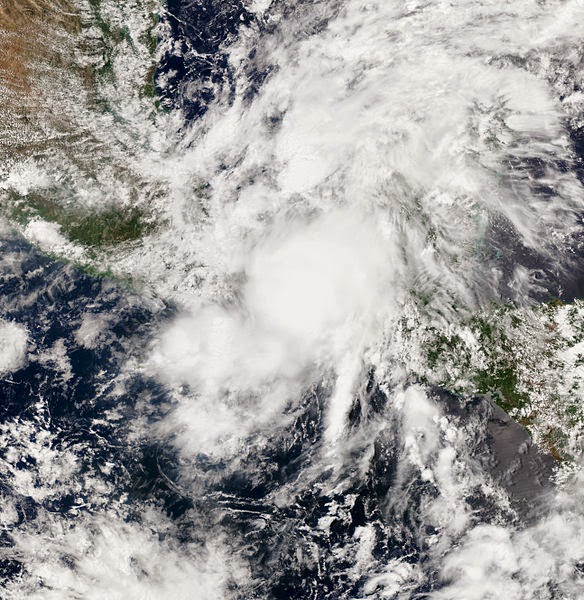
Tropical Storm Hernan forms off Mexico's Pacific coast

Terra Daily via AFP: Fearing potentially deadly flooding, Mexican disaster officials are closely monitoring the weather after Tropical Storm Hernan formed off the country's Pacific coast of Mexico late Saturday.

Hernan was located 585 kilometers (more than 360 miles) southwest of the tourist port of Manzanillo and was moving in a northwesterly direction, parallel to the coastline, at a speed of 22 kilometers per hour, Mexico's National Meterological Service (SMN) reported at 0300 GMT.

The storm was packing maximum winds of 65 kilometers per hour, with gusts up to 85 kilometers per hours, the SMN said.

The Miami-based National Hurricane Center, which had slightly different figures, warned that Hernan was picking up strength. "Additional strengthening is expected" overnight Saturday to Sunday, "and Hernan could be near hurricane strength by Sunday afternoon," the NHC said....

NASA image of Hernan, July 27, 2014

Wednesday, July 23, 2014

NASA's HS3 mission spotlight: The HIRAD instrument

NASA: The Hurricane Imaging Radiometer, known as HIRAD, will fly aboard one of two unmanned Global Hawk aircraft during NASA's Hurricane Severe Storm Sentinel or HS3 mission from Wallops beginning August 26 through September 29.

One of the NASA Global Hawks will cover the storm environment and the other will analyze inner-storm conditions. HIRAD will fly aboard the inner-storm Global Hawk and will be positioned at the bottom, rear section of the aircraft.

“HIRAD’s purpose is to map out where the strongest winds are in a hurricane. During its first deployment in 2010 for the GRIP airborne campaign, HIRAD had two interesting hurricane cases, Earl and Karl," said Daniel J. Cecil, the principal investigator for the HIRAD instrument at NASA's Marshall Space Flight Center, Huntsville, Alabama. "We have made improvements to the instrument since then, and are looking forward to the next good case - out over water, avoiding land of course!”

HIRAD is a passive microwave radiometer that was developed at NASA Marshall. A radiometer is an instrument used to measure the power of electromagnetic radiation. Because HIRAD is a passive microwave radiometer it detects microwave radiation naturally emitted by Earth. The radiation HIRAD detects is then used to infer wind speed at the surface of an ocean.

The antenna on HIRAD makes measurements of microwaves emitted by the ocean surface that are increased by the storm. As winds move across the surface of the sea they generate white, frothy foam. This sea foam causes the ocean surface to emit increasingly large amounts of microwave radiation, similar in frequency or wavelength, but much lower intensity, to that generated within a typical home microwave oven. HIRAD measures that microwave energy and, in doing so, allows scientists to deduce how powerfully the wind is blowing. With HIRAD’s unique capabilities, the two-dimensional structure of the surface wind speed field can be much more accurately determined than current operational capabilities allow....

A NASA artist's conception of HIRAD imaging

Saturday, July 12, 2014

Study provides new approach to forecast hurricane intensity

A press release from the University of Miami's Rosenstiel School of Marine and Atmospheric Science: New research from University of Miami (UM) Rosenstiel School of Marine and Atmospheric Science suggests that physical conditions at the air-sea interface, where the ocean and atmosphere meet, is a key component to improve forecast models. The study offers a new method to aid in storm intensity prediction of hurricanes.

“The general assumption has been that the large density difference between the ocean and atmosphere makes that interface too stable to affect storm intensity,” said Brian Haus, UM Rosenstiel School professor of ocean sciences and co-author of the study. “In this study we show that a type of instability may help explain rapid intensification of some tropical storms.”

Experiments conducted at the UM Rosenstiel School Air-Sea Interaction Salt Water Tank (ASIST) simulated the wind speed and ocean surface conditions of a tropical storm. The researchers used a technique called “shadow imaging,” where a guided laser is sent through the two fluids – air and water – to measure the physical properties of the ocean’s surface during extreme winds, equivalent to a category-3 hurricane.

Using the data obtained from the laboratory experiments conducted with the support of the Gulf of Mexico Research Initiative (GOMRI) through the CARTHE Consortium, the researchers then developed numerical simulations to show that changes in the physical stress at the ocean surface at hurricane force wind speeds may explain the rapid intensification
of some tropical storms. The research team’s experimental simulations show that the type of instability, known as Kelvin-Helmoltz instability, could explain this intensification.

Haus and colleagues will conduct further studies on hurricane intensity prediction in the new, one-ofa- kind Alfred C. Glassell, Jr., SUSTAIN research facility located at the UM Rosenstiel School. The SUrge-STructure-Atmosphere INteraction laboratory is the only facility capable of creating category- 5 level hurricanes in a controlled, seawater laboratory. The nearly 65-foot long tank allows scientists to simulate major hurricanes using a 3-D wave field to expand research on the physics of hurricanes and the associated impacts of severe wind-driven and wave-induced storm surges on coastal structures....

The eyewall of Cyclone Neoguri, image from from NASA

Saturday, July 5, 2014

Hurricane Arthur weakens to a post-tropical storm

Jeff Lawson and Craig Moeller in USA Today: Hurricane Arthur continued to weaken across New England and Canada Saturday after causing some damage on North Carolina's barrier islands.

On North Carolina's barrier islands, people hoped to salvage the rest of the holiday weekend despite some flooding and power outages. Arthur made landfall on the southern end of the barrier islands Thursday with sustained winds up to 100 mph.

Arthur was downgraded to a post-tropical storm Saturday with maximum sustained winds of 65 miles per hour, according to an advisory from the National Hurricane Center. Arthur was moving at about 22 mph and located about 65 miles southwest of Yarmouth, Nova Scotia.

New England was largely spared from damage spawned by the storm. In its daily report FEMA (the Federal Emergency Management Agency) said it had no reports of injuries, deaths or major damage, and no state had requested federal assistance. Early Monday morning, FEMA had reports of 22,000 homes and businesses without power, including 3,000 in Massachusetts and 15,000 in Maine. Massachusetts reported 261 people in shelters.

There were reports of localized flooding in coastal areas of Massachusetts and the Nova Star Ferry suspended service Friday and Saturday morning because of dangerous seas. No injuries or deaths have been reported....

Satellite image of Arthur on July 3, 2014

Wednesday, July 2, 2014

Tropical Storm Arthur strengthens, nets hurricane watch

USA Today: As the Fourth of July weekend nears, the Atlantic hurricane season's first named storm was slowly strengthening off Florida's coast early Wednesday. At 5 a.m. Wednesday, the National Hurricane Center reported Tropical Storm Arthur was located about 90 miles east of Cape Canaveral. A tropical storm watch is in effect for Florida's east coast, from Sebastian Inlet to Flagler Beach.

Forecasters said Arthur was becoming better organized but is likely to stay just offshore, passing northeastern Florida Wednesday night and moving parallel to the southeastern U.S. coast, becoming a hurricane by Thursday.

Maximum sustained winds were recorded at 60 mph. The storm has picked up speed and is currently moving north at 6 mph. The NHC predicts a turn to the north-northeast Wednesday night followed by a turn toward the northeast and an increase in forward speed on Thursday.

A hurricane watch is also in effect from Bogue Inlet to Oregon Inlet in North Carolina. Also a tropical storm watch is in effect from south Santee River South Carolina to south of Bogue Inlet and from north of Oregon Inlet to the North Carolina/Virginia border including eastern Albemarle Sound.

The NHC urged those as far north as parts of Virginia to monitor Tropical Storm Arthur's path. "I think everybody's keeping one eye on the weather and one eye on the events this weekend," said Joe Marinelli, president of Visit Savannah, the Georgia city's tourism bureau....

Tropical Storm Arthur on July 1, 2014, via NASA

Thursday, June 5, 2014

Weakened storm Boris still packing heavy rains, mudslide risk

Terra Daily via AFP: Boris, now a tropical depression after losing some of its punch, nevertheless was potent enough to prompt evacuations of thousands of inhabitants Wednesday along Mexico's Pacific coast.

The season's second named storm -- downgraded overnight from a tropical storm -- Boris brought "extraordinarily" heavy rains that led disaster officials to evacuate some 16,000 people.

On his Twitter account, the head of Mexico's National Civil Protection office, Luis Felipe Puente, said Boris so far has caused no loss of life, although it continues to carry the risk of potentially lethal flash floods and mudslides.

Officials from the US National Hurricane Center said that at 1500 GMT, Boris was 80 miles (130 kilometers) east of the town of Salina Cruz, with maximum sustained winds of 30 miles (45 kilometers) per hour.

It was moving north at two miles (four kilometers) per hour, a leisurely pace ensuring it will linger, continuing to dump up to another 10 inches of heavy rain in some areas, including the states of Oaxaca, Chiapas, Veracruz and Tabasco, the Miami-based NHC said....

NASA image of Boris making landfall in Mexico on June 3, 2014

Wednesday, June 4, 2014

The wages of sexism: Hurricanes with female names result in greater death toll

Environmental News Network: Hurricanes with feminine names are likely to cause nearly three times as many deaths than storms with masculine names after new research found girl names are perceived as less threatening.

A new University of Illinois study is warning to watch out for hurricanes with benign-sounding names like Dolly, Fay or Hanna because people in the path of these severe storms may take fewer protective measure, leaving them more vulnerable to harm.

Analysis of more than six decades of death rates from US hurricanes shows that severe hurricanes with a more feminine name result in a greater death toll, simply because a storm with a feminine name is seen as less foreboding than one with a more masculine name.

The finding indicates an unfortunate and unintended consequence of the gendered naming of hurricanes, which has important implications for policymakers, meteorologists, the news media and the public regarding hurricane communication and preparedness, the researchers say.

"The problem is that a hurricane's name has nothing to do with its severity," said Kiju Jung, a doctoral student in marketing in the U of I's College of Business and the lead author on the study. "Names are assigned arbitrarily, based on a predetermined list of alternating male and female names," he said. "If people in the path of a severe storm are judging the risk based on the storm's name, then this is potentially very dangerous."...

Male or female:  A NOAA image of the eyewall of Hurricane Katrina in 2005

Sunday, June 1, 2014

NASA widens 2014 hurricane research mission

A press release from NASA: During this year's Atlantic hurricane season, NASA is redoubling its efforts to probe the inner workings of hurricanes and tropical storms with two unmanned Global Hawk aircraft flying over storms and two new space-based missions.

NASA's airborne Hurricane and Severe Storm Sentinel or HS3 mission, will revisit the Atlantic Ocean for the third year in a row. HS3 is a collaborative effort that brings together several NASA centers with federal and university partners to investigate the processes that underlie hurricane formation and intensity change in the Atlantic Ocean basin. The flights from Wallops Flight Facility in Virginia take place between Aug. 26 and Sept. 29 during the peak of the Atlantic hurricane season that runs from June 1 to Nov. 30.

"This year we're going full-force into tropical cyclone research," said Scott Braun, HS3 mission principal investigator and research meteorologist at NASA's Goddard Space Flight Center in Greenbelt, Maryland. "We'll have two Global Hawks equipped with six instruments. The new NASA-JAXA Global Precipitation Measurement (GPM) Core Observatory will be providing much higher quality data than previously available on rain structure in tropical cyclones in all ocean basins. The surface-wind monitoring ISS-RapidScat instrument to be launched to the International Space Station t
his season will provide valuable information on surface winds in storms."

One of the remaining mysteries that HS3 is attempting to solve is the effect of the hot, dry and dusty Saharan Air Layer (SAL) in tropical storm formation and intensification. Some research points to SAL contributing to storm formation, while other research indicates SAL suppresses it. HS3 also will investigate the role of strong thunderstorms near the core of the storms as a possible driver of intensity change.  

This year NOAA, in addition to managing all of the dropsondes during the HS3 mission, will enable the mission to fly another week to better study tropical cyclones. A dropsonde is a device that measures winds, temperature and humidity, dropped from an aircraft.

The NASA Global Hawks are unmanned aircraft that will be piloted remotely from the HS3 mission control at NASA's Wallops Flight Facility. Global Hawk aircraft are well-suited for hurricane investigations because they can fly for as long as 26 hours and fly above hurricanes at altitudes greater than 55,000 feet...

Artist's rendering of NASA's ISS-RapidScat instrument (inset), which will launch to the ISS in 2014 to measure ocean surface wind speed and direction and help improve weather forecasts, including hurricane monitoring. It will be installed on the end of the station's Columbus laboratory. Image Credit: NASA/JPL-Caltech/JSC

Friday, May 30, 2014

NASA 'bisects' Tropical Storm Amanda

Stephanie Pappas in Yahoo News via Live Science: NASA has sliced and diced the first named storm of the 2014 hurricane season, capturing a bisected view of Hurricane Amanda at its strongest. Amanda — now a tropical depression — formed over Memorial Day weekend and reached Category 4 hurricane strength, with winds reaching 155 mph (250 km/h).

Those wind speeds made the storm the strongest May hurricane ever seen. Fortunately, Amanda remained far out to sea in the eastern Pacific and never threatened land. After turning north over cooler waters this week, the storm weakened, its winds receding to tropical-storm level. As of today (May 29), Amanda is a mere tropical depression, with max
imum sustained winds of only about 35 mph (56 km/h), according to the National Hurricane Center.

NASA's CloudSat satellite caught a detailed glimpse of the storm when it was still a hurricane. On May 25, the storm's winds were blowing at around 150 mph (240 km/h) when the satellite passed over about 25 miles (40 km) from the center of the storm. [Hurricanes from Above: See Nature's Biggest Storms]

CloudSat uses ultrasensitive radar to measure clouds and their moisture. In Amanda's eastern half, the satellite detected moderate and heavy-moderate precipitation deep in the storm, below the altitude at which precipitation turns from solid into liquid. The profile of the storm revealed an expansive, anvil-shaped cloud extending northward, as well as smaller cumulus clouds underneath, NASA reported today (May 29)....

NASA image of Amanda on May 23, 2014

Friday, May 23, 2014

Migrating cyclones pose new threat

Eco-Business via Climate Science News Network: Tropical cyclones – hurricanes in the Caribbean, typhoons in the South China Sea – are moving further north and south, threatening to create new havoc in unsuspecting coastal areas.

New research published in the journal Nature reveals that, on average, the storms have been migrating towards the poles at the rate of 53 kilometres a decade in the northern hemisphere, and 62 kilometres in the southern.

This means that landfalls that in the past that would not have expected violent storms will become increasingly at risk − “with obvious effects on coastal residents and infrastructure”, the paper says.

Jim Kossin, an atmospheric research scientist at the US National Oceanic and Atmospheric Administration (NOAA), and colleagues looked at data for the last 30 years and measured the latitudes as which storms reached their peak intensity. They found an uneven but measurable shift of around half a degree of latitude every 10 years.

The news makes sense, as researchers have previously identified a steady “expansion” of the tropics as a result of global warming....

Thursday, May 22, 2014

Near-normal or below-normal 2014 Atlantic hurricane season predicted

Science Daily: In its 2014 Atlantic hurricane season outlook issued today, NOAA's Climate Prediction Center is forecasting a near-normal or below-normal season.

The main driver of this year's outlook is the anticipated development of El Niño this summer. El Niño causes stronger wind shear, which reduces the number and intensity of tropical storms and hurricanes. El Niño can also strengthen the trade winds and increase the atmospheric stability across the tropical Atlantic, making it more difficult for cloud systems coming off of Africa to intensify into tropical storms.

The outlook calls for a 50 percent chance of a below-normal season, a 40 percent chance of a near-normal season, and only a 10 percent chance of an above-normal season. For the six-month hurricane season, which begins June 1, NOAA predicts a 70 percent likelihood of 8 to 13 named storms (winds of 39 mph or higher), of which 3 to 6 could become hurricanes (winds of 74 mph or higher), including 1 to 2 major hurricanes (Category 3, 4 or 5; winds of 111 mph or higher).

These numbers are near or below the seasonal averages of 12 named storms, six hurricanes and three major hurricanes, based on the average from 1981 to 2010. The Atlantic hurricane region includes the North Atlantic Ocean, Caribbean Sea and Gulfof Mexico.

"Thanks to the environmental intelligence from NOAA's network of earth observations, our scientists and meteorologists can provide life-saving products like our new storm surge threat map and our hurricane forecasts," said Kathryn Sullivan, Ph.D., NOAA administrator. "And even though we expect El Niño to suppress the number of storms this season, it's important to remember it takes only one land falling storm to cause a disaster."...

Image from NOAA

Friday, April 11, 2014

Quiet 2014 hurricane season forecast

Doyle Rice in USA Today: Top forecasters from Colorado State University predict a quiet 2014 Atlantic hurricane season, suggesting that nine tropical storms will form, but only three will become hurricanes.

The forecast published Thursday follows two consecutive poor forecasts: In 2012, when more than twice as many hurricanes formed as had been predicted, and in 2013, when only two hurricanes formed after a spring prediction of nine.

A typical year, based on weather records dating to 1950, has 12 tropical storms, of which seven become hurricanes. A tropical storm has sustained winds of 39 mph; it becomes a hurricane when its winds reach 74 mph.

The forecast was released by meteorologists Philip Klotzbach and William Gray of Colorado State University's Tropical Meteorology Project. The Atlantic hurricane season runs from June 1 to Nov. 30.

Klotzbach said a predicted El Niño is one factor that led to their quiet forecast. El Niño, a climate pattern defined by warmer-than-normal water in the tropical Pacific Ocean, tends to suppress Atlantic hurricanes.

"The tropical Atlantic has ... cooled over the past several months, and the chances of a moderate to strong El Niño event this summer and fall appear to be quite high," Klotzbach said. "Historical data indicate fewer storms form in these conditions....

The eye of Hurricane Wilma in 2005, from the International Space Station