Showing posts with label Nepal. Show all posts

Sunday, March 8, 2015

En route to climate change adaptation

Ayesha Qaisrani in Pakistan Today: With no adherence to geographical boundaries, climate change continues to hover over our heads like a dense, dark cloud of uncertainty. Even with all the sophisticated projections of climate change, only one thing about it remains certain: that it is happening and we better act now.

Realising the gravity of the situation, Climate Action Network South Asia (CANSA) in collaboration with Janathakshan and Asia Pacific Adaptation Network (APAN), organised a sub-regional workshop for the South Asian nations in Colombo, Sri Lanka, to discuss the latest adaptation initiatives taken up and exchange best practices and information. The workshop took place on the 23rd and 24th of February 2015 and was attended by representatives of Pakistan, India, Sri Lanka, Bangladesh, the Maldives, Bhutan and Nepal including representation from the respective governments, the parliaments and the civil society.

...It was encouraging to get insights about the adaptation initiatives being taken up by the nations of South Asia. Even more encouraging was the general recognition of the need of cooperation and collaboration among the nations for an effective response to climate change. Emphasising on the need of regional cooperation, Mr Malik Muhammad Uzair Khan, Member Parliament, Pakistan, commented, “Pakistan like India, Nepal, Sri Lanka and Bangladesh is reeling under the worst impacts of climate change. Clearly, climate change knows no borders and now more than ever it is critical that our leaders come together to share best practices for climate change adaptation and set the region on the path of sustainable development.”

Underlining that capacity building is the keystone to effective adaptation to climate change. The representatives advocated a balanced investment in physical infrastructure and skills of the population. They stressed upon focusing on education and awareness, health, agriculture sector, water management and disaster preparedness to increase the resilience of people and reduce their vulnerability. Besides individual and community level, focus should also be directed at institutional capacity building as, quite often, it is the institutions that are inefficient in setting their priorities for strategic response to climate change....

NASA image of 2010 flooding in Pakistan

Monday, February 2, 2015

UN agency continues distribution of emergency health kits to Nepal's flood survivors

UN News Centre: Five months after a series of landslides and subsequent flooding brought devastation to large swathes of Nepal, thousands of survivors continue to remain exposed to bitter temperatures and wintry conditions, the United Nations Population Fund (UNFPA) has warned.

The UN agency – which has a mandate to focus on improving sexual and reproductive health issues for women around the world – has been active on the ground since mid-August when the Government of Nepal launched an appeal for humanitarian assistance following the massive flooding and landslides which affected some 130,000 people across 23 of the country’s districts.

The agency has since been distributing so-called ‘dignity kits’ containing warm winter clothes, flashlights, soap, and sanitary napkins, as well as reproductive health kits to uprooted families. The reproductive health kits, for their part, are made up of medicines, equipment to support safe deliveries, family planning supplies and supplies to aid in the treatment of rape.

Overall, each kit is designed to provide reproductive health services to between 10,000 and 30,000 women for a three-month period....

A September 2014 flood in Nepal, shot by Beemall.99, Wikimedia Commons, under the Creative Commons Attribution-Share Alike 4.0 International license 

Monday, November 3, 2014

Nepal disaster preparedness needs to go local

IRIN: Mid-summer monsoon rains in Nepal triggered over three dozen floods and landslides, killing over 200 people and displacing tens of thousands. Experts say this highlights preparedness and response challenges and the urgent need for these to be prioritized in development plans and at local government level.

"There was nothing unpredictable about this summer's events in Nepal," Moira Reddick, coordinator at Nepal Risk Reduction Consortium (NRRC), a coalition of humanitarian, development, financial and government bodies, told IRIN.

"Until we see investments effectively risk managed and centred into development planning across all sectors of government and international community, we won't start to see the kind of revolution we need in terms of disaster management, risk-proofing and effective preparedness," she said.

Nepal's Ministry of Home Affairs put the number of people dead between June and September due to floods and landslides at 265, with 256 missing and 157 injured. A landslide on 2 August was the deadliest in the country's history. According to the International Federation of Red Cross and Red Crescent Societies (IFRC), monsoon disasters in 2014 affected over 200,000 people across Nepal and displaced more than 34,000.

Humanitarians point to a 2008 flood in the River Koshi, which killed several hundred and displaced nearly 60,000 families, as a turning point for Nepal's disaster mitigation and response work....

A 2013 flood in the Darchula district of Nepal, shot by Krish Dulal, Wikimedia Commons, under the Creative Commons Attribution-Share Alike 3.0 Unported licens

Friday, August 22, 2014

Nepal's disaster preparedness woefully inadequate

Om Astha Rai in My Republica: Nepal has put in place plenty of plans, strategies and mechanisms to deal with disasters in the last five years.  But, is Nepal now well-prepared to manage disasters?  The answer is a big NO. In the aftermath of the recent Sunkoshi landslide and other devastating floods, particularly in the plains of the midwestern region, it seems that Nepal´s disaster preparedness is almost non-existent.

Government officials often dub 2009 as a landmark year in the field of disaster risk management. On October 11 that year, the government approved a national strategy for disaster risk management, outlining top five priority areas.  In the years since 2009, several mechanisms, as envisioned by the national strategy, have been formed to manage disasters.

...So, despite all this preparedness, why did the recent floods cause so much damage in the mid-western region? According to the National Emergency Operation Center (NEOC) of the Ministry of Home Affairs (MoHA), floods and landslides have killed 123 people, injured 67 people and left 126 people missing in several parts of the country since August 14.

..."Perhaps, our disaster preparedness is far from adequate," says Ramesh Shrestha, an early warning system officer at Mercy Corps Nepal, an NGO working in disaster management sector. Shrestha believes that there is no gap in disaster management policies and strategies but their implementation is far from satisfactory. "This is why disasters continue to cause so much destruction every year," says Shrestha....

A highway next to the Sunkoshi River, shot by Rajesh2044, Wikimedia Commons, under the Creative Commons Attribution-Share Alike 3.0 Unported license 

Wednesday, August 6, 2014

Nepal landslide deaths highlight disaster risk reduction gaps

IRIN: A landslide in Nepal on 2 August killed 33 and 122 are still missing as search and rescue continues. Experts say this event, one of the deadliest in the country’s recent history, is a wake-up call for hazard mapping, early warning, and disaster management. “The scale of human casualties in terms of fatal incidents is enormous and this is appalling,” Nepal Red Cross Society’s (NRCS) disaster risk reduction coordinator Krishna KC told IRIN.

During the early morning of 2 August, a 1.9km long slope of land perched 1,350 metres above the Sun Koshi river collapsed, according to an evaluation report by the Kathmandu-based International Centre for Integrated Mountain Development (ICIMOD). Seven hundred and fifty personnel from the Nepal Army and Armed Police Force (a paramilitary unit) are continuing search and rescue efforts in the area, around 200km northeast Kathmandu.

...According to NRCS, the disaster caused one of the highest death tolls due to a landslide in a single village in Nepal’s history since records began in the 1950s. In the past decade landslides killed over 1,300 people and destroyed 10,000 houses, according to NRCS.

Government officials and scientists from ICIMOD and UN agencies have travelled to the affected area to support the ongoing response efforts and research how prevention and preparedness can be improved in what the Asia Disaster Preparedness Center calls one of the most disaster-prone countries in the world.

While search and rescue continues in the Himalayan foothills, experts are concerned about potential flood risk downstream. According to the government’s Department of Hydrology and Meteorology (DHM), debris created a dam across the Sun Koshi river within 13 hours of the landslide starting. Seven million cubic metres of water now extend around 3km upstream, creating a large lake. The latest report by NRCS predicts that the breach of the land mass could create substantial flood risk for 11 downstream Nepali districts....

A river in the Himalayas (okay, it's Tibet, not Nepal). Shot by Mayank Bhagya, Wikimedia Commons via Flickr, under the Creative Commons Attribution 2.0 Generic license

Monday, August 4, 2014

More than 500 foreign hikers rescued after deadly landslide in Nepal

Gopal Sharma in Reuters: More than 500 foreign tourists and their guides have been rescued after a deadly landslide in Nepal blocked a major highway, leaving them stranded in a border town over the weekend, Nepali hiking officials said on Monday.

The mostly Indian and European tourists were returning to Kathmandu after hiking expeditions in Tibet when heavy rains triggered the landslide, blocking the Arniko highway to the capital and forcing them to take refuge in Tatopani town on the Nepal-Tibet border.

Officials said more than 400 hikers and their guides were picked up by helicopters and brought to Kathmandu on Sunday and another 200 people were evacuated on Monday.

"The trekkers were worried and confused. But now they are very much relieved and comfortable," Airlines Operators Association official Yog Raj Kandel told Reuters. This is peak trekking season in Tibet, with thousands of tourists annually visiting the Himalayan region from Nepal....

A landslide area in Nepal, a shot from 2010 by Moralist, Wikimedia Commons, under the Creative Commons Attribution 3.0 Unported license 

Wednesday, July 23, 2014

Flood alert data not reaching communities in Nepal

Om Astha Rai in Republica: ...Until last year, there was no early warning system in the Mahakali River basin. This year, just a month ahead of the onset of monsoon, the Department of Hydrology and Meteorology (DHM), with support from Mercy Corps, an INGO that has been supporting disaster preparedness programs in Nepal, developed early warning system in the Mahakali River basin.

Under the system, two early warning stations were installed in the Mahakali basin -- one in Dattu VDC of Darchula district and another in Sirsha VDC of Dadeldhura district. However, both stations could be useful only for people living downstream of Khalanga of Darchula, the worst-hit place in last year´s flood.

"We have no early warning system as yet," says Bohara, who now leads a group of Mahakali flood victims fighting for adequate relief and compensation from the government. "We are still vulnerable to floods."

Over the last five years, Nepal has made huge progress in collecting real-time information about floods. Today, flood forecasting stations have been set up in as many as 21 places of seven different river basins. Apart from Mahakali, flood forecasting stations are in operation in Karnali, Babai, West Rapti, Narayani, Bagamati, Koshi and Kankai river systems as well.

In these rivers, if water levels rise above warning points, the system automatically sends sound alarms to government authorities and local people. "If we react to these alarms on time, we can save lives as well as properties," says Rajendra Sharma, chief of flood forecasting section at the DHM....

The Chandani Dodhara suspension bridge over the Mahakali River, shot by Shivagoutam, Wikimedia Commons, under the Creative Commons Attribution-Share Alike 3.0 Unported license 

Thursday, June 12, 2014

Drones zero in on Himalayan glaciers

Shahani Singh in SciDev.net: Drones or unmanned aerial vehicles (UAVs) are finding a role in the study of glaciers in the rugged and remote Himalayas. Using UAVs to study the Lirung glacier in Nepal’s Langtang region, scientists from the University of Utrecht, the Netherlands, and the International Centre for Integrated Mountain Research, Kathmandu, have shown that glacial melt water generated under debris is only marginal to the total amount of water generated in the Lirung catchment.

The Lirung glacier being at a comparatively low elevation is sensitive to temperature changes and data from it can give clues to the fate of debris-covered Himalayan glaciers that are higher up, if glo
bal warming persists at projected rates, says the study, to be published in the July 2014 issue of Remote Sensing of Environment.

The UAVs collected data from sub-surface areas in the highly inaccessible, debris-covered Lirung glacier and provided imagery at a resolution superior to satellite-derived data, says Walter Immerzeel, lead author of the study and assistant professor at the department of physical geography, University of Utrecht.

...The higher melt rates in supra-glacial lakes (lakes or ponds formed on top of glaciers) and ice cliffs place emphasis on studying ‘englacial hydrology,’ or water dynamics and mass change in the internal regions of a glacier. In the future the melt rate may be connected to or created by englacial conduits and voids, the study says.

UAV technology increases the cost-effectiveness and accuracy of research as traditional methods of measuring melt rates are labour intensive, time consuming and difficult to carry out, especially on thick layers of debris.....

Imja Lake and glacier in Nepal,  shot by Daniel Alton Byers, Wikimedia Commons, under the Creative Commons 3.0 license

Thursday, May 29, 2014

To reduce flood threats, Nepal builds climate risk into planning

Naresh Newar at the Thomson Reuters Foundation: It is nearly time for the monsoon, but there has not been even a drop of rain yet in this village on the fringes of Chitwan National Park, a deep worry for local farmers. Retired forest guard Potahariyu Chaudhary, 65, looks at his dry maize fields and says he doubts the monsoon will ever be normal again. “The climate is getting strange in this country. Either it is too dry or disastrous,” he said.

Chaudhary, like his neighbours, has endured plenty of droughts and severe floods over the last few decades in this flattest, most flood-prone district of Nepal. The worst flooding, in 1993, wiped out his crops and house, killed his livestock and nearly swept away his traumatized wife and children.

“Our eyes are constantly on the rivers and we all take turns every day to check the level of Narayani River,” said Chaudhary’s 29-year old son, Ranjan, who remembers being carried on his father’s shoulder to safety through a previous flood.

In neighboring Harnari village, the last big flood displaced 300 households for months. “It’s almost 10 years since the last big flood and we are all worried we might have another disaster,” 55-year old Kumar Chettri said. “That is where all the floods will attack from,” he said, pointing towards the north of the village, an area planned government-provided embankments and dikes have yet to reach.

The vulnerability of these villages also means grave danger for nearby Chitwan National Park, a key tourist attraction in Nepal and one of the last refuges for the endangered Bengal tiger and home to some of the largest populations of Asiatic one-horned rhinoceros....

A grounded boat in Chitwan National Park, shot by MMuzammils, Wikimedia Commons, under the Creative Commons Attribution-Share Alike 3.0 Unported2.5 Generic2.0 Generic and 1.0 Generic license

Wednesday, April 30, 2014

China and Nepal agree to cooperate on mountain science

Bhrikuti Rai in SciDev.net: China has agreed to share scientific knowledge with Nepal on the effects of climate and environmental changes on the Tibetan plateau in order to spur sustainable development. The Chinese Academy of Sciences (CAS) signed memorandums of understanding earlier this month (7 April) with Nepalese research institutions the International Centre for Integrated Mountain Development (ICIMOD) and Tribhuvan University.

The agreement is part of the Third Pole Environment (TPE) initiative, a research programme CAS set up in 2009 to study the Tibetan plateau. The area is often referred to as the ‘third pole’ because it contains huge quantities of ice in the form of glaciers that feed major Asian rivers.

Glacial melt in Nepal has previously been a source of flooding: in 2008 a devastating flood hit northern India after a river breached flood defences, leading some to call for better cross-border monitoring of conditions in the mountain regions where the rivers begin.

ICIMOD could now become an important player in environmental research spearheaded by TPE in the Himalayan region, says Dong Qi of the bureau of international cooperation at CAS. The agreement will also open the way for government institutions to cooperate on environmental research, he says.

Areas for cooperation outlined in the memorandum include: monitoring air quality levels; studying high-altitude wetland and river systems to share information on water discharge and strengthen flood forecasting; and researching climate change impacts, for example the effect of pollutants such as elemental carbon on glacial melt and fresh water availability in the region....

Taboche (6367 m) seen from the same point in 2007. The clean, debris-free glaciers and ice nestled below the Taboche summit have been reduced considerably by recent warming trends. Shot by Alton Byers, Khumbu, Nepal, 2007, The Mountain Institute., Wikimedia Commons via Flickr, under the Creative Commons Attribution 2.0 Generic license

Friday, April 4, 2014

What Nepal doesn’t know about water

Malika Aryal in IPS: Water is a critical resource in Nepal’s economic development as agriculture, industry, household use and even power generation depends on it. The good news is that the Himalayan nation has plenty of water. The bad news – water abundance is seasonal, related to the monsoon months from June to September.

Nepal’s hydrologists, water experts, meteorologists and climate scientists all call for better management of water. But a vital element of water management – quality scientific data – is still missing. “Luna Bharati, who heads the International Water Management Institute (IWMI) in Kathmandu, tells IPS, “If we don’t know how much water there is, we cannot manage it or carry out good water resources assessment.”

Shib Nandan Shah of the Ministry of Agricultural Development agrees that accurate and timely data, especially rainfall data, is important to rural farming communities. Thirty-five percent of Nepal’s GDP and more than 74 percent of its 27 million people are dependent on agriculture. And most of Nepal’s agriculture is rain fed.

“Reliable data is especially important for a farmer who wants to insure his crops,” says Shah. “If the information is lacking or if it is inaccurate, how is a poor farmer supposed to protect himself?” Every year, floods and landslides cause 300 deaths in Nepal on average, and economic losses are estimated to exceed over 10 million dollars.

Data becomes important in a country like Nepal that has large, unutilised water resources. At the local level, development work becomes harder, and there’s a risk that development is being based on “guesstimates”....

Farping reservoir in Nepal, shot by Krish Dulal, Wikimedia Commons, under the Creative Commons Attribution-Share Alike 3.0 Unported license

Saturday, March 15, 2014

Factoring conflict reduction into water, sanitation, hygeine programmes

IRIN: Evidence that sanitation interventions can contribute to local stability and conflict reduction is encouraging and should be considered in programme design, experts say.

"We have seen that WASH [water, sanitation and hygiene] interventions done well have the direct benefit of supporting community cohesion. This is itself a very significant indicator, and crucial to the sustainability of any project," Ben Ayers, the Nepal country director for the dZi Foundation, a development organization working in eastern Nepal, told IRIN.

However, WASH programmes, such as "Open Defecation Free" (ODF) campaigns, must be carefully crafted if they are to take into account local socio-political conditions, say experts.

"Delivering services such as WASH is not necessarily going to contribute to peacebuilding or community cohesion on its own. It really matters how the services are delivered - and there are many methods, none of which works universally," explained Nathaniel Mason, a research fellow at the London-based Overseas Development Institute (ODI).

After a 2009 diarrhoea outbreak in Nepal's Far West Region that killed hundreds of people, the government in 2011 launched a national campaign to end open defecation, which can contribute to water contamination and the spread of infectious diseases, including cholera, by 2017....

A well in Bhaktapur, Nepal, shot by Michel Royon, Wikimedia Commons,  under the Creative Commons CC0 1.0 Universal Public Domain Dedication 

Saturday, February 8, 2014

Measuring resilience to climate change in Nepal from the community up

Susannah Fisher in Eco-Business: Nepal’s vulnerability to a warming climate became clear in May 2012 when the Seti river burst its banks during flash floods and landslides that killed more than 60 people. Scientists say such events are likely to become more common as the world warms, so communities need to adapt.

The Government of Nepal is well aware of the challenges. With support from development partners, it is investing heavily in climate change adaptation. For example, the Pilot Programme on Climate Change Resilience (part of the Climate Investment Funds) is providing US$110 million in grants and loans. The UK Department for International Development and the European Union are supporting district and village institutions to develop and implement Local Adaptation Plans of Action to address the impacts of climate change.

...A project may achieve its goal (for example improving water supplies, or increasing biodiversity) but it may not have contributed to overall resilience to current or future climate threats. It may not have even set out to.

To address this gap, we have been working with communities and policymakers in Nepal to develop local indicators of resilience to climate-related threats and to identify what could be monitored at a national level....

Macchermo River (and glacier) in Nepal, shot by DARIO SEVERI, Wikimedia Commons, under the Creative Commons Attribution-Share Alike 3.0 Unported license 

Saturday, November 9, 2013

Climate change is melting away Nepal's mountain tourism

Coco Liu in E&E News: Dawa Tshering Sherpa remembers the 1985 flood as if it happened just yesterday. ...Sherpa ran out of his house with his wife and 9-year-old son, watching the river -- mixed with rocks, mud and livestock -- passing along his village a quarter of a mile away.

...That was the first glacier lake outburst flood that Sherpa and his neighbors have experienced, but it probably won't be the last. Glacial lakes are a normal feature of mountain geography, formed by melting ice, but as temperatures have increased in recent years, a lot more of them have been created, setting up a time bomb for villages downstream.

At the same time, erratic weather patterns, decreasing freshwater supplies and other problems likely associated with global warming have emerged here, making it more costly and challenging for locals to cater to global travelers. Mount Everest alone attracts more than 36,000 travelers each year. But experts doubt whether the attraction will persist under changing climate conditions.

"One of the biggest challenges that arise with a series of extreme events is the disruption of the image Nepal has built as a tourism destination," said Marjorie van Strien, a tourism specialist at the International Centre for Integrated Mountain Development, a nongovernmental organization headquartered in Katmandu.

"The country had just recently rebuilt its attractiveness with an image of being a safe and accessible destination. Extreme events could set these developments back," she added....

The north face of Mount Everest, shot by Luca Galuzzi - www.galuzzi.it Wikimedia Commons, under the Creative Commons Attribution-Share Alike 2.5 Generic license

Friday, October 25, 2013

Loss and damage from climate change

Science Daily: An open access special issue of the International Journal of Global Warming brings together, for the first time, empirical evidence of loss and damage from the perspective of affected people in nine vulnerable countries. The articles in this special issue show how climatic stressors affect communities, what measures households take to prevent loss and damage, and what the consequences are when they are unable to adjust sufficiently. The guest-editors, Kees van der Geest and Koko Warner of the United Nations University Institute for Environment and Human Security (UNU-EHS) in Bonn, Germany, introduce the special issue with an overview of key findings from the nine research papers, all of which are available online free of charge.

'Loss and damage' refers to adverse effects of climate variability and climate change that occur despite mitigation and adaptation efforts. Warner and van der Geest discuss the loss and damage incurred by people at the local-level based on evidence from research teams working in nine vulnerable countries: Bangladesh, Bhutan, Burkina Faso, Ethiopia, The Gambia, Kenya, Micronesia, Mozambique and Nepal. The research papers pool data from 3269 household surveys and more than 200 focus groups and expert interviews.

The research reveals four loss and damage pathways. Residual impacts of climate stressors occur when:
  • existing coping/adaptation to biophysical impact is not enough;
  • measures have costs (including non-economic) that cannot be regained;
  • despite short-term merits, measures have negative effects in the longer term; or
  • no measures are adopted -- or possible -- at all.
The articles in this special issue provide evidence that loss and damage happens simultaneously with efforts by people to adjust to climatic stressors. The evidence illustrates loss and damage around barriers and limits to adaptation: growing food and livelihood insecurity, unreliable water supplies, deteriorating human welfare and increasing manifestation of erosive coping measures (e.g. eating less, distress sale of productive assets to buy food, reducing the years of schooling for children, etc.). These negative impacts touch upon people's welfare and health, social cohesion, culture and identity -- values that contribute to the functioning of society but which elude monetary valuation....

Turner's 1805 painting, "The Shipwreck"

Piloting agro-meteorological early warnings for Nepal’s farmers

IRIN: The Nepalese government is planning to pilot the country’s first weather warnings for farmers, something it is hoped will stem agricultural losses during the June-August monsoon.  Thousands of hectares of arable land are damaged during this period; in 2013 alone an estimated 10,000 hectares were lost to land erosion, floods and water-logging, according to the Ministry of Agricultural Development (MOAD).

..."We cannot avert natural disasters but we can make the farmers better prepared with the help of timely information through an efficient communication system,” MOAD’s senior official Shib Anand Shah told IRIN in Kathmandu.

For the first time, the Nepal government (with US$31 million from the World Bank) is expected to create an agricultural information management system tailored for farmers, said Shah.  According to almost all major risk analyses, Nepal is among the most climate-vulnerable countries worldwide.

MOAD is preparing to launch the system in collaboration with the semi-governmental Nepal Agricultural Research Council (NARC) and the Department of Hydrology and Meteorology (DHM) by early 2014 in 25 of the country’s 75 districts judged to be most vulnerable to natural disasters. The goal is to pilot the system in four districts by the end 2013.

Until now, the government has only monitored water levels in rivers through real-time, manual data collection, which limited its capacity to issue timely accurate warnings for hydro-meteorological hazards, according to the World Bank.

The new information system will see the installation of three Doppler weather monitoring radars nationwide (WSR-88D - costing $2 million each) capable of forecasting heavy rainfall and drought through DHM...

Sunset on the flood-prone Rapti River in Nepal, shot by Ashokdhamala,Wikimedia Commons, under the Creative Commons Attribution-Share Alike 3.0 Unported license

Tuesday, July 23, 2013

Cleaner, healthier cities for Nepal's urban population

Asian Development Bank press release: Bharatpur in Chitwan is one municipality in Nepal that is taking steps to improve the urban environment, making the city more climate-resilient in the process. Bharatpur is one of Nepal’s fastest growing municipalities. Engineer Bhoj Kaudel of the city’s planning department sees this trend as an opportunity for his native city to become one of Nepal’s key urban centers.

“If we can develop good services here, why would people need to move to Kathmandu?” he says. Attracting people to live and work in such secondary cities takes pressure off congested Kathmandu, spreading economic development more evenly across the country.

In early 2000, Bharatpur was on the track to unplanned urban sprawl. Migrants were settling on the riverbanks in unsafe and unsanitary conditions. Wastewater from these and other settlements was flowing into the Narayani River, polluting the fresh water flowing down from the Himalayan Mountains. Housing construction was spreading in every direction around the city center, causing the traditional water supply to dry up. Drainage problems in the flood season were getting bad.

These growing pains were the reason that Bharatpur was selected as one of the sites for ADB’s Urban and Environmental Improvement Project, which started in 2005. The project promoted sustainable urban development through better municipal planning and upgrading of infrastructure for clean water supply, drainage, and sanitation.

With ADB’s support the municipality transformed the city’s riverside into a green space with a cement embankment that protects the residential land from erosion and provides steps down to the river’s edge....

Namche Bazaar in Nepal, shot by stevehicks, Wikimedia Commons via Flickr, under the Creative Commons Attribution 2.0 Generic license

Sunday, July 14, 2013

Flood death toll rises to 60 in Nepal

Space Daily: The death toll from recent floods triggered by heavy monsoon downpours in Nepal has climbed to at least 60, police told AFP Friday.

Heavy rainfall in mid-June struck mostly farming communities in the country's southern plains and remote western hills, killing at least 50 people, the government earlier said.

A further 10 deaths were reported Friday by local police. "At least 10 people have been killed by floods triggered by heavy rains.

Three are missing and two have been injured," Bhoj Dev Khatiwada, a local police official in Biratnagar town said.

Some 6,000 homes were damaged by the floods, which mainly hit southeastern Nepal over the past four days, Khatiwada said. "We have launched rescue operations. A total of 1,800 people have been displaced. The victims have been transported to safe places such as schools and local government offices," he said....

Tuesday, July 9, 2013

No early warning for Nepal’s deadly landslides

IRIN: Landslides in Nepal are the country’s costliest and most deadly type of natural disaster, but their management is still seen as low priority, say experts.  In the past decade landslides killed over 1,300 people and destroyed 10,000 houses, according to the Nepal Red Cross Society (NRCS).

NRCS estimates landslides killed more than 36 people in 10 districts from 1 June to 1 July, mostly in the country’s Far West region, which has notoriously treacherous topography, limiting access for relief and basic services.

It is the country’s poorest region with over 46 percent of its 2.7 million people living on less than US$1 a day (nationally 25 percent live on such a low income). “Landslide disasters further impoverish their [survivors’] conditions even more, especially when their breadwinners [are] killed,” senior government official and landslides and watershed management expert Madhukar Upadhya told IRIN.

One problem, said Upadhya, is that there is no ministry or government department with a clear mandate to study, act on, and execute landslide programming.  Until now key government offices dealing with landslide matters included the Ministry of Soil and Conservation, the Department of Roads (in the Ministry of Physical Infrastructure and Transport), the Department of Water Induced Disaster Prevention (in the Ministry of Water Resources) and the Department of Irrigation (Ministry of Irrigation), but none have the power to manage, officials told IRIN.

“The government needs to really take a lead on this and start exploring how the nation can best deal with landslides to avoid any more casualties,” said Pitamber Aryal, disaster management director of NRCS....

The village of Mochhermo in Nepal, shot by Dario Severi, public domain

Tuesday, May 7, 2013

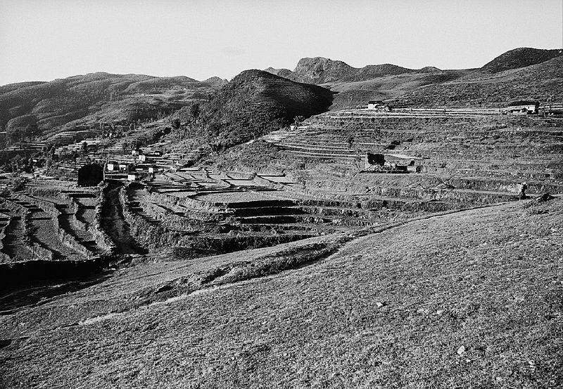
Nepal farmers' adaptation to climate change

Dr. Narahari p. Ghimire in the Himalayan Times: Nepali farmers have perceived climate change and have experienced the changes in climatic pattern since many years. A study was conducted in Gulmi district on farmer’s perceptions, witnesses and experiences on effects of climate change on agriculture and adaptations by farmers. While studying the farmers’ perception and pattern of climate change, it was found that temperature is increasing at a lower rate. Big change has not been noticed in total monsoon precipitation. Erratic rainfall is continuing and winter rain is decreasing. The proper timing and amount of rainfall is very important in agriculture as it has great impact on yields. Erratic rainfall is also increasing incidences of drought as well as floods.

Problems of soil fertility and irrigation management have also increased and farmers have even lost some local rice varieties which were unable to adjust to the changing environment. Similarly, an erratic rainfall and increasing temperatures have promoted the incidence of insect pests and diseases directly affecting the growth and development of crops resulting in reduced production. The farmers’ past experience tells that untimely and decreasing rainfall was the biggest threat to rice growers. Only 5-10 per cent financially well-off farmers have irrigation facility to raise nursery, prepare the field and transplant paddy while others have to wait for the monsoon rain.

Water has been the major limitation in this area, so that, adaptation to vegetable farming is almost impossible. Most of the farmers have slowly shifted to hybrid, less water-requiring and early-maturing varieties. To adjust with the climatic extremity of drought and late rainfall, most of farmers have changed cropping calendar, pattern and planting method. They have made adjustments in agricultural practices such as varietal changes, changes in cropping calendar, pattern, planting method, application of pesticide and chemical fertilizers and resource conservation technologies such as zero tillage and surface seeding are adopted by farmers in both low and upland areas...

Tutemani with its single farm settlements is a cultural landscape typical for eastern Nepal. Despite the barren landscape, rice, wheat and maize is grown. The surrounding hills used to be covered in trees. Photo: Fritz Berger, Etter Studio. Wikimedia Commons via Flickr, under the Creative Commons Attribution 2.0 Generic license