Showing posts with label Arizona. Show all posts

Wednesday, December 10, 2014

Black Mesa mines: Native Americans demand return of their ancestors' bones

Leslie Macmillan in the Guardian (UK): In 1967 the Peabody coal company came to the Navajo and Hopi reservations in northern Arizona and Utah to excavate a strip mine – but the land it leased from the tribes was on an ancient tribal burial ground. So, as required by law, it hired archeologists and for the next 17 years a dig known as the Black Mesa archeological project – the largest in North American history – unearthed more than one million artefacts, including the remains of 200 Native Americans.

Now the bones and artefacts are at the centre of a debate between tribes people who say ancestral remains and archeological ruins have been desecrated, and a coal company and government officials who are planning a new dig.

Native American groups and the Sierra Club are suing the US government to protect ancient Indian burial sites as one of the world’s biggest coal companies, Peabody, seeks a lifetime mining permit for the land it leases from the tribes. “I am incensed that my ancestors were dug up, ground up and send off to universities to be studied,” said Vernon Masayesva, a plaintiff and former Hopi tribal chairman.

Peabody says it has taken good care of the artefacts and bones. The collection is curated “with the express wishes of both tribes” and “in compliance with federal law,” said Beth Sutton, a company spokesperson.

But a report by the Army Corps of Engineers, which surveyed the collection early last decade at the University of Illinois, where it is housed, found the curation to be “substandard in every respect”. Rodents and spiders “were a problem”, according to the report, which notes that facilities had been broken into and artefacts were missing.

What’s more, Alan Downer, a former historical preservation officer for the Navajo Nation, said the tribe had never authorised any remains to be loaned to a professor, Debra L Martin, who teaches at the University of Nevada at Las Vegas. He said he was “shocked to find out” about eight years ago, that she had had the bones since 1980...

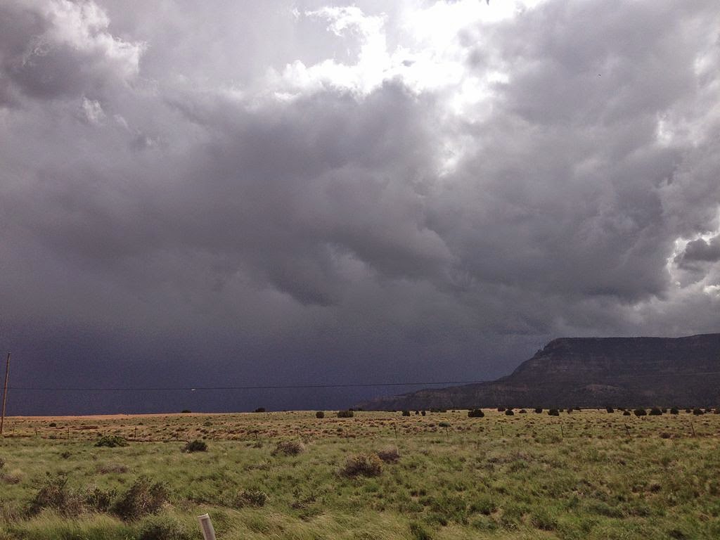
A thunderstom of Black Mesa, near Kayenda, Arizona. Shot by Famartin, Wikimedia Commns, under the Creative Commons Attribution-Share Alike 3.0 Unported license

Monday, June 2, 2014

Study links urbanization, future heat-related mortality

Arizona State University News:  ...Phoenix stands at a parched crossroads. Global scale climate change is forecast to bring hotter summers and more extreme heat to the Valley, but regional urbanization also will impact temperatures experienced by residents.

So how should Phoenix grow knowing that such growth could cause temperatures to increase in the future and bring added health risks? Should the city deploy mitigating technologies to help fight summer’s heat? Would adopting a low-growth strategy reduce the adverse health consequences of hot weather?

New Arizona State University research examines the heat-health aspects resulting from urbanization and the challenge of sustainable future growth in Maricopa County. A study released this week shows how urban development could be a factor in the number of lives lost due to heat in future summers. The study is described in the article, “Challenges associated with projecting urbanization-induced heat-related mortality” published in the current online issue of the journal Science of the Total Environment.

“Extreme heat is the leading weather-related killer in the United States,” said David Hondula, a postdoctoral scholar in health informatics in ASU’s Center for Policy Informatics and lead author of the study. “In Maricopa County, we see more than 100 premature deaths and hundreds of excess emergency department visits as a result of high temperatures each summer. Understanding how different urban development strategies will impact the health risks associated with heat can help long-term planners and public officials make more informed decisions that lead to sustainable and healthy cities.”

...Overall, projections of heat related mortality ranged from a decrease of 46 deaths per year (-95 percent) to an increase of 339 deaths per year (+359 percent). Projections based on minimum temperature showed the greatest increase for all expansion and adaptation scenarios and were substantially higher than those for daily mean temperature. Projections based on maximum temperature were largely associated with declining mortality. Low growth and adaptation scenarios led to the smallest increase in predicted heat related mortality based on mean temperature projections....

An aerial photo of Phoenix, shot by CyberXRef, Wikimedia Commons, under the Creative Commons 3.0 license

Thursday, November 14, 2013

New research reveals dengue fever mystery in two US cities both exposed to risk

EurekAlert via the American Society of Tropical Medicine and Hygiene: As dengue fever continues to spread from Key West north into the Florida mainland, it remains a mystery as to why this dangerous mosquito-borne illness is not yet common around Tucson, Arizona—even though outbreaks routinely occur in nearby Mexico and mosquitoes that can carry dengue are now common in the state, according to a new research presented today at the annual meeting of the American Society of Tropical Medicine and Hygiene (ASTMH).

"Key West and Tucson share a lot of risk factors. Even in arid Tucson we have a large population of mosquitoes that can carry dengue, and people here spend a lot of time outdoors, but we have yet to see evidence of locally-acquired infections," said Kacey Ernst, PhD, an infectious disease epidemiologist at the University of Arizona in Tucson.

Ernst presented preliminary findings from an ongoing study she is conducting with Mary Hayden, PhD, a scientist at the National Center for Atmospheric Research (NCAR) in Boulder, Colorado, whose work focuses on the link between human behavior and climate-related health threats.

Their survey of residents in the two cities 2,000 miles apart and with different climates turned up many similarities. More than half of the respondents in both cities reported spending at least an hour outside each day. The use of central air conditioning, thought to lower the risk of dengue, was virtually identical (55% in Key West vs. 56% for Tucson), though some of the Tucson air conditioning systems are less dengue-friendly. They note that many people in the Tucson area use evaporative cooling systems or "swamp coolers," which increase the humidity in the home and may increase mosquito survivability, particularly in a desert environment.

"It is still a mystery as to why dengue infection has not shown up here," Ernst said. "When researchers looked at why dengue is not more common along the Texas side of the Mexico border, they cited factors limiting contact with mosquitoes, like people spending a lot of time in sealed, air conditioned buildings. Those issues are extremely important considerations, but we don't think they fully explain why Key West has dengue and Tucson doesn't."...

Tucson at dusk shot by Zereshk, Wikimedia Commons, under the Creative Commons Attribution 3.0 Unported license

Monday, July 1, 2013

Yarnell Hill Fire: Wildfire grows to more than 6,000 acres, 19 firefighters killed

ABC15 News (Arizona): Nineteen firefighters have died fighting the fast-moving Yarnell Hill Fire, the deadliest wildfire involving firefighters in the U.S. for at least three decades. The blaze had tripled in size in just hours Sunday, growing from 2,000 acres to 6,000 acres as of 11:30 p.m., according to Incident Commander Mike Reichling.

Reichling confirmed 18 of the firefighters killed in the blaze are with the Granite Mountain Hotshot crew out of Prescott . It is unclear at this time where the 19th victim is from. "We grieve for the family. We grieve for the department. We grieve for the city," Prescott Fire Chief Dan Fraijo said at a news conference Sunday evening. "We're devastated. We just lost 19 of the finest people you'll ever meet."

Reichling said that crews died when the winds turned around and they were caught in a bad situation. He said it was a catastrophic situation with dry vegetation fueling the fire. “This fire was very radical in its behavior, the fuels were very dry, the relative humidity was low, the wind was coming out of the south, it turned around on us because of monsoon action this afternoon,” Reichling said. “That’s what caused the deaths, the change in the radical behavior of the burning fuels.”

The "hotshot" firefighters were forced to deploy their fire shelters -- tent-like structures meant to shield firefighters from flames and heat -- when they were caught near the central Arizona town of Yarnell, state forestry spokesman Art Morrison said. Reichling said it is the biggest firefighter casualty in our state's history. It's also the deadliest in the U.S. for at least 30 years....

Image from space of the Horseshoe Fire in Arizona, in 2011

Monday, December 24, 2012

Smaller Colorado River projected for coming decades, study says

EurekAlert via the Earth Institute at Columbia University: Some 40 million people depend on the Colorado River Basin for water but warmer weather from rising greenhouse gas levels and a growing population may signal water shortages ahead. In a new study in Nature Climate Change, climate modelers at Columbia University's Lamont-Doherty Earth Observatory predict a 10 percent drop in the Colorado River's flow in the next few decades, enough to disrupt longtime water-sharing agreements between farms and cities across the American Southwest, from Denver to Los Angeles to Tucson, and through California's Imperial Valley.

"It may not sound like a phenomenally large amount except the water and the river is already over-allocated," said Richard Seager, a climate scientist at Columbia University's Lamont-Doherty Earth Observatory and lead author of the new study.

The study expands on findings published in 2007 in the journal Science that the American Southwest is becoming more arid as temperatures rise and rainfall patterns shift from human-caused climate change. It also comes on the heels of a major study of the Colorado River Basin by the U.S. Department of Interior that projected longer and more severe droughts by 2060, and a 9 percent decline in the Colorado's flows.

"The projections are spot on," said Bradley Udall, an expert on hydrology and policy of the American West, at the University of Colorado, Boulder. "Everyone wondered what the next generation of models would say. Now we have a study that suggests we better take seriously the drying projections ahead."

The present study narrows in on three key regions for water managers—the Colorado River headwaters, the greater California-Nevada region and Texas, which gets nearly all of its water from within state borders. The study makes use of the latest models (those used by the Intergovernmental Panel on Climate Change in its Fifth Assessment Report due out next fall), to estimate seasonal changes in precipitation, evaporation, water runoff and soil moisture in the near future, 2021-2040. "It's a much finer grain picture than the one we had in 2007," said Seager....

The Colorado River, near Page, Arizona, shot by Adrille, Wikimedia Commons,  under the Creative Commons Attribution-Share Alike 3.0 Unported license

Thursday, September 13, 2012

Researchers emphasize need for evaluation of tradeoffs in battling urban heat islands

Arizona State University: Urbanization will increase average temperatures in Arizona’s Sun Corridor and white roofs can combat that, but not without consequences for the region’s hydroclimate A team of researchers from Arizona State University has found that warming resulting from megapolitan expansion is seasonally dependent, with greatest warming occurring during summer and least during winter. Among the most practical ways to combat urbanization-induced warming – the painting of buildings' roofs white – was found to disrupt regional hydroclimate, highlighting the need for evaluation of tradeoffs associated with combating urban heat islands (UHI).

“We found that raising the reflectivity of buildings by painting their roofs white is an effective way of reducing higher average temperatures caused by urban expansion,” said Matei Georgescu, an assistant professor in ASU’s School of Geographical Sciences and Urban Planning. “However, increased reflectivity also modifies hydroclimatic processes and, in the case of the ‘Sun Corridor,’ can lead to a significant reduction of rainfall. Our maximum Sun Corridor expansion scenario leads to a 12 percent reduction in rainfall, averaged across the entire state. Painting roofs white leads to an additional 4 percent reduction in rainfall.”

...The paper focuses on Arizona’s Sun Corridor, the most rapidly growing megapolitan area in the United States. Located in a semi-arid environment, the Sun Corridor is composed of four metropolitan areas: Phoenix, Tucson, Prescott and Nogales. With a population projection expected to exceed 9 million people by 2040, the rapidly expanding megapolitan offers the opportunity to identify tradeoffs focused on sustainable expansion of the built environment.

The authors used 2050 projections of Sun Corridor growth developed by the Maricopa Association of Governments (MAG), the regional agency for metropolitan Phoenix that provides long-range and sustainably oriented planning. They conducted continuous multi-year, multi-member, continental scale numerical experiments for several 2050 Sun Corridor growth and adaptation scenarios and compared results with a modern day Sun Corridor representation....

Tucson at dusk, shot by Zereshk, Wikimedia Commons, under the Creative Commons Attribution 3.0 Unported license

Sunday, August 12, 2012

Modeling reveals significant climatic impacts of megapolitan expansion

PhysOrg: According to the United Nations' 2011 Revision of World Urbanization Prospects, global urban population is expected to gain more than 2.5 billion new inhabitants through 2050. Such sharp increases in the number of urban dwellers will require considerable conversion of natural to urban landscapes, resulting in newly developing and expanding megapolitan areas.

Could climate impacts arising from built environment growth pose additional concerns for urban residents also expected to deal with impacts resulting from global climate change?

In the first study to attempt to quantify the impact of rapidly expanding megapolitan areas on regional climate, a team of researchers from Arizona State University (ASU) and the National Center for Atmospheric Research has established that local maximum summertime warming resulting from projected expansion of the urban Sun Corridor could approach 4 degrees Celsius. This finding establishes that this factor can be as important as warming due to increased levels of greenhouse gases.

Their results are reported in the early online edition (Aug. 12) of the journal Nature Climate Change. Arizona's Sun Corridor is the most rapidly growing megapolitan area in the United States. Nestled in a semi-arid environment, it is composed of four metropolitan areas: Phoenix, Tucson, Prescott and Nogales. With a population projection expected to exceed 9 million people by 2040, the developing Sun Corridor megapolitan provides a unique opportunity to diagnose the influence of large-scale urbanization on climate, and its relation to global climate change.

"We posed a fundamental set of questions in our study, examining the different scenarios of Sun Corridor expansion through mid-century. We asked what are the summertime regional climate implications, and how do these impacts compare to climate change resulting from increased emissions of greenhouse gases," says Matei Georgescu, lead author and assistant professor in the School of Geographical Sciences and Urban Planning in ASU's College of Liberal Arts and Sciences...

Downtown Phoenix, viewed from South Mountain, shot by Bigmikebmw, Wikimedia Commons,  under the Creative Commons Attribution-Share Alike 3.0 Unported license

Saturday, May 26, 2012

Smoke from huge wildfire envelops parts of New Mexico, Arizona

Russell Contreras in the Boston Globe: Wildfires cast a pall over Memorial Day weekend in parts of the West Friday as smoke from a massive New Mexico blaze prompted widespread air-quality warnings and high fire danger in Colorado spurred officials to put thousands of firefighters on standby.

The privately owned ghost town of Mogollon was placed under a voluntary evacuation order as firefighters worked to tame the wildfire in the southwestern New Mexico woods, which has grown to 85,000 acres or more than 130 square miles.

Two lightning-sparked fires merged Wednesday to form the giant Gila Wilderness blaze, which has destroyed 12 cabins and seven small outbuildings. The Baldy fire was first spotted May 9 and the Whitewater blaze was sparked May 16, but nearly all of the growth has come in recent days due to relentless winds. More than 500 firefighters were battling the blaze.

The strong winds pushed ash 35 to 40 miles away, while smoke from the giant fire spread across the state and into Arizona. The haze blocked views of the Sandia Mountains in Albuquerque, and a smell of smoke permeated the air throughout northern New Mexico.

Health officials as far away as Albuquerque and Santa Fe issued alerts for the holiday weekend, advising people to limit outdoor activities and keep windows closed. They said the effects on most people would be minor but noted mild throat and eye irritation or allergy-like symptoms could be expected. Officials warned people with heart and lung conditions to be especially diligent in minimizing their exposure to the smoky air...

A fire in Los Alamos, New Mexico, in June 2011, shot by Larry1732, Wikimedia Commons via Flickr, under the Creative Commons Attribution 2.0 Generic license

Thursday, May 17, 2012

Crews battle to contain raging Arizona wildfires

Tim Gaynor in Reuters: Crews with hand tools battled to contain wind-whipped Arizona wildfires on Wednesday that have raced across more than 30 square miles of parched ponderosa forest, brush and grassland, consuming several buildings and threatening a small town.

The Sunflower Fire, the largest of at least four blazes in central and eastern Arizona, has burned nearly 20 square miles (52 square kilometers) in the Tonto National Forest, about 40 miles north of Phoenix, fire officials said.

Days after the weekend eruption of the blaze, fire crews had managed to carve containment lines around just 10 percent of its perimeter.

This week's conflagrations marked the first major wildfires of the year in Arizona, after a record 2011 fire season in which nearly 2,000 recorded blazes swallowed more than 1,500 square miles, according to the National Interagency Fire Center.

...About 350 residents of Crown King in central Arizona remained under evacuation orders after another blaze, the fast-moving Gladiator Fire, burned nearly 9 square miles (22 square kilometers) of ponderosa pine, brush and chaparral in the Prescott National Forest and destroyed several buildings.

Fanned by strong winds and dry weather, the Gladiator Fire also threatened homes in the Horsethief Basin area, as well as U.S. Forest Service campgrounds, lookout towers and power lines in the rugged, mountainous terrain, officials said. It was 5 percent contained...

Tuesday, May 15, 2012

Arizona fires continue; smoke from blaze in Tonto forest reaches Valley

Liz Kotalik in the Arizona Republic:   The haze that sat on top of the Valley on Monday afternoon is expected to be cleared away by southeasterly winds Tuesday as the northern Arizona fires that pushed the smoke south continue to blaze.

Monday's smoke came from the Sunflower Fire in the Tonto National Forest, which remained uncontained Monday evening, according to David Albo with the Tonto National Forest. It has burned about 3,100 acres, and its cause was still under investigation.

The state and county air-quality departments issued a health watch Monday evening for the Valley that will last until 5 a.m. today, Mark Shaffer with the Arizona Department of Environmental Quality said.

This is caused by extremely small solid particles and liquid droplets found circulating in the air, specifically from the Sunflower Fire smoke, Shaffer said. An ozone health watch was also issued Monday and extended into today because of high temperatures. These temperatures are estimated to be between 102 and 106 degrees locally today with no heat advisory in effect, according to Dan Leins with the National Weather Service.

Other fires are burning across the state, including the Gladiator Fire, which forced almost all residents of Crown King to evacuate their homes Monday afternoon, according to Dwight D'Evelyn with the Yavapai County Sheriff's Office...

A fire in Sedona, Arizona, earlier in 2012, shot by Coffeegirlyme, public domain

Sunday, October 16, 2011

Wallow Fire out, but flooding and erosion dangers remain

Dennis Wagner in the Arizona Republic: A few days after the Wallow Fire blew up in the White Mountains in May, Chris Nelson began work to save the forest from rain. Planning for a flood in the midst of flame may seem incongruous. But as a U.S. Forest Service expert on wildfire rehabilitation, Nelson knew that erosion caused by Arizona's summer storms would pose a threat nearly as great as the billowing inferno.

"The biggest concerns from a wildfire are the flooding and the loss of soil afterward when the monsoons hit," said Nelson, watershed program manager for the Apache-Sitgreaves National Forests. While flames consumed the backcountry, Nelson and other scientists raced to prevent the kind of secondary destruction that would harm the forest even further.

Higher-than-normal precipitation was forecast within a few weeks, possibly the most rain in 25 years. Absent a military-efficient response, Nelson said, the scorched forest floor might wash away in mudslides, tearing up roads, inundating communities. After the 2010 Schultz Fire, which was a fraction of the size of the Wallow, flash flooding swamped dozens of homes near Flagstaff and caused the drowning of a 12-year-old girl.

Once critical topsoil is washed away, grasses, trees and other plants struggle to grow back. When habitat is damaged, wildlife stays away. The Forest Service's answer to that threat is a program known as Burned Area Emergency Response, or BAER. It is designed to protect lives, property and cultural resources such as artifacts and petroglyphs in fire-ravaged woods by removing trees that may topple and other public-safety hazards, as well as stabilizing soils and salvaging burned trees....

Wallow Fire and Horseshoe Two Fires (lower left), Arizona. NASA satellite image, acquired midday, June 12, 2011

Friday, October 14, 2011

Severe drought, other changes can cause permanent ecosystem disruption

Oregon State University: An eight-year study has concluded that increasingly frequent and severe drought, dropping water tables and dried-up springs have pushed some aquatic desert ecosystems into “catastrophic regime change,” from which many species will not recover. The findings, just published in the journal Freshwater Biology, raise concerns that climate change, over-pumping of aquifers for urban water use, and land management may permanently affect which species can survive. The research was supported by the National Science Foundation.

“Populations that have persisted for hundreds or thousands of years are now dying out,” said David Lytle, an associate professor of zoology at Oregon State University. “Springs that used to be permanent are drying up. Streams that used to be perennial are now intermittent. And species that used to rise and fall in their populations are now disappearing.”

The research, done by Lytle and doctoral candidate Michael Bogan, examined the effect of complete water loss and its subsequent impact on aquatic insect communities in a formerly perennial desert stream in Arizona’s French Joe Canyon, before and after severe droughts in the early 2000s.

The stream completely dried up for a period in 2005, and again in 2008 and 2009, leading to what researchers called a rapid “regime shift” in which some species went locally extinct and others took their place. The ecosystem dynamics are now different and show no sign of returning to their former state. Six species were eliminated when the stream dried up, and 40 others became more abundant. Large-bodied “top predators” like the giant waterbug disappeared and were replaced by smaller “mesopredators” such as aquatic beetles.

...“Our study focused on a single stream in isolation, but this process of drying and local extinction is happening across the desert Southwest,” Bogan said. “Eventually this could lead to the loss of species from the entire region, or the complete extinction of species that rely on these desert oases.”...

A view from White Pocket in northern Arizona, shot by Brian Thomas

Tuesday, September 27, 2011

University of Arizona to study human-fire-climate interactions

Spero News: A University of Arizona-led research team will study the interplay among human activities at the wildland-urban interface, climate change and fire-adapted pine forests. While fire is a natural part of the Southwest's forests and grasslands, the region's massive forest fires this year were exacerbated by decade-long drought. In addition, more people are living in or near fire-adapted ecosystems, increasing the likelihood that human activities will affect and be affected by forest fires.

Now a UA-led interdisciplinary team of researchers will examine how humans in the Southwest have responded to changes in the surrounding forests over multiple centuries with the help of a four-year, $1.5 million grant from the National Science Foundation. "Humans and fire are interconnected all the way back to our beginnings," said Thomas W. Swetnam, principal investigator on the grant and director of the UA Laboratory of Tree-Ring Research.

The project is about forest fire history, fuels and forests, how human activities have changed them, and the influence of drought and dry conditions, he said. "Drought and dry conditions are going to keep going on, so there's an urgency in understanding what's happening," Swetnam said. "We're seeking to know how we can live in these forests and these landscapes so they are more resilient in the face of climate change."...

From July 2011, the Las Conchas Fire seen from Placitas, New Mexico. Shot by John Fowler, Wikimedia Commons via Flickr, under the Creative Commons Attribution 2.0 Generic license

Friday, August 19, 2011

Dust storms in Arizona

Carly M. Price, Morgan Sailor and Angela Piazza in the Arizona Republic: A massive wall of dust struck the Valley on Thursday night, but microbursts throughout the area wreaked the most havoc. The scattered microbursts reached winds of up to 60 mph and knocked over trees and power poles that left 1,500 customers across the Valley without power and another 3,100 around Eloy and Casa Grande during the storm's peak.

The Eloy area was one of the earliest and hardest hit by the storm, with 25 to 30 power poles knocked over. Trees falling on power lines also caused power outages. The damaging winds collapsed walls and tore off the roofs of buildings. Shingles from roofs of houses in the San Tan Valley area were also ripped off. The punishing storms caused sporadic outages throughout the area.

Of the 1,500 Valley customers without power, 1,100 of those were in Peoria. As of this morning, only two customers did not have service restored in this area. Although the Eloy and Casa Grande areas were the hardest hit, APS Spokesman Dan Wool expects the remaining customers to be basking in their air-conditioning and drinking ice-cold water by noon.

Currently, 90 customers Valley-wide are sweating the effects of powerless homes, but only 30 of those are storm-related, SRP Spokesman Jeff Lane said. The remaining homes were undergoing routine, scheduled outages. "Crews worked overnight, and as of 7 (this morning), only 15 were without power," Wool said about the Eloy area....

A dust storm blowing into Ahwatukee, Phoenix, Arizona on 22 August 2003.Shot by Junebug172, Wikimedia Commons

Wednesday, July 6, 2011

Arizona wildfires leave bitter aftermath for water, climate

Shaun McKinnon in the Arizona Republic: The physical scars burned into Arizona's forests this summer are the most visible proof of wildfires' fury, but the aftermath will spread far beyond the charred landscape. The loss of so many trees and other vegetation will affect air and water quality for years to come, some Arizona scientists say, reversing the ability of forests to help slow climate change and protect desert water supplies.

So far, more than 932,000 acres have burned statewide this year, a total closing in on the 975,000 acres in 2005, the worst year on record. Not all the acres were in forests and not all were severely burned, but the toll on the state's wildlands is significant.

"What's really key here is the forest's recovery," said Tom Kolb, a tree physiologist at Northern Arizona University's School of Forestry. His research includes the site of a fire near Flagstaff where a forest that once absorbed carbon dioxide now emits it, the result of decomposing dead trees on the ground and newly grown grasses and shrubs, which absorb far less carbon.

..."We are concerned that we are witnessing the conversion of forests that take in carbon and store it to vegetation types that have little ability to do that," Kolb said. "That is a situation where these fires will contribute to global warming. We've reduced the capacity of the land to store carbon dioxide."

On severely burned forest floors, meanwhile, the trees and shrubs that help contain runoff from storms and melted snow are gone. The result, hydrologists say, is floods that will fill streams and creeks with sediment. Aquifers, springs and rivers will suffer losses as less water percolates into the ground....

High winds and low humidity fueled extreme fire behavior as the Wallow Fire continued to consume acres of forested land in the mountains of eastern Arizona on June 7, 2011. By the end of the day, the fire had burned 311,481 acres (487 square miles), up 77,959 acres (122 square miles) from the previous day. As the fire raged, smoke poured across the United States, clouding skies over the Midwest. NASA, June 2011

Saturday, June 18, 2011

Landsat 5 satellite helps emergency managers fight largest fire in Arizona history

NASA: The largest fire in the history of the state of Arizona continues to burn and emergency managers and responders are using satellite data from a variety of instruments to plan their firefighting containment strategies and mitigation efforts once the fires are out.

The Landsat 5 satellite captured images of the Wallow North and Horseshoe 2 fires burning in eastern Arizona on June 15, 2011 at 19:54:23 Zulu (3:54 p.m. EDT). Both images are false-colored to allow ease of identification of various objects that will help firefighters and emergency managers. In the images burn scars appear in red and ongoing fire in bright red. Vegetation is colored green, smoke is colored blue and bare ground is tan-colored. The Landsat 5 image is a false color image with a 7, 4, 2 band combination.

The Wallow fire began May 29, 2011 in the Bear Wallow Wilderness area located in eastern Arizona. High winds and low humidity meant that by June 14, 2011 the Wallow Fire became Arizona’s largest wildfire to date with over 487,016 acres burned. On the morning of June 16 the fire is now 29 percent contained, according to Inciweb. Inciweb, the "Incident Information System" website, (www.inciweb.org) is an interagency all-risk incident information management system. The National Weather Service has posted a Red Flag Warning for June 16 and 17. The warning forecasts strong winds from the southwest with gusts to between 35 and 45 mph.

Inciweb reported that the Horseshoe 2 Fire began on May 8 in Horseshoe Canyon on the Douglas Ranger District of the Coronado National Forest, located in southeast Arizona. The Chiricahua National Monument in the northern area of the fire was closed on June 9 and remains closed. As of June 16, 184,198 acres had burned, and the fire is reported as 60 percent contained….

This Landsat 5 satellite image of the Horseshoe 2 Fire in southeastern Arizona was taken on June 15, 2011 at 19:54:23 Zulu (3:54 p.m. EDT). This false-colored image uses a 7, 4, 2 band combination and shows the burn scar in red the fire ongoing in really bright red, vegetation is green, smoke is blue and bare ground is tan. Credit: NASA/USGS, Mike Taylor

Friday, June 17, 2011

Get used to mega-fires in the US west

Chip Ward in CBS News: Arizona is burning. Texas, too. New Mexico is next. If you need a grim reminder that an already arid West is burning up and blowing away, here it is. As I write this, more than 700 square miles of Arizona and more than 4,300 square miles of Texas have been swept by monster wildfires. Consider those massive columns of acrid smoke drifting eastward as a kind of smoke signal warning us that a globally warming world is not a matter of some future worst-case scenario. It’s happening right here, right now.

Air tankers have been dropping fire retardant on what is being called the Wallow fire in Arizona and firefighting crews have been mobilized from across the West, but the fire remained “zero contained” for most of last week and only 18% so early in the new week, too big to touch with mere human tools like hoses, shovels, saws, and bulldozers. Walls of flame 100 feet high rolled over the land like a tsunami from Hades. The heat from such a fire is so intense and immense that it can create small tornadoes of red embers that cannot be knocked down and smothered by water or chemicals. These are not your grandfather’s forest fires.

Because the burn area in eastern Arizona is sparsely populated, damage to property so far has been minimal compared to, say, wildfire destruction in California, where the interface of civilization and wilderness is growing ever more crowded. However, the devastation to life in the fire zone, from microbiotic communities that hold soil and crucial nutrients in place to more popular species like deer, elk, bear, fish, and birds -- already hard-pressed to cope with the rapidity of climate change -- will be catastrophic.

…And if evolving at warp speed (while Mother Nature experiences hot flashes) isn’t enough, plants, animals, and birds are struggling within previously reduced and fragmented habitats. In other words, wildlife already thrown off the mothership now finds the lifeboats, those remnants of their former habitats, on fire. Sometimes extinction happens with a whimper, sometimes with a crackle and a blast….

Smoke from the Wallow Fire in Albequerque, New Mexico, shot by John Fowler, Wikimedia Commons via Flickr, under the Creative Commons Attribution 2.0 Generic license

Sunday, June 12, 2011

The Wallow Fire: The monster that didn't have to awaken

Stephen J. Pyne in the Arizona Republic: It's never too early to second-guess, but as the Wallow Fire continues to rake through the White Mountains like a giant grizzly paw, it's worth reviewing how such a burn could happen.

…Letting fires burn freely in the backcountry is cheap, safe and ecologically benign until, inevitably, one bolts free, rips through towns, smokes in valleys, and overruns protected places outside its designated domain. Setting prescribed burns replaces nature's fires with tamer surrogates until they fail to do the ecological work required or one slips its leash and runs amok. Large-scale landscaping - clearing, thinning, building roads, converting - can change the behavior of fires but does not eliminate them. Big fires can still ramble, and the meddling can fundamentally mar the character of the land under protection. Firefighting, or fire suppression, loses 2 to 3 percent of fires under extreme conditions. The resulting firefight is like a declaration of martial law, a means to put down a temporary insurrection; it is not a means to govern. Trying to exclude fire in naturally fire-prone places only stirs up an ecological insurgency.

Each approach fails on its own. What has a chance to work is a mixture of strategies, adjusted to particular places. Restoration takes time, patience and support from a sustaining society. Its prescriptions are political as much as ecological. Like a culture's architecture or legal system, its fire regimes reflect the choices it makes and the values on which it bases them.

…What is striking about the American style of fire is how technically robust it is and how politically dysfunctional and inept in practice so much of it has become. There are exceptions. Florida has mastered prescribed fire and created a legal framework to make it work. Southern California knows how to battle fires in the I-zone, where wildland and a city slam together. The Gila Wilderness has, over 40 painstaking years, evolved a natural fire program…

A satellite photo of the Wallow Fire on June 7, 2011

Wednesday, June 8, 2011

Massive Arizona wildfire continues to grow

Disaster News Network: Wind-whipped flames from a massive 365-square-mile Arizona wildfire pushed toward New Mexico early Tuesday as more people evacuated their homes, officials said. The Wallow Fire, burning more than 233,000 acres of eastern Arizona wilderness and the 1.8 million-acre Apache National Forest, has forced more than 3,000 people to flee their homes, officials said. More than 2,300 firefighters from coast to coast battled the fire about 250 miles northeast of Phoenix -- the third-largest in state history.

Only two other Arizona fires have reached more than 200,000 acres -- the Cave Creek Complex Fire of 2005, which burned nearly 250,000 acres, and the 2002 Rodeo-Chediski Fire, which burned almost 470,000 acres, officials said. It is believed the Wallow Fire -- whose smoky haze traveled more than 1,300 miles over six states into Iowa -- was sparked May 29 by an abandoned campfire, state fire authorities said.

Heavy smoke from the blaze blanketed Gallup, N.M., and filled the valley surrounding Albuquerque. Gallup, with more than 20,000 people, is the most populous city between Albuquerque and Flagstaff, Ariz.

Fire crews sought to protect the town of Luna, N.M., after evacuating the Arizona mountain communities of Alpine and Nutrioso, as well as the vacation town of Greer, amid the Apache-Sitgreaves National Forest.

The Round Valley communities of Eagar, population 4,000, and Springerville, population 2,000, were told to be ready to evacuate, The Arizona Republic reported Tuesday…

Lockheed P2V dropping retardant on the Alambre Fire, Arizona, in 2007. U.S. Forest Service photo by Dyan Bone, from http://inciweb.org/incident/pictures/large/789/24/

Wednesday, May 25, 2011

The Colorado River's (nonexistent) emergency plan

Rob Davis in the Voice of San Diego points out a hole in the governance of the Colorado River’s water: The Colorado River, the lifeblood water supply of San Diego and the Southwest, made history late last year. And it wasn't good. Lake Mead, the reservoir holding the Colorado River back behind the Hoover Dam outside Las Vegas, hit its lowest point since being filled in the 1930s. Had it dropped just a few more feet, federal officials would've declared the first shortage in the river's modern history. Arizona and Las Vegas would've gotten less water.

Fortunately, the lake's decline stopped. Officials began a massive transfer of water from Lake Powell, the river's other major reservoir, on the Utah-Arizona border. Along with a wet winter in the Colorado Rockies, that staved off what was once unthinkable. The Colorado River wasn't supposed to come up short.

Though the Southwest got a reprieve, it was a troubling sign for a river relied on by 27 million people in places like San Diego, Los Angeles, Phoenix, Las Vegas and across the border in Mexico. The Colorado River today faces two serious threats, either of which would mean less water for the arid Southwest.

The first: The river's annual supply was divided in the 1920s during a historically wet period. The Southwest created its expectations of the Colorado's annual yield during one of the wettest centuries on record. If yields return to their historic average, there won't be enough water to go around.

The second: Climate change is projected to cut the Colorado's yield between 10 percent and 30 percent by 2050. Even a small reduction would have a major impact. In the lower Colorado basin, California, Arizona, Nevada and Mexico take nearly every last drop to which they're entitled. Scientists at the Scripps Institution of Oceanography say a 10 percent drop could cause shortages in six of every 10 years.

Underlying those dire projections is a major uncertainty: If the Colorado consistently comes up short, no one knows who will cut consumption to keep Lake Mead from running dry. A short-term plan is in place from the time the reservoir hits 1,075 feet above sea level until 1,025 feet. Arizona and Las Vegas take that hit. (At 895 feet, the reservoir wouldn't be able to distribute water and the Hoover Dam wouldn't produce power. The lake is currently at 1,096 and climbing.)…

Hoover Dam, shot by Tobi 87, Wikimedia Commons, under the Creative Commons Attribution-Share Alike 3.0 Unported