Showing posts with label Pacific. Show all posts

Sunday, April 19, 2015

That sinking feeling: Developing nations speak out on climate change

Thom Mitchell in New Matilda: Developing nations around the world - rarely big emitters of carbon emissions - are ramping up their calls for radical global action to tackle the climate threat that is already looming large for low-lying countries.

As Vanuatu grapples with the fall out of category five Tropical Cyclone Pam which struck the Pacific nation on March 15, developing nations’ calls for action from high-emitting nations like Australia are being amplified.

At the United Nations Third World Disaster Risk Reduction conference in Sendai, Japan, calls to action from Vanuatu’s President and other highly exposed nations came at a grimly ironic time - March 14 to 18 - as Pam bore down on, then battered, the Pacific.

“Overnight a devastating disaster can wipe out years of development and reduce people [to] a state of increased poverty,” Baldwin Lonsdale, the President of Vanuatu, said at the conference.

"According to the World Bank report of 2012 it places Vanuatu on the map as the most prone country in the South Pacific region in all natural hazards such as earthquakes, volcanic eruptions, tsunami, drought, floods, landslides, tropical cyclones and impacts of climate change and rising sea level,” he said....

Hideaway Island on Vanuatu, shot by Graham Crumb, Wikimedia Commons, under the Creative Commons Atribution-Share Alike 3.0 Unported license 

Sunday, April 12, 2015

‘Warm blob’ in Pacific Ocean linked to weird weather across the US

Hannah Hickey at UW Today (University of Washington): The one common element in recent weather has been oddness. The West Coast has been warm and parched; the East Coast has been cold and snowed under. Fish are swimming into new waters, and hungry seals are washing up on California beaches.

A long-lived patch of warm water off the West Coast, about 1 to 4 degrees Celsius (2 to 7 degrees Fahrenheit) above normal, is part of what’s wreaking much of this mayhem, according to two University of Washington papers to appear in Geophysical Research Letters, a journal of the American Geophysical Union.

“In the fall of 2013 and early 2014 we started to notice a big, almost circular mass of water that just didn’t cool off as much as it usually did, so by spring of 2014 it was warmer than we had ever seen it for that time of year,” said Nick Bond, a climate scientist at the UW-based Joint Institute for the Study of the Atmosphere and Ocean, a joint research center of the UW and the U.S. National Oceanic and Atmospheric Administration.

Bond coined the term “the blob” last June in his monthly newsletter as Washington’s state climatologist. He said the huge patch of water – 1,000 miles in each direction and 300 feet deep – had contributed to Washington’s mild 2014 winter and might signal a warmer summer.

...Bond says that although the blob does not seem to be caused by climate change, it has many of the same effects for West Coast weather. “This is a taste of what the ocean will be like in future decades,” Bond said. “It wasn’t caused by global warming, but it’s producing conditions that we think are going to be more common with global warming.”...

Image of the warm blob in April 2014 from NOAA

Sunday, March 15, 2015

Tuvalu among other Pacific nations also battered by cyclone

Terra Daily via AFP: Nearly half the population of Tuvalu have been severely affected by the devastation wrought by Cyclone Pam, Prime Minister Enele Sopoaga said Sunday, with other Pacific island nations also taking a hit.

While the focus has been on devastation in neighbouring Vanuatu, Tuvalu -- a grouping of nine coral atolls with a population of less than 11,000 -- is also struggling to cope, he told Radio New Zealand International.

"Forty five percent of the population of Tuvalu, most of whom are on the outer islands, have been affected, badly, severely affected," he said of the island chain some 1,550 kilometres (960 miles) northeast of Vanuatu.

"We are worried about the aftermath in terms of hygiene and supplies of essential materials like food, medicine and water."

Few details of the impact were given. But Sopoaga said most people living on the outer islands of the ex-British colony formerly known as the Ellice Islands had been affected, with houses and crops washed away....

Devastation after Cyclone Pam, March 14, 2015. Shot by Graham Crumb Graham Crumb, Wikimedia Commons, under the Creative Commons Attribution Share-Alike 3.0 Unported license

Monday, September 15, 2014

'Dangerous' hurricane eyes Mexico Pacific resorts

Terra Daily via AFP: Hurricane Odile swirled menacingly toward Mexico's Los Cabos resorts on Sunday, forcing authorities to evacuate high-risk areas and open shelters as the powerful storm threatened to thrash the Pacific coast.

The "dangerous" category three storm in the five-level Saffir-Simpson scale packed 205 kilometer (125 mile) per hour winds as it approached the Baja California peninsula, according to the US National Hurricane Center.

"All preparedness actions to protect life and property should be rushed to completion," the Miami-based center said, warning that the hurricane could produce life-threatening floods and mudslides.

The core of Odile will pass close to, or over, the southern tip of the peninsula late Sunday and Monday, it added.

Four-meter (13-foot) waves crashed on the beaches and intense rains lashed Los Cabos, which is known for its high-end hotels. Some 26,000 foreign tourists and another 4,000 Mexicans were staying in 18 hotels converted into temporary shelters, officials said....

NASA image of Odile on September 13, 2014

Monday, September 8, 2014

Hurricane Norbert drenches Mexican coast

Greg Botelho in CNN: Hurricane Norbert lashed Mexico's west coast Saturday with strong winds and drenching rains, the latter of which triggered mudslides that cut off some communities.

As of 5 p.m. (8 p.m. ET), the storm had 100 mph sustained winds as it moved northwest at an 8 mph clip. The worst of it was not rolling over land -- centered, as it was, 180 miles west-northwest of Cabo San Lazaro -- meaning its winds haven't been as devastating as might have otherwise been the case.

The U.S. National Hurricane Center predicted that 3 to 6 inches will likely fall in the central and northern Baja California peninsula, with 10 inches possible in some spots.

All that water has already caused dangerous mudslides and damage. "There are no terrestrial communications" in two communities in the Loreto municipality after landslides, said Baja California official Jose Luis Perpuly Drew, according to the Notimex state news agency.

Local authorities working with army, navy and civil protection forces are moving to bring food and medical supplies to Ague Verde and San Cosme, said Drew....

NASA image of Norbert, September 7, 2014

Monday, August 25, 2014

Marie remains powerful hurricane south of California

Brian Lada in AccuWeather: Hurricane Marie rapidly intensified into a major hurricane on Saturday night, becoming the third major hurricane of the 2014 Eastern Pacific Hurricane Season. While the storm will not have any direct impacts on Mexico or the United States, indirect impacts, such as rough surf and enhanced monsoonal rainfall, could be rather significant.

During Saturday morning, local time, Marie intensified into a Category 1 hurricane. By Sunday afternoon, Marie had undergone explosive intensification to become a Category 5 hurricane with maximum sustained winds of 160 mph. Since then, the hurricane intensity slipped slightly a powerful Category 4 with sustained winds of 150 mph.

Marie is expected to remain a major hurricane during the start of the week before gradually weakening around midweek. After being classified as a Category 5 hurricane, Marie has become the strongest hurricane over the eastern Pacific since Hurricane Celia in 2010.

"Marie is a very large hurricane, and as its moisture gets drawn to the northeast into the region, very heavy rainfall is possible, along with localized flooding," said AccuWeather.com Meteorologist Anthony Sagliani.

Sagliani continued by saying, "Some of the most likely cities to see locally heavy rainfall include La Paz, Cabo San Lucas and Hermosillo in Mexico, and Phoenix, Tucson and Albuquerque in the southwestern United States."...

NOAA image of Hurricane Marie on August 24, 2014

Monday, August 18, 2014

Dust — and the microbes hitching rides on it — influences rain, climate

A press release from the American Chemical Society: Dusty air blowing across the Pacific from Asia and Africa plays a critical role in precipitation patterns throughout the drought-stricken western U.S. Today, a scientist will present new research suggesting that the exact chemical make-up of that dust, including microbes found in it, is the key to how much rain and snow falls from clouds throughout the region. This information could help better predict rain events, as well as explain how air pollution from a variety of sources influences regional climate in general.

...“We’ve learned that not all of the particles in the air at high altitudes have the same influence on clouds. We’re starting to think that these differences contribute to how rain gets distributed,” says Kim Prather, Ph.D.

Most of the dust that Prather’s team at the University of California, San Diego, detects in clouds and precipitation originates in Asian and Chinese deserts. It gets swept westward by the jet stream where it mixes with a variety of other airborne particles such as sea spray and smoke. Prather says that each of these types of particles — collectively known as aerosols — has its own, distinctive impact on clouds.

A major key to what turns ordinary clouds into rainmakers in the first place is their ability to form ice crystals around the microscopic particles that invade and “seed” them, Prather said. Without ice crystals as a catalyst, rain development inside clouds can be impaired.   “The standard belief is the more ice you have in a cloud, the more likely you will get precipitation out of it,” she says. “Our goal is to catch the first stages of ice forming and find out what exactly the chemical constituents are that the ice is forming on.”

...Prather speculates that the microbes hitch a ride on bits of sand, iron and other debris swept aloft from desert regions. Microbes and biological components could also become mixed with the dust as it is transported across the Pacific. She and her team are eager to learn just how important these bioparticles are in the rainmaking process.

...“Long term, our goal is to be able to predict how much precipitation we can expect to form when certain aerosols such as dust are coming toward us,” says Prather. “That’s a lofty goal but we’re making headway.”...

Via NASA, a satellite view of a dust cloud over Asia

Monday, July 28, 2014

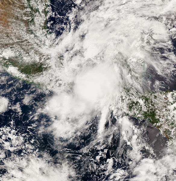
Tropical Storm Hernan forms off Mexico's Pacific coast

Terra Daily via AFP: Fearing potentially deadly flooding, Mexican disaster officials are closely monitoring the weather after Tropical Storm Hernan formed off the country's Pacific coast of Mexico late Saturday.

Hernan was located 585 kilometers (more than 360 miles) southwest of the tourist port of Manzanillo and was moving in a northwesterly direction, parallel to the coastline, at a speed of 22 kilometers per hour, Mexico's National Meterological Service (SMN) reported at 0300 GMT.

The storm was packing maximum winds of 65 kilometers per hour, with gusts up to 85 kilometers per hours, the SMN said.

The Miami-based National Hurricane Center, which had slightly different figures, warned that Hernan was picking up strength. "Additional strengthening is expected" overnight Saturday to Sunday, "and Hernan could be near hurricane strength by Sunday afternoon," the NHC said....

NASA image of Hernan, July 27, 2014

Monday, July 14, 2014

UN initiative strengthens drought monitoring and early warning in Asia-Pacific

UN News Centre: Although drought is a “silent killer” in Asia and the Pacific, access to scientific information and knowledge remain a challenge for many countries in the region, the United Nations Economic and Social Commission for Asia and the Pacific (ESCAP) said today at a milestone forum on drought monitoring and early warning.

“Over the past three decades, it is estimated that droughts in the region have affected more than 1.3 billion people and caused damages of over $53 billion,” Shamika Sirimanne, Director of ESCAP’s Information and Communications Technology and Disaster Risk Reduction Division, said today in Colombo, Sri Lanka.

The meeting, organized by ESCAP and the Sri Lanka Ministry of Technology and Research, drew senior Government representatives, regional experts and UN agencies to exchange good practices and discuss strategies to reduce the impacts of agricultural drought and help save lives.

...However, despite significant progress in monitoring agricultural drought, access to satellite-derived data and knowledge for improving early warning remains a challenge for many countries in Asia and the Pacific.

In 2013, ESCAP launched the Regional Drought Mechanism – a platform providing timely and free satellite-based data; products; and training to regional drought-prone countries – to enhance the capacity of Governments for agricultural monitoring and early warning. When combined with information collected on the ground, the data leads to more effective detection of potential drought conditions....

The Victoria Dam in Sri Lanka submerged Teldeniya city under a reservoir. A 2012 drought lowered the reservoir and exposed the city again. Shot by Hasindu2008, Wikimedia Commons, under the Creative Commons Attribution-Share Alike 3.0 Unported license

Thursday, June 5, 2014

Weakened storm Boris still packing heavy rains, mudslide risk

Terra Daily via AFP: Boris, now a tropical depression after losing some of its punch, nevertheless was potent enough to prompt evacuations of thousands of inhabitants Wednesday along Mexico's Pacific coast.

The season's second named storm -- downgraded overnight from a tropical storm -- Boris brought "extraordinarily" heavy rains that led disaster officials to evacuate some 16,000 people.

On his Twitter account, the head of Mexico's National Civil Protection office, Luis Felipe Puente, said Boris so far has caused no loss of life, although it continues to carry the risk of potentially lethal flash floods and mudslides.

Officials from the US National Hurricane Center said that at 1500 GMT, Boris was 80 miles (130 kilometers) east of the town of Salina Cruz, with maximum sustained winds of 30 miles (45 kilometers) per hour.

It was moving north at two miles (four kilometers) per hour, a leisurely pace ensuring it will linger, continuing to dump up to another 10 inches of heavy rain in some areas, including the states of Oaxaca, Chiapas, Veracruz and Tabasco, the Miami-based NHC said....

NASA image of Boris making landfall in Mexico on June 3, 2014

Wednesday, June 4, 2014

Tropical storm Boris downgraded, still packing heavy rain

Terra Daily via AFP: A storm named Boris that is lingering off Mexico's west coast was downgraded to a tropical depression on Wednesday, but is still packing heavy rains that could cause deadly flash floods and mudslides. The warning from the US National Hurricane Center said Boris could dump as much as 20 inches (50 cm) of rain in some parts of the states of Chiapas and Oaxaca.

Boris was expected to make landfall later Wednesday, according to the center's tracking map. The storm was packing maximum sustained winds of almost 55 kilometres (35 miles) per hour, down slightly from Tuesday. It was still moving toward the north at seven kilometres (five miles) per hour.

As of 0900 GMT, the storm was 140 kilometres (85 miles) from the town of Salina Cruz, the center said. But Boris is expected to weaken later Wednesday.

...The storm is expected to make landfall as a tropical depression on Wednesday between the southwestern Mexican states of Oaxaca and Chiapas, according to a US National Hurricane Center tracking map. The Miami-based center said the storm would likely produce life-threatening flash floods and mudslides....

Friday, May 30, 2014

NASA 'bisects' Tropical Storm Amanda

Stephanie Pappas in Yahoo News via Live Science: NASA has sliced and diced the first named storm of the 2014 hurricane season, capturing a bisected view of Hurricane Amanda at its strongest. Amanda — now a tropical depression — formed over Memorial Day weekend and reached Category 4 hurricane strength, with winds reaching 155 mph (250 km/h).

Those wind speeds made the storm the strongest May hurricane ever seen. Fortunately, Amanda remained far out to sea in the eastern Pacific and never threatened land. After turning north over cooler waters this week, the storm weakened, its winds receding to tropical-storm level. As of today (May 29), Amanda is a mere tropical depression, with max
imum sustained winds of only about 35 mph (56 km/h), according to the National Hurricane Center.

NASA's CloudSat satellite caught a detailed glimpse of the storm when it was still a hurricane. On May 25, the storm's winds were blowing at around 150 mph (240 km/h) when the satellite passed over about 25 miles (40 km) from the center of the storm. [Hurricanes from Above: See Nature's Biggest Storms]

CloudSat uses ultrasensitive radar to measure clouds and their moisture. In Amanda's eastern half, the satellite detected moderate and heavy-moderate precipitation deep in the storm, below the altitude at which precipitation turns from solid into liquid. The profile of the storm revealed an expansive, anvil-shaped cloud extending northward, as well as smaller cumulus clouds underneath, NASA reported today (May 29)....

NASA image of Amanda on May 23, 2014

Friday, May 23, 2014

Warm Pacific may paradoxically cause US winter freeze, says a study

Reuters: Unusually warm western Pacific waters linked to global warming may be the paradoxical cause of a bone-chilling winter in parts of the United States this year, a scientific study said on Thursday. The theory contrasts with other experts' views, including that the freeze was simply a freak natural event or that it was linked to a thawing of the Arctic in recent years that sent a blast of cold air south.

"People's reaction when they sit under 10 feet of snow is to say 'this cannot be man-made climate change'," said Professor Tim Palmer of Oxford University, who published his research in the journal Science. "But there is a plausible link," he told Reuters.

He said a strengthening of trade winds had led to a build-up of warm water in the western tropical Pacific, aggravated in recent years by global warming from man-made emissions of greenhouse gases. Thunderstorms linked to the warmth in turn disrupted the jetstream, high altitude winds which flow in vast meandering loops around the northern hemisphere, and sucked cold air from the Arctic. Detroit, for instance, suffered record snows and the coldest January since 1977.

Pinpointing the causes of the U.S. chill, when climate change should make cold winters less likely, would help companies, farmers, city planners or even home owners wondering if they should invest in extra roof insulation. Two other experts were unconvinced by Palmer's study.

Jennifer Francis of Rutgers University, who wrote in 2011 that a melting of Arctic ice may cause cold snaps, said the Pacific had a similar pattern of heavy rainfall in 2011-12 but the winter was mild in the United States....

A winter storm in New York City, MTA of the state of New York, Wikimedia Commons via Flickr, under the Creative Commons Attribution 2.0 Generic license

Monday, April 28, 2014

Recognising resilience innovation in the Pacific

A press release from the UN Office for Disaster Risk Reduction: To help mark the approaching 10th anniversary of the Hyogo Framework for Action (HFA), the global strategy for reducing disaster losses worldwide, the United Nations Office for Disaster Risk Reduction (UNISDR) Sub-Regional Office for the Pacific today launched the inaugural Pacific Innovation and Leadership Award for Resilience (PILAR), a pioneering initiative in the region.

The award recognises exemplary action taken by individuals, businesses, communities, governments and or non-governmental organisations across all the Pacific Island Countries and Territories, to build community and national resilience through disaster risk reduction measures.

Mr Timothy Wilcox, UNISDR’s Sub-Regional Coordinator for the Pacific, said: “This is the last Pacific Platform before a post-2015 framework for disaster risk reduction is endorsed next year by the global community in Japan. It is appropriate that we mark the contributions of so many activities with the launch of an award that recognises and promotes innovation, good-practice and leadership in these areas”.

Pacific Island Countries and Territories face extreme risk from naturally occurring hazards that are likely to intensify with the onset of climate change. Despite the inherent vulnerabilities that confront the Pacific, there have been many opportunities for innovation and ingenuity from all sectors of society to reduce disaster impact and to ensure long term sustainability of nations and communities.

The award covers a range of areas including awareness-raising, knowledge sharing, community engagement, policy interventions, and other resilience-building activities....

Landing in Fiji, shot by Kat Clay, Wikimedia Commons via Flickr, under the Creative Commons Attribution 2.0 Generic license

Wednesday, March 12, 2014

Asia-Pacific failing to save forests and grasslands

Stian Reklev in Reuters: Asia-Pacific nations are failing to halt the loss of natural forests and grasslands, the U.N. Food and Agriculture Organization (FAO) said on Tuesday, robbing people of their livelihoods and worsening environmental problems like desertification and climate change.

Forests and grasslands make up 58 percent of the region's land mass, but each year 2 million hectares (20,000 square kms) are degraded and rendered useless, Patrick Durst, a FAO senior forestry officer told a food conference in Ulan Bator.

Across the Asia-Pacific, 400 million hectares (4 mln sq kms) - an area equal to the combined size of India and Myanmar - are now in bad need of restoration, he said. "We are already seeing strong negative impacts," Durst told Reuters at the conference.

In China and Mongolia, over-grazing and poor land management mean herders increasingly have to give up feeding their livestocks and instead look for new jobs in fast-growing cities. Lost grassland boosts desertification and helps cause massive sand storms that sometimes carry as far as eastern Canada....

A lone tree in Mongolia, shot by tiarescott, Wikimedia Commons via Flickr,  under the Creative Commons Attribution 2.0 Generic license

Friday, March 7, 2014

Reef fate in hands of chiefs and researchers — for now

Jan Piotrowski in SciDev.net: Trust and strong relationships between researchers and traditional tribal leaders of small pacific islands allows for quick and effective implementation of science-based strategies that slow the decline of coral reefs, an international conference has heard.

Coral reefs recovered far quicker when scientists worked directly with leaders of local communities — rather than national governments — on changing the damaging land-use practices that pollute coastal waters, said Robert Richmond, a professor of marine biology at the University of Hawaii, United States.

...But these strategies can only be a stopgap as the rising sea levels, water temperatures and acidification — which could spell the end for many reef ecosystems — will need to be addressed by an international climate change agreement, he said.

For local populations dependent on ever-diminishing coral reefs for survival, conservation laws take too long to devise, and are difficult to enforce and monitor in remote regions, Richmond tells SciDev.Net.

Local chiefs have the ability to quickly change damaging practices but researchers must first work to build trust before their advice will be considered, he adds. “Many times, the local level is much more efficient than national governance. Working at a local level means communities can act immediately,” Richmond says....

Hawaii's Pearl and Hermes atoll, US Fish and Wildlife photo

Saturday, January 25, 2014

Will fleeing home be the last resort as the climate changes?

Jaspreet Kindra in IRIN: ...Like many other Micronesian states, Palau is extremely vulnerable to rising sea levels and storm surges - several islands are less than a metre above sea level. In other low-lying countries like Bangladesh, people have become used to the idea of moving, but "planned relocation" evokes strong feelings in this part of the Pacific.

Palau gained independence from the United States in 1994 and signed the Compact of Free Association, which will run until 2044. Under this agreement, the US provides substantial financial assistance to Palau, whose nationals can also travel to the US with relative ease and work there. Almost everyone has a family member in the US, but no one talks about moving there permanently.

...People in neighbouring islands like Kiribati and Tuvalu are being forced to move away from the constantly encroaching sea. Planning for possible dual citizenship, shopping for land, and providing new skills so their people can get jobs in another country are among the policy decisions that confront low-lying countries and islands.

"Some countries expressed reservations about the idea of having planned relocation ... since [they]...have hardly contributed to dangerous climate change, but would be asked to concede significant things like administration of viable populations and habitable territory - both key parts of sovereignty" But many Pacific islanders feel like Josephs. Tony de Brum, the
Minister in Assistance to the President of the Marshall Islands, told IRIN that the idea of planned relocation is not even being considered. “If we do that, it will be an admittance of failure in our part,” on two counts - adaptation and global mitigation efforts...

Aerial view of limestone islands of Palau, shot by NOAA

Sunday, January 12, 2014

One dead, widespread destruction in Tonga cyclone

Space Daily via AFP: At least one person was killed when powerful Cyclone Ian ploughed into Tonga's northern Ha'apai islands, causing extensive damage and destroying houses, reports said Sunday. The full extent of the destruction began to emerge when communications were partially restored a day after the South Pacific kingdom's first category five cyclone struck early Saturday morning.

Initial reports on Saturday said the cyclone had left minor damage. Ian was downgraded to a category four cyclone late Saturday morning, but increased in intensity later in the day and was restored to the most severe rating of category five.

By Sunday there were reports of houses destroyed and trees flattened across the island chain, which is home to about 8,000 people and is popular with tourists.
The head of the Tonga Red Cross, Sione Taumoefolau, said he had been informed of one death in Ha'apai but did not have further details.

He said staff in the region told him by satellite phone the main island of Lifuka was devastated....

US Navy aerial photo of one port in Tonga, pre-storm

Sunday, December 1, 2013

UN develops innovative early warning tool for drought prone Asia-Pacific regions

UN Economic and Social Commission for Asia and the Pacific: Senior officials from governments across the Asia-Pacific region today agreed on a set of collective priorities and ground-breaking initiatives that will build resilience to natural disasters and further enhance regional cooperation, at a meeting convened by the United Nations Economic and Social Commission for Asia and the Pacific (ESCAP) in Bangkok.

Faced with the continued, severe impact of natural disasters across the region, representatives at the Third Session of the Committee on Disaster Risk Reduction called on ESCAP to facilitate regional cooperation aimed at harnessing technological advances for resilient, inclusive and sustainable development.

In line with this, ESCAP's long-standing Regional Space Applications Programme for Sustainable Development (RESAP) announced the development and operationalization of a new regional mechanism on drought. With this mechanism, the monitoring and early warning capabilities of drought-prone countries will be significantly strengthened through the effective use of space-based information provided by service nodes in the region.

Every year in the Asia-Pacific region, droughts push millions of farmers into debt and deepen poverty and hunger but this new regional mechanism is capable of issuing early warnings before the drought is visible to the human eye. Its satellite sensors will detect warning soil and water conditions before the worst of the droughts take hold, so that early action can be taken.

Initially supported by Chinese and Indian space agencies, the regional drought mechanism will provide monitoring and early warning services and capacity building for drought-prone countries in the region. Mongolia is already piloting the mechanism, and Cambodia, Myanmar and Sri Lanka are expected to join soon as pilot counties....

Thursday, November 14, 2013

Island biodiversity in danger of total submersion with climate change

Pensoft Publishers: Sea level rise caused by global warming can prove extremely destructive to island habitats, which hold about 20% of the world's biodiversity. Research by C. Bellard, C. Leclerc and F. Courchamp of the University of Paris Sud look at 3 possible scenarios, from optimistic to very pessimistic, to bring attention to the dangers in store for some of the richest biodiversity hotspots worldwide. The study was published in the open access journal Nature Conservation.

Despite climate change having received considerable attention in recent years, no global assessment of the consequences of sea rising is available for island ecosystems. Yet those are amongst the regions most vulnerable to potential sea level rise, which in their case would cause a direct reduction of habitat.

Several recent studies strongly suggest that sea levels will rise substantially until the end of the century, with estimates ranging from 0.5 m to 2.3 m increase. Worst case scenarios of ice sheet melting and sliding lead to estimates of sea-level rise of the worrying 4 to 6 m. Such increases could lead to the immersion of very large proportions of many islands with low elevation. In many cases, sea level rise may lead to their total submersion, wiping out completely self-contained ecosystems and their inhabitants .

The study uses the 1,269 islands from different areas that France harbored, out of which, New Caledonia and French Polynesia are found to be the most vulnerable to sea level rise. The French maritime domain is ranked as the second most important in the world, these islands in total holding a large proportion of the world's biodiversity. Research shows that 5% of the number of islands could be permanently inundated under an increase of sea level by 1 meter. This figure dramatically rises to 8% and 11%, in the more pessimistic scenarios, respectively, for 2 and 3 meters of sea level rise. Assuming that French islands are representative of worldwide islands, roughly 10,800 islands could be entirely lost in the 1 meter scenario, the most optimistic one.

For the New Caledonia hotspot, under the worst scenario, up to 6.8 % of the islands could be half submerged. Speaking in terms of biodiversity loss, this indicates endemic plant species that are already at risk of extinction will be the most vulnerable to sea level rise.

"Losses of insular habitats will thus be relatively important in the future, probably leading to a major impoverishment of insular biodiversity. Given the implications of these results, decision makers are required to define island conservation priorities that accounts for sea level rise following climate change."comments the lead author Dr. C. Bellard.

Image of New Caledonia by René Moutouh, Wikimedia Commons, under the Creative Commons Attribution-Share Alike 3.0 Unported licens